Featured Quizzes
User Quizzes
Create Quiz
Data and Charts
Word Search
Flash Cards
Badges and Games
About JetPunk
Message Board
Dark Mode
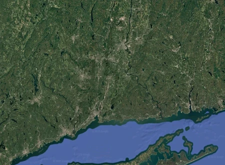
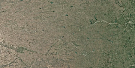
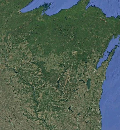
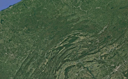
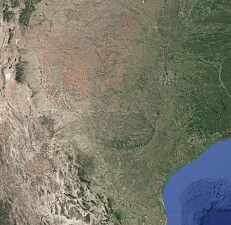
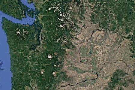
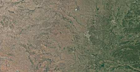
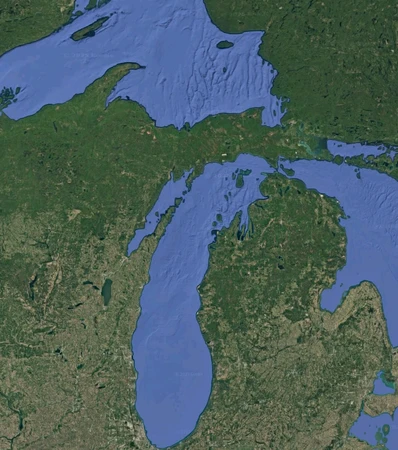
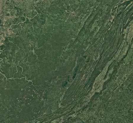
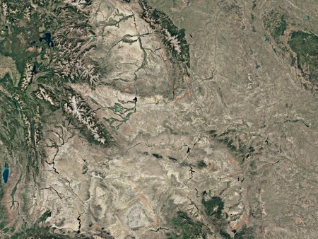
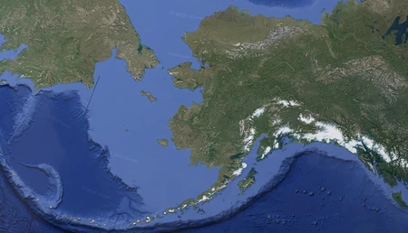
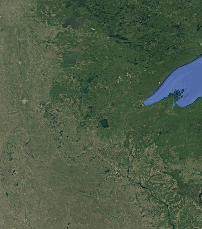
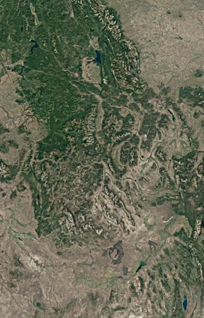
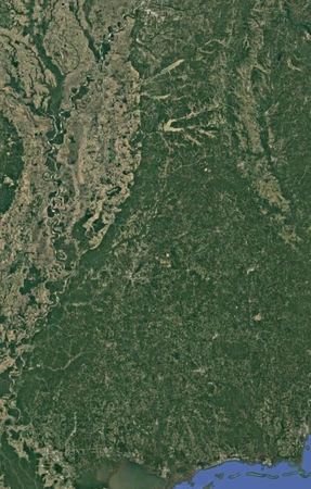
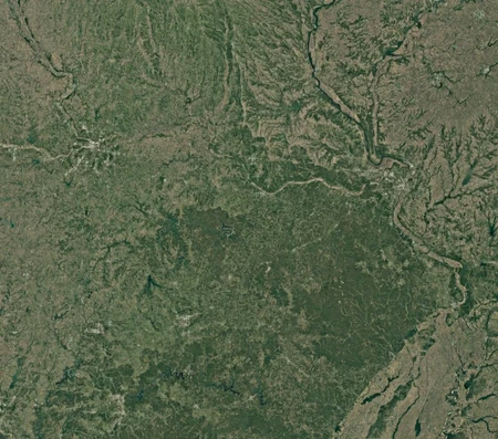
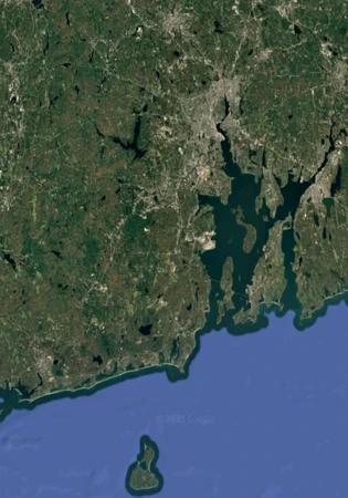
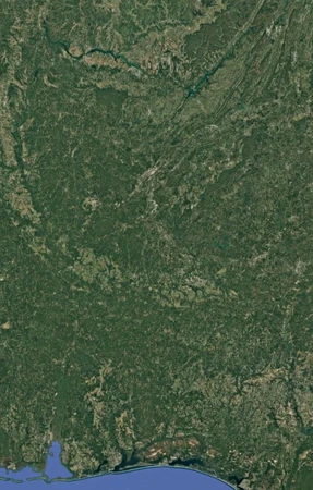
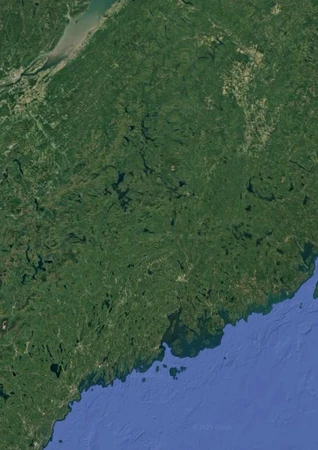
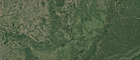
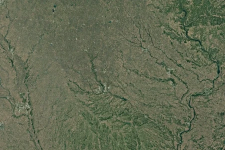
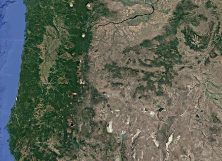
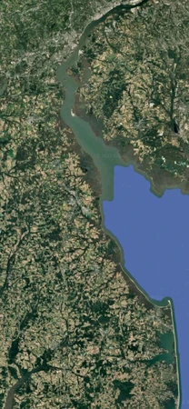
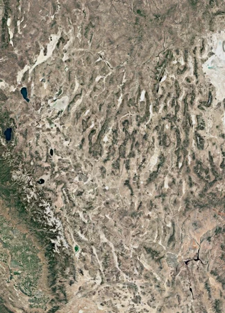
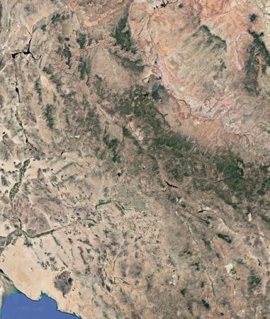
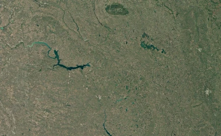
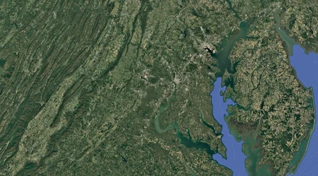
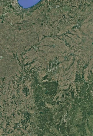
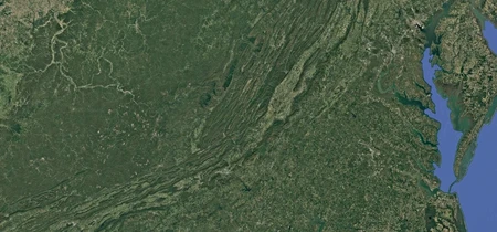
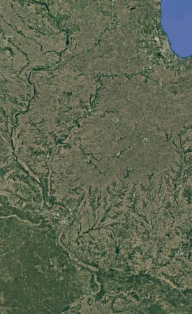
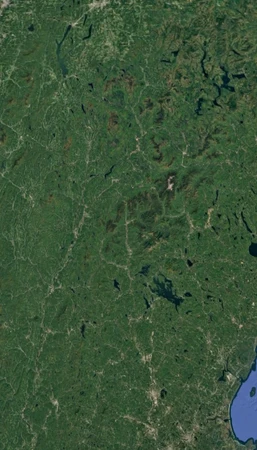
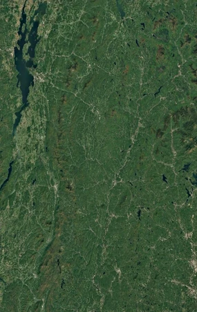
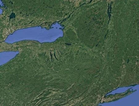
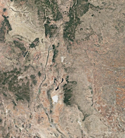
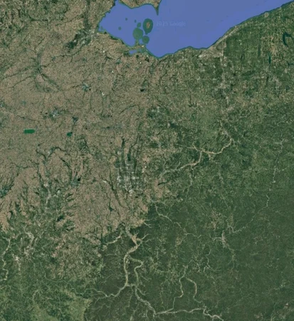
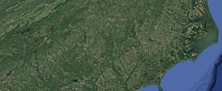
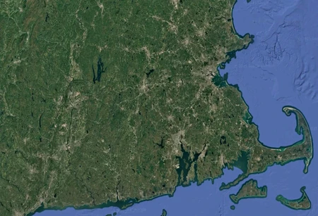
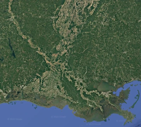
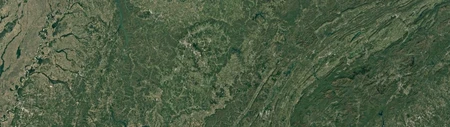
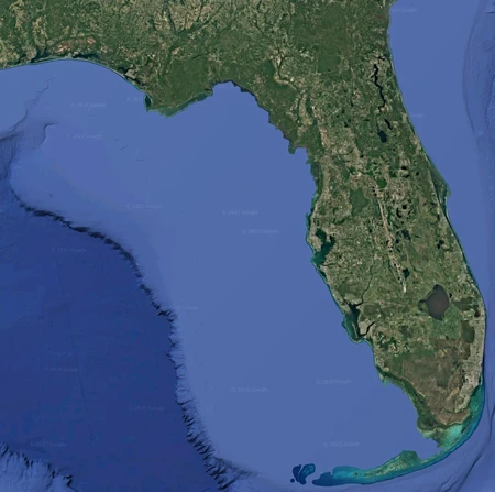
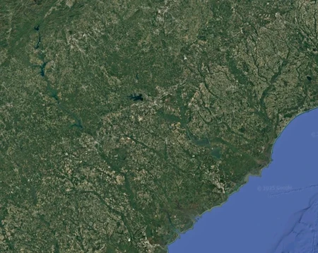
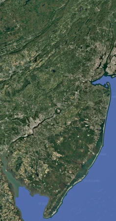
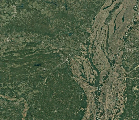
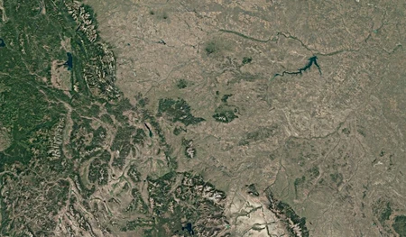
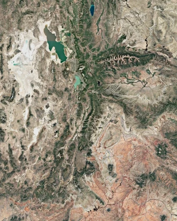
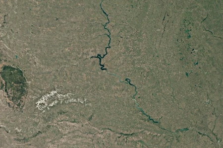
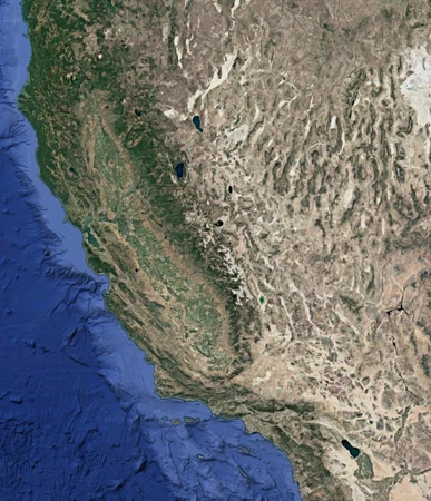
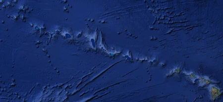
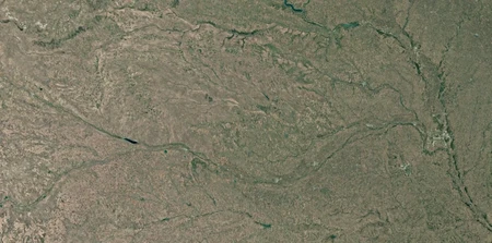
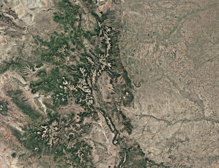
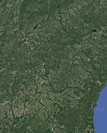
All US States by Satellite Image
Can you name each state of the United States when shown a satellite image?
Note: If multiple states fully appear in an image, type the one that the map's extent best matches
Rate:
Last updated: July 3, 2025
You have not attempted this quiz yet.
More quiz info >>
| First submitted | June 23, 2025 |
| Times taken | 663 |
| Average score | 56.0% |
| Rating | 4.92 | Report this quiz | Report |
7:00
Enter answer here
0
/ 50 guessed
Time Used
00:00
Best Time
00:00
The quiz is paused. You have remaining.
Copied!
Scoring
You scored / = %
This beats or equals
% of test takers
also scored 100%
The average score is
Your high score is
Your fastest time is
Keep scrolling down for answers and more stats ...
Save Your Stats
Email Address
Screen Name
Password
Confirm Password
Language
Weekly e-mails about new quizzes?
Save Your Stats
Your Next Quiz

There are 118 named elements in the Periodic Table. How many can you guess?

There are 78 different names for the currencies used by the different countries of the world. How many can you name?

Drag the flag onto the correct state. Careful, though! One wrong move and the game ends.

Drag the flag onto the correct country. Careful, though! One wrong move and the game ends.
4 Comments
nerdalert
+1
Level 89
Jun 24, 2025
I absolutely love this quiz. Very well-designed.
D31415
+2
Level 84
Jul 3, 2025
Nice! But would have liked more time to be able to deduce more of the inland states by patterns of mountains/rivers (speaking as a non-USA player).
jackson33miller
+1
Level 71
Jul 3, 2025
Wow, some of these are super tricky. Pretty cool to see the ones whose borders were drawn upon natural features
Jeremy
+1
Level 79
Jul 5, 2025
Great quiz, a new favorite for sure. Should be featured
New and Popular
Satellite Images
Quiz series by TurkeyCookTime
...