Featured Quizzes
User Quizzes
Create Quiz
Data and Charts
Word Search
Badges and Games
About JetPunk
Message Board
Random Quiz
Dark Mode
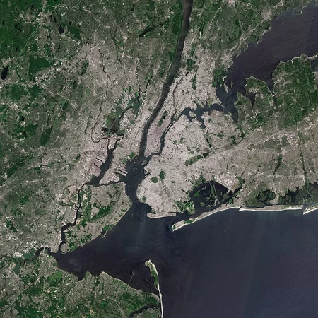
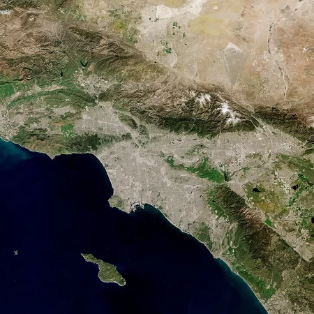
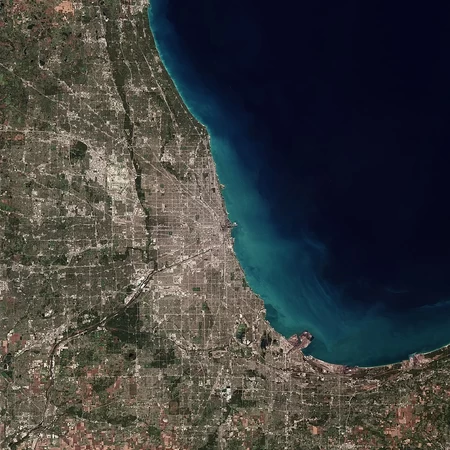
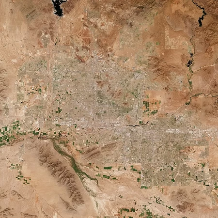
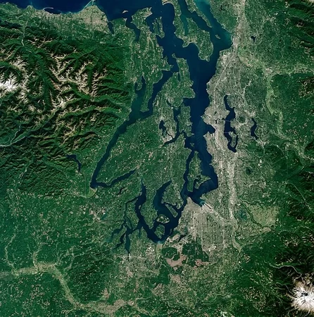
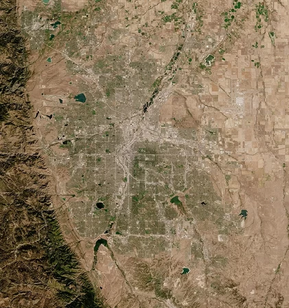
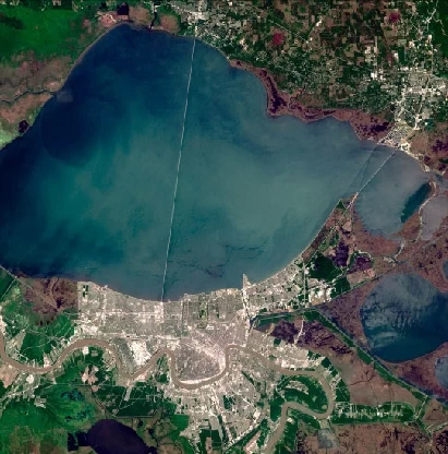
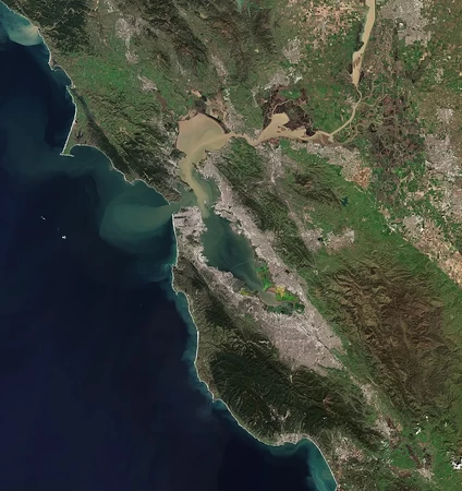
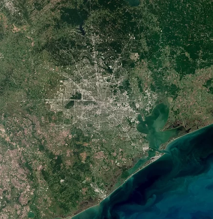
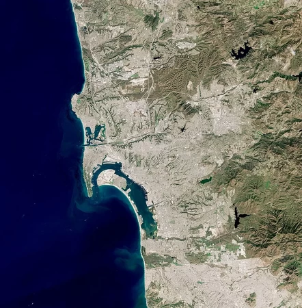
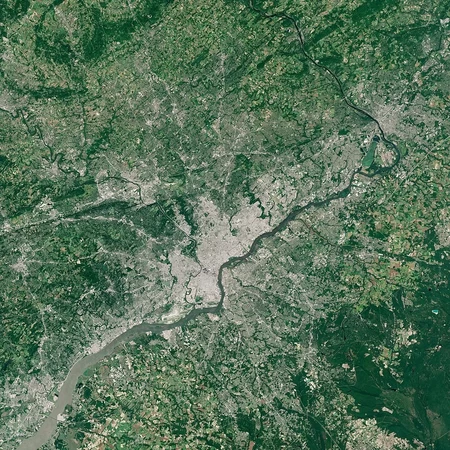
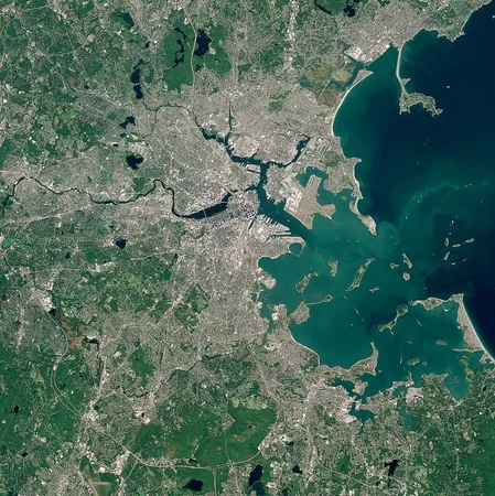
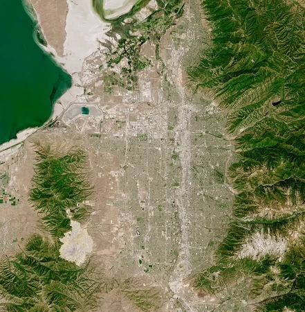
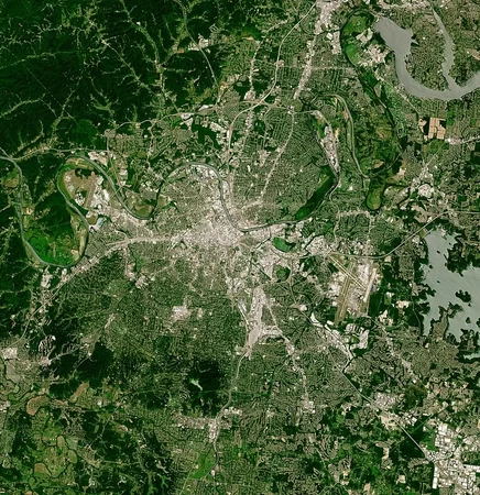
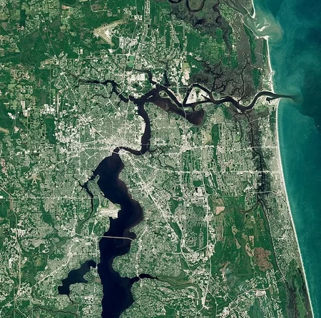
US Cities by Satellite Picture
Can you correctly identify the US city by looking at a satellite picture of it?
Rate:
Last updated: April 5, 2021
You have not attempted this quiz yet.
More quiz info >>
| First submitted | April 5, 2021 |
| Times taken | 3,104 |
| Average score | 66.7% |
| Rating | 4.80 | Report this quiz | Report |
3:00
Enter answer here
0
/ 15 guessed
Time Used
00:00
Best Time
00:00
The quiz is paused. You have remaining.
Copied!
Scoring
You scored / = %
This beats or equals
% of test takers
also scored 100%
The average score is
Your high score is
Your fastest time is
Keep scrolling down for answers and more stats ...
Save Your Stats
Your Next Quiz

Can you name the ten Asian countries with the largest GDPs?

Name these 10 random state capitals of the map. The answers change every time you play!

With the help of a map, can you name the 50 states of the U.S. and also their capitals?

New York City is home to more than 260 different neighborhoods. How many can you name?
New and Popular
Out of curiosity, why is the picture for Seattle so zoomed out? You've got Aberdeen in there.