Featured Quizzes
User Quizzes
Create Quiz
Data and Charts
Word Search
Badges and Games
About JetPunk
Message Board
Random Quiz
Dark Mode
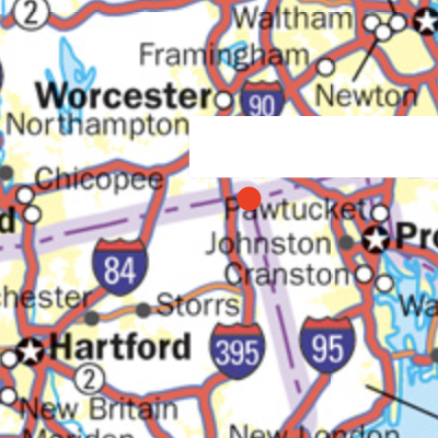
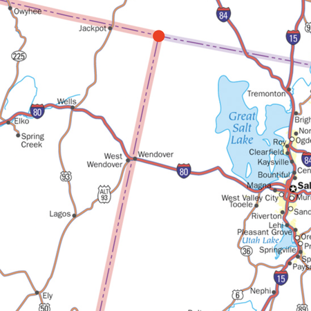
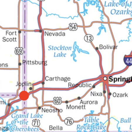
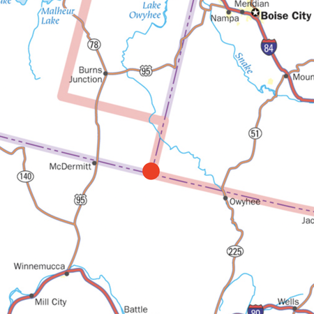
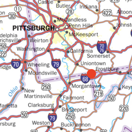
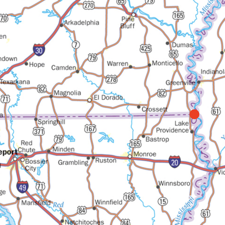
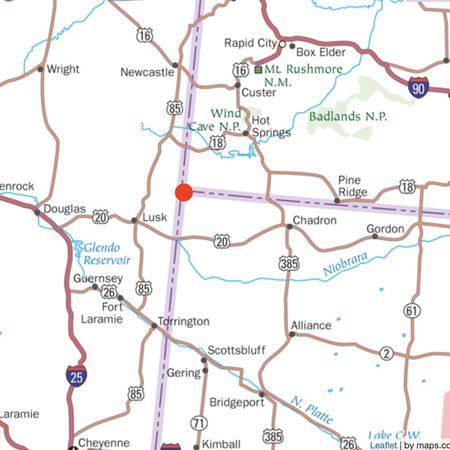
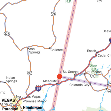
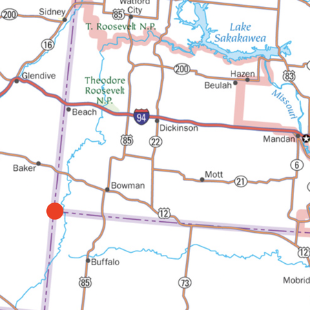
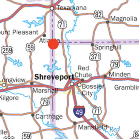
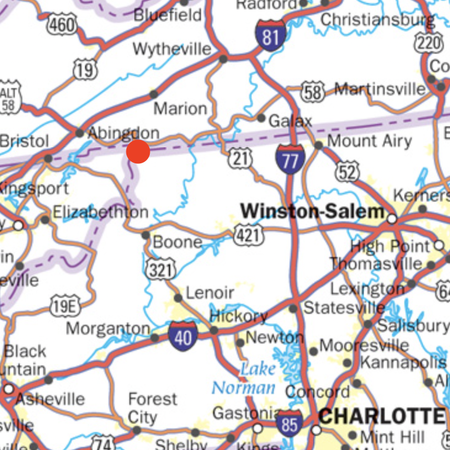
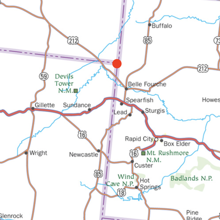
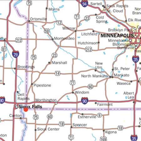
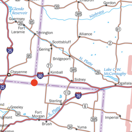
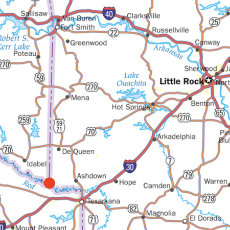
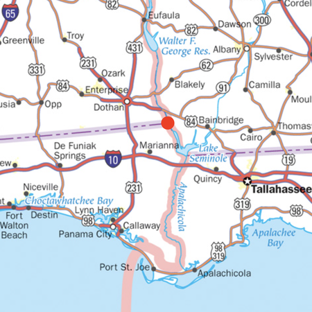
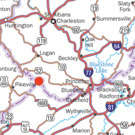
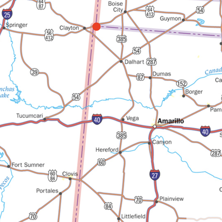
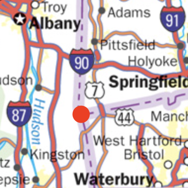
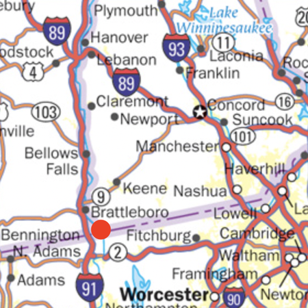
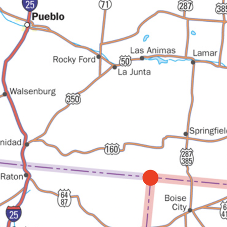
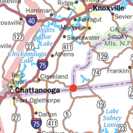
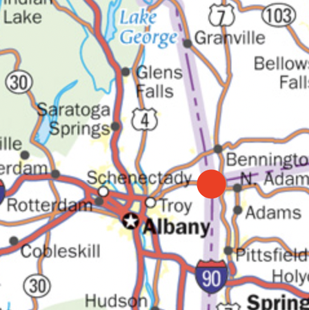
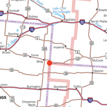
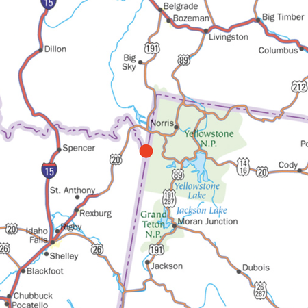
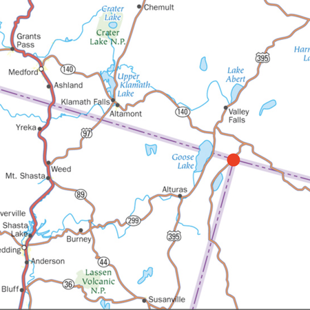
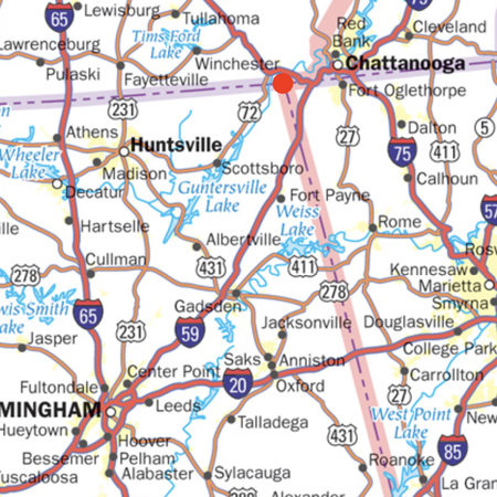
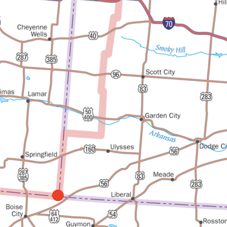
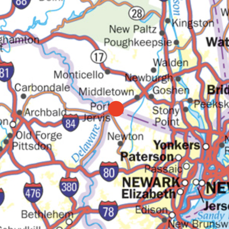
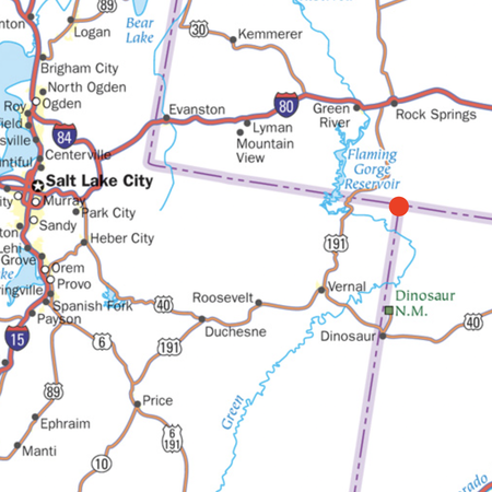
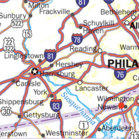
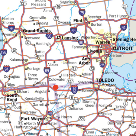
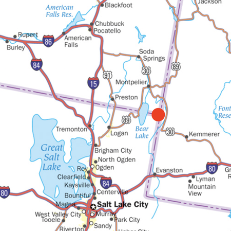
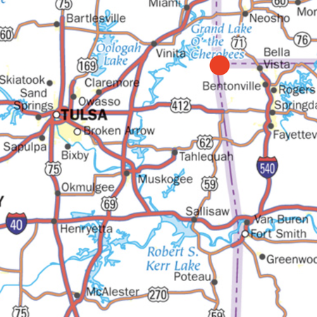
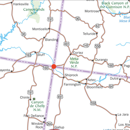
Tri-State Borders
Identify the three states that make up each land border using the provided map close-up. The actual point is denoted by a red dot. (Hint: Many places show up on multiple maps!)
Bonus: the Four Corners!
Purple lines/dashed lines are state borders, pink lines are time zone borders
Please list the three states in alphabetical order. Abbreviations accepted
Click on each photo for a larger image
See comments for sources
Rate:
Last updated: July 29, 2022
You have not attempted this quiz yet.
More quiz info >>
| First submitted | July 29, 2022 |
| Times taken | 44 |
| Average score | 55.6% | Report this quiz | Report |
20:00
Enter answer here
0
/ 36 guessed
Time Used
00:00
Best Time
00:00
The quiz is paused. You have remaining.
Copied!
Scoring
You scored / = %
This beats or equals
% of test takers
also scored 100%
The average score is
Your high score is
Your fastest time is
Keep scrolling down for answers and more stats ...

Save Your Stats
Your Next Quiz

How many countries do you know? In this quiz, you've got 15:00 to name as many as you can. Go!

20 random countries have been removed from the map of the world! Can you identify them in 3 minutes?

Can you remember which squares have Jeppy the JetPunk fish inside them?

Drag the pin onto the correct country. Careful, though! Three wrong moves and the game ends.
Maps source: https://usa.zoom-maps.com/
This is my first picture quiz, so any and all comments are appreciated!