Featured Quizzes
User Quizzes
Create Quiz
Data and Charts
Word Search
Flash Cards
Badges and Games
About JetPunk
Message Board
Random Quiz
Dark Mode
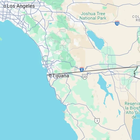
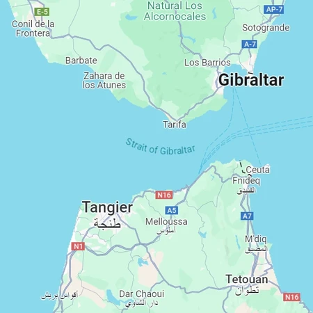
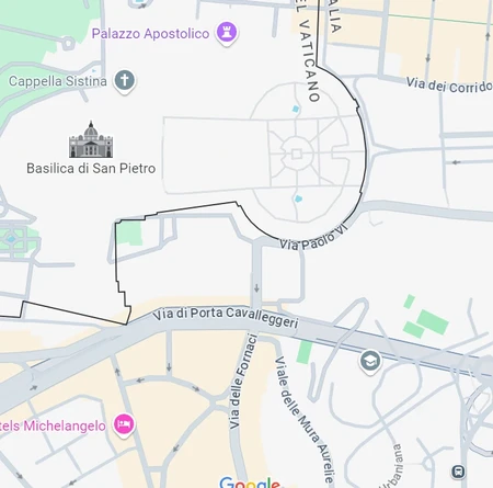
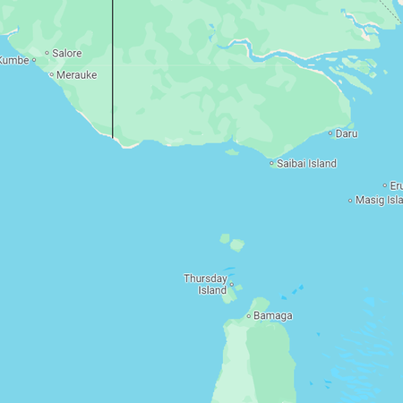
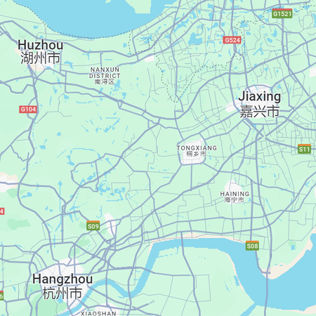
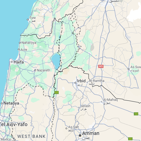
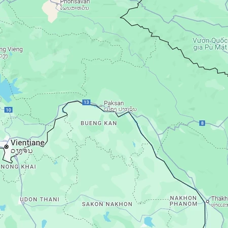
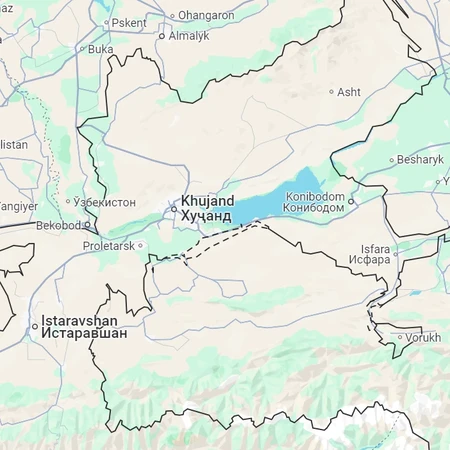
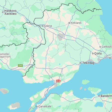
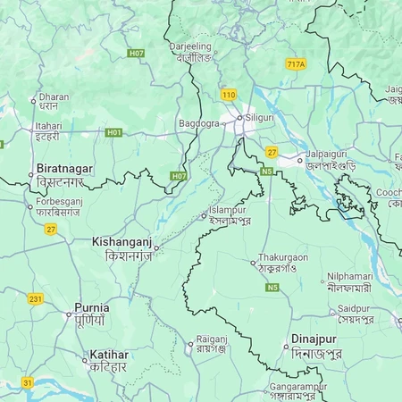
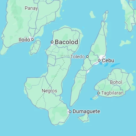
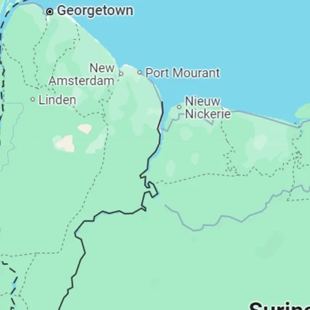
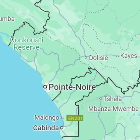
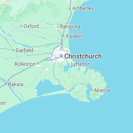
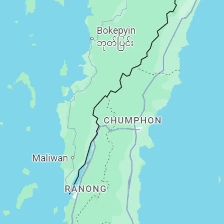
Countries By Google Maps Screenshots #2
Can you recognize countries based on the cities, borders, roads, and bodies of water on Google Maps?
Click on an image to zoom in
To answer, guess any country with land in the picture
Also try the rest of the series!
Rate:
Last updated: April 20, 2025
You have not attempted this quiz yet.
More quiz info >>
| First submitted | September 24, 2024 |
| Times taken | 220 |
| Average score | 87.5% | Report this quiz | Report |
6:00
Enter answer here
0
/ 16 guessed
Time Used
00:00
Best Time
00:00
The quiz is paused. You have remaining.
Copied!
Scoring
You scored / = %
This beats or equals
% of test takers
also scored 100%
The average score is
Your high score is
Your fastest time is
Keep scrolling down for answers and more stats ...
Save Your Stats
Email Address
Screen Name
Password
Confirm Password
Language
Weekly e-mails about new quizzes?

Save Your Stats
Your Next Quiz

Can you guess the 50 most populous cities in the United States according to 2024 U.S. Census estimates?

Name the twenty countries whose residents have the lowest median age.

Name the countries that the Himalayas pass through.

Click on every square of the world map which contains an urban agglomeration with a population of at least 10 million.
2 Comments
YjGMD
+1
Level 57
Sep 25, 2024
Missed 3. Most were easy, some were definantly hard, overall nice quiz.
KiloNova
+1
Level 62
Sep 25, 2024
Thanks!
New and Popular
Countries By Google Maps
Quiz series by KiloNova