Featured Quizzes
User Quizzes
Create Quiz
Data and Charts
Word Search
Flash Cards
Badges and Games
About JetPunk
Message Board
Dark Mode

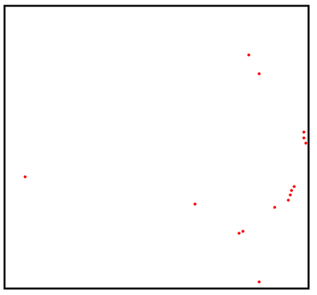
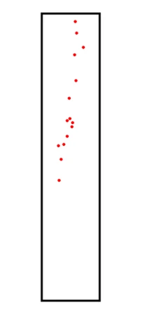
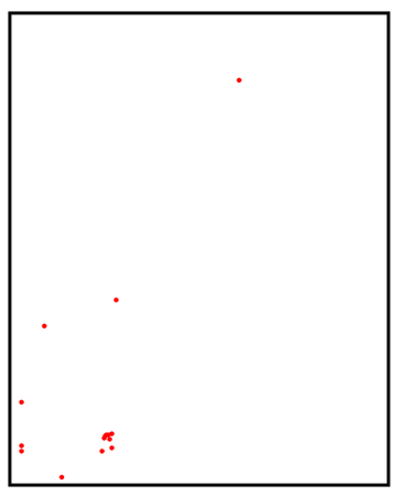
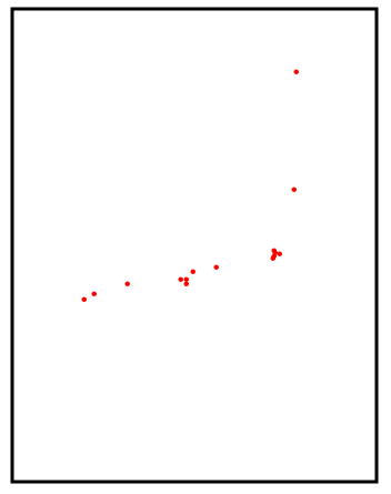
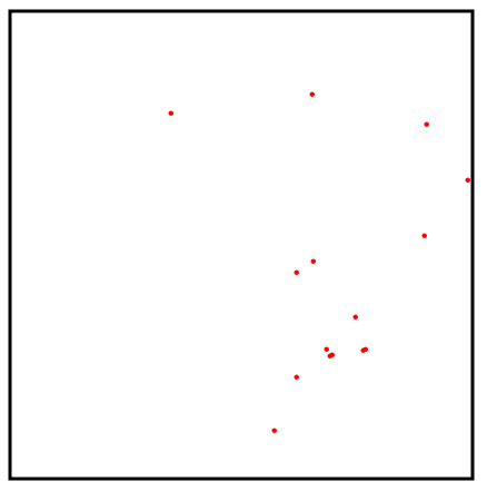
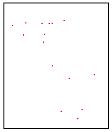
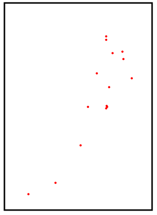
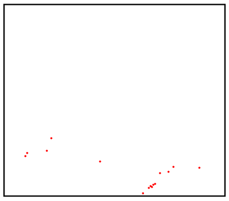
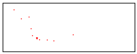
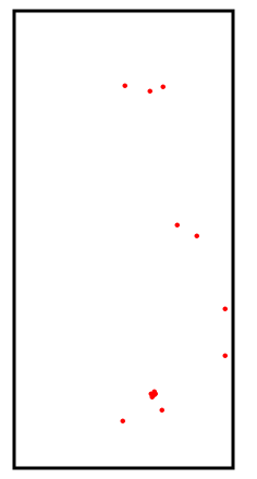
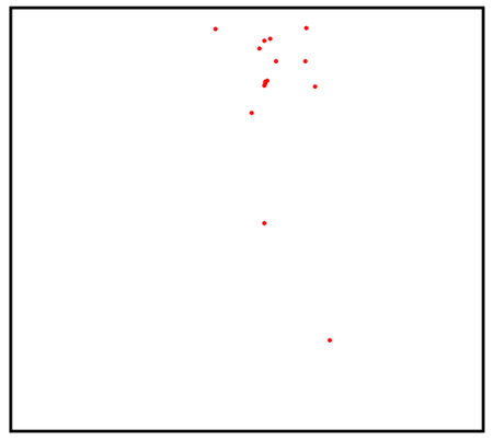
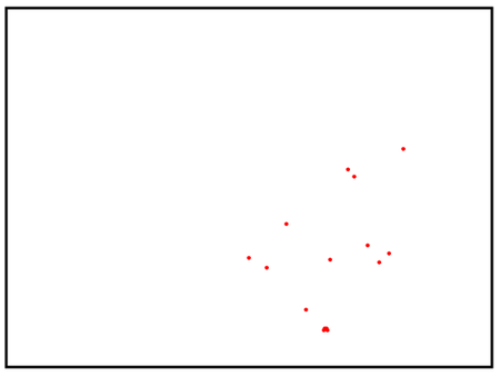
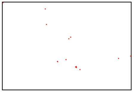
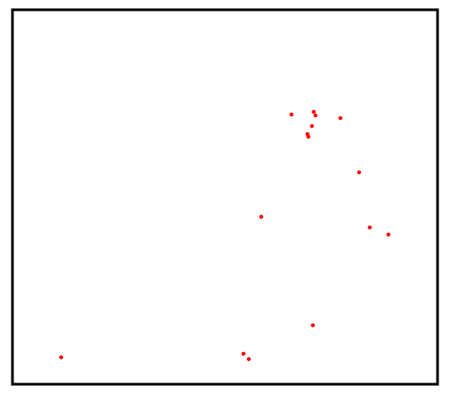
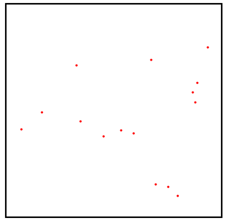
Countries by Location of 15 Biggest Cities on a Map
Name the countries by a map that only shows the location of their 15 most populated cities.
The black box represents the furthest extents of the country outline
Click the pictures to zoom
Rate:
Last updated: March 10, 2025
You have not attempted this quiz yet.
More quiz info >>
| First submitted | March 9, 2025 |
| Times taken | 77 |
| Average score | 53.3% | Report this quiz | Report |
10:00
Enter country here
0
/ 15 guessed
Time Used
00:00
Best Time
00:00
The quiz is paused. You have remaining.
Copied!
Scoring
You scored / = %
This beats or equals
% of test takers
also scored 100%
The average score is
Your high score is
Your fastest time is
Keep scrolling down for answers and more stats ...
Save Your Stats
Your Next Quiz

Name all 50 states in the USA. Easy, right?

Fill in the map by guessing languages. When you guess a language, all the countries that use it as an official language will be filled in.

Drag the flag onto the correct country. Careful, though! One wrong move and the game ends.

Drag the pin onto the correct country. Careful, though! Three wrong moves and the game ends.
2 Comments
TomatosRaafatos
+2
Level 76
Mar 9, 2025
Really tough, but very enjoyable! In hindsight, I see now that one should keep in mind that the white space in the rest of each country's square is still part of the country, and that helps paint a clearer picture of the shape of the country in mind as it provides a rough idea of the population distribution. That would've helped me a lot on China as the country shape is nowhere near apparant from the red dots alone. Same goes to Egypt and Canada.
RubenR
+1
Level 65
Mar 10, 2025
I am glad you enjoyed it! I added a caveat about the meaning of the black box
New and Popular