Featured Quizzes
User Quizzes
Create Quiz
Data and Charts
Word Search
Badges and Games
About JetPunk
Message Board
Dark Mode

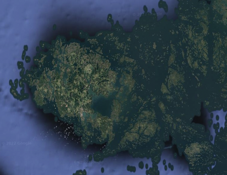
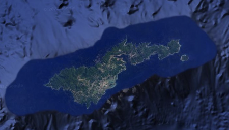
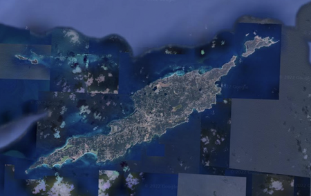
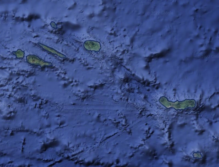
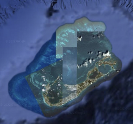
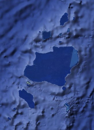
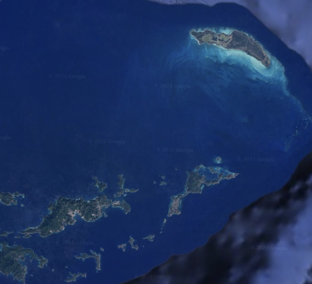
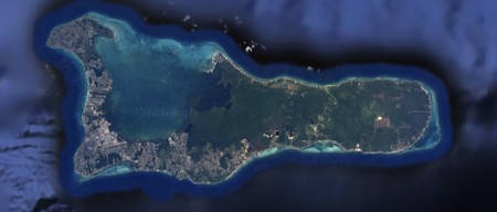
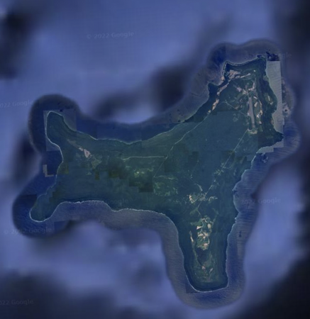
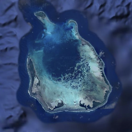
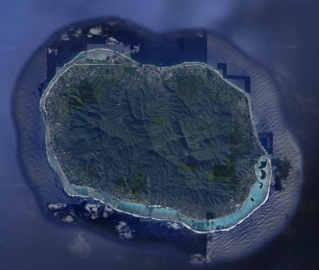
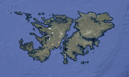
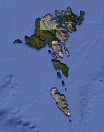
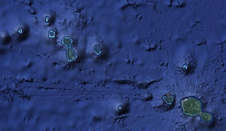
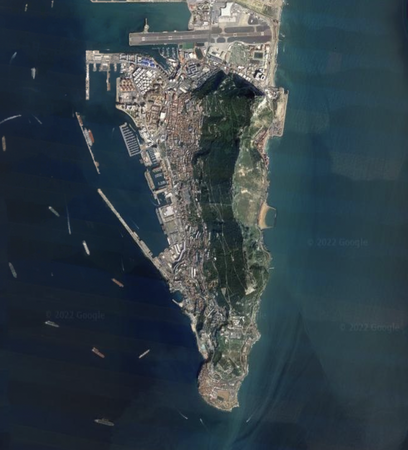
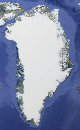
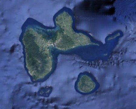
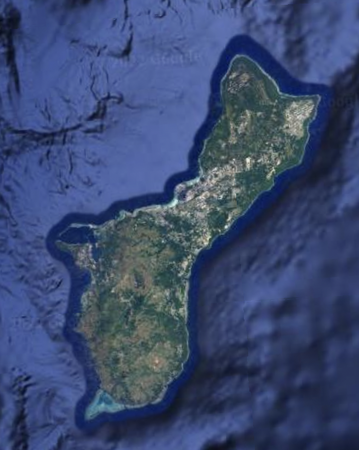
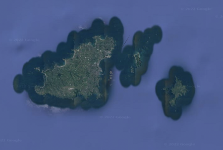
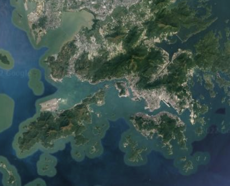
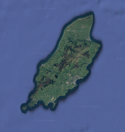
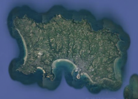
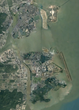
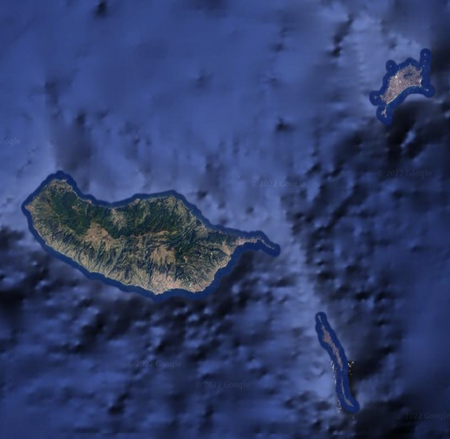
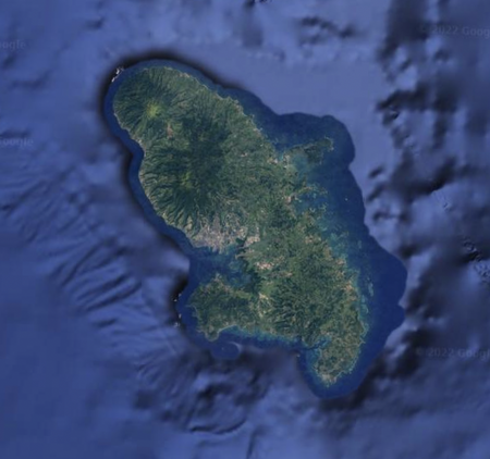
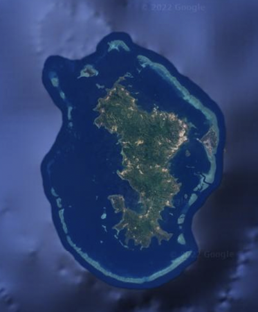
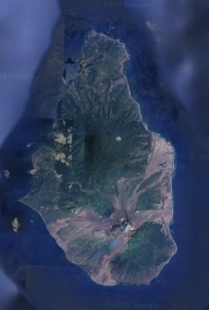
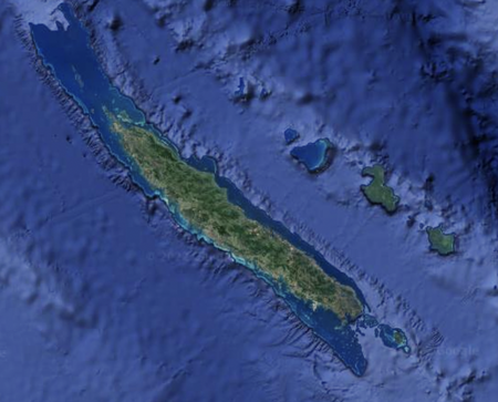
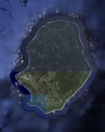
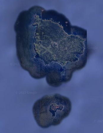
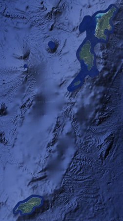
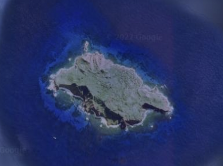
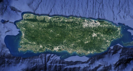
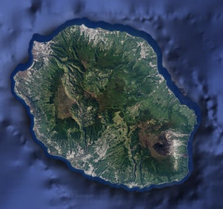
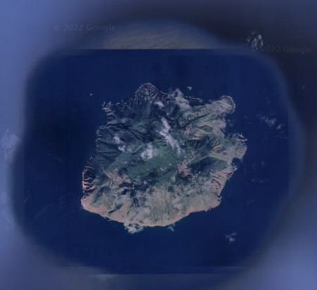
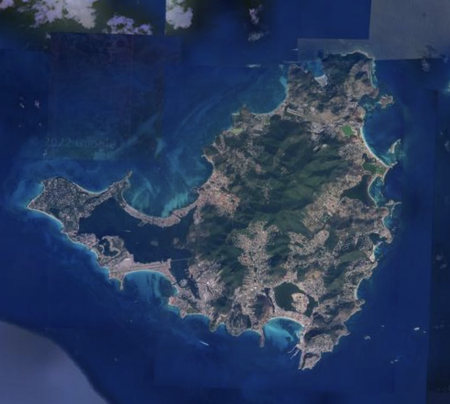
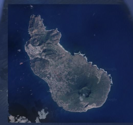
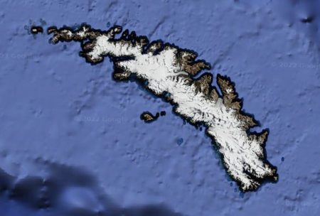
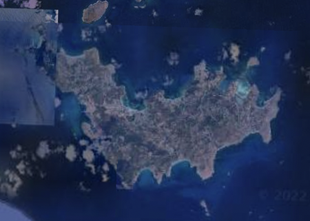
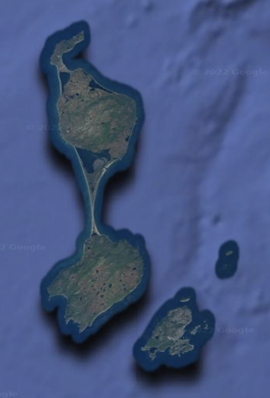
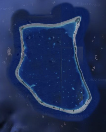
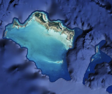
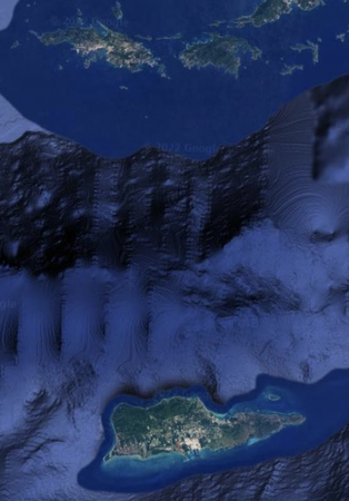
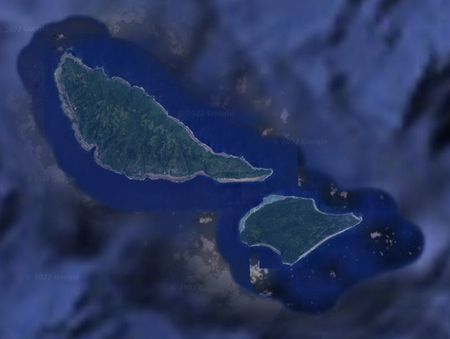
Territories By Satellite Image
Identify the territories by their satellite image.
Includes territories, overseas regions, overseas collectivities, and crown dependencies.
For territories with many islands, the main island(s) are pictured.
Rate:
Last updated: January 7, 2023
You have not attempted this quiz yet.
More quiz info >>
| First submitted | December 23, 2022 |
| Times taken | 23 |
| Average score | 20.5% | Report this quiz | Report |
3:30
Enter answer here
0
/ 44 guessed
Time Used
00:00
Best Time
00:00
The quiz is paused. You have remaining.
Copied!
Scoring
You scored / = %
This beats or equals
% of test takers
also scored 100%
The average score is
Your high score is
Your fastest time is
Keep scrolling down for answers and more stats ...
Save Your Stats
Your Next Quiz

How many countries do you know? In this quiz, you've got 15:00 to name as many as you can. Go!

Fill in the map by guessing languages. When you guess a language, all the countries that use it as an official language will be filled in.

20 random countries have been removed from the map of the world! Can you identify them in 3 minutes?

Drag the flag onto the correct country. Careful, though! One wrong move and the game ends.
Comments
No comments yet
New and Popular