Language
Recent User Quizzes
Create Quiz
Recent User Puzzles
Flash Cards
Recent User Blogs
More
About JetPunk
Random Quiz
Dark Mode
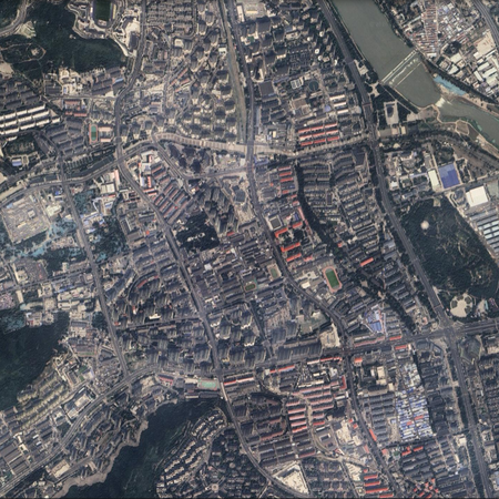
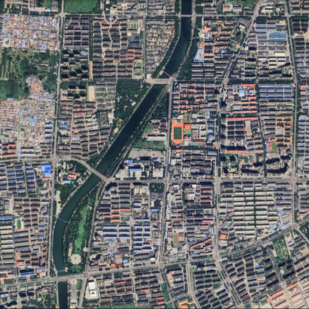
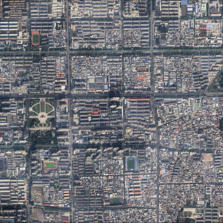
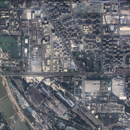
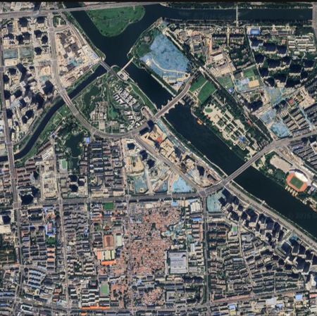
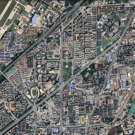
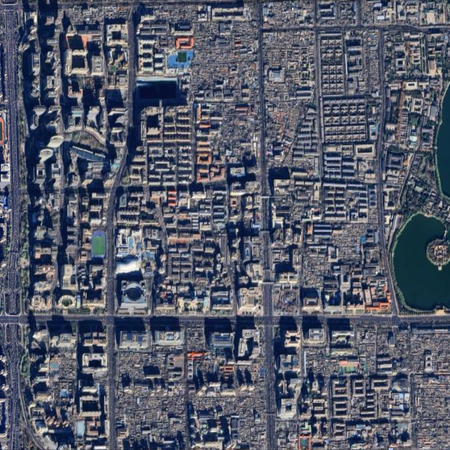
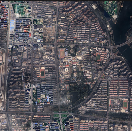
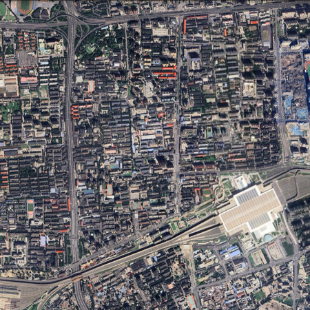
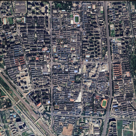
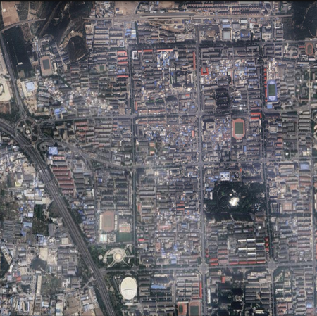
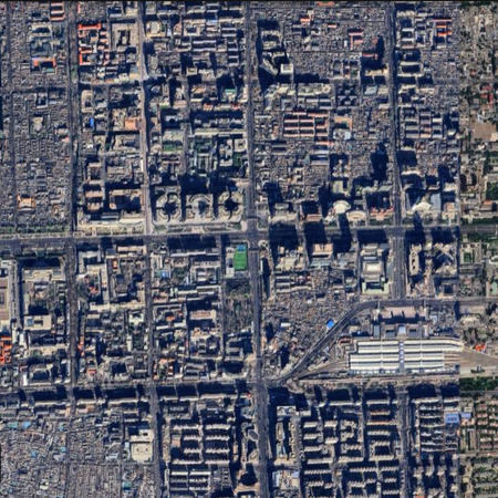
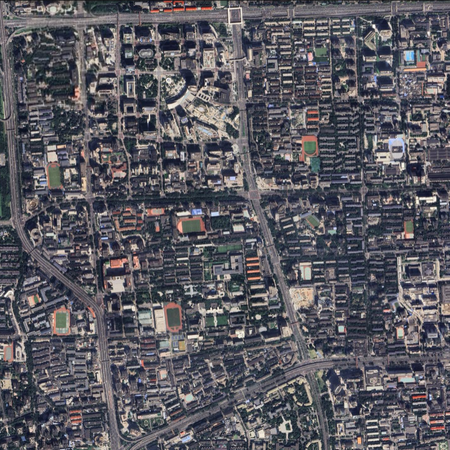
以城区卫星图认北京各区 Beijing districts by satellite images
请尝试借助城市建成区中心或区政府附近的比较大比例尺的卫星照片,辨认北京的16个区。
图片来源:谷歌地球,视角高度统一为5km
每次刷新,顺序会随机变化;注意时间限制
都认不出来?问题不大,仔细看看,总有认得出来的!其它的就当看答案科普啦
暂时只接受简体中文答案;单字区需要写出“区”字,多字区不用
Rate:
Last updated: April 25, 2026
You have not attempted this quiz yet.
More quiz info >>
| First submitted | April 25, 2026 |
| Times taken | 8 |
| Average score | 75.0% | Report this quiz | Report |
2:40
Enter answer here
0
/ 16 guessed
Time Used
00:00
Best Time
00:00
The quiz is paused. You have remaining.
Copied!
Scoring
You scored / = %
This beats or equals
% of test takers
also scored 100%
The average score is
Your high score is
Your fastest time is
Keep scrolling down for answers and more stats ...
Save Your Stats
Email Address
Screen Name
Password
Confirm Password
Language


Save Your Stats
Your Next Quiz

Try to name the best-selling video game consoles and of all-time.

When you guess a country, all the countries it borders will also be completed. Can you fill in the world map in just 90 seconds?

Drag the flag onto the correct country. Careful, though! One wrong move and the game ends.

Play "hangman" to guess the last names of a random U.S. President.
1 Comments
Ming1461
+2
Level 24
May 19, 2026
这要答不出来我都不敢说我是北京的()
中国地市城区图 Chinese metro areas map