Language
Recent User Quizzes
Create Quiz
Recent User Puzzles
Flash Cards
Recent User Blogs
More
About JetPunk
Dark Mode

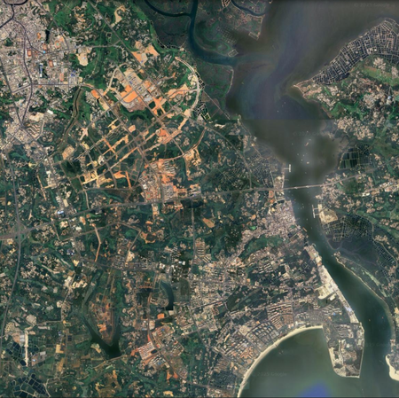
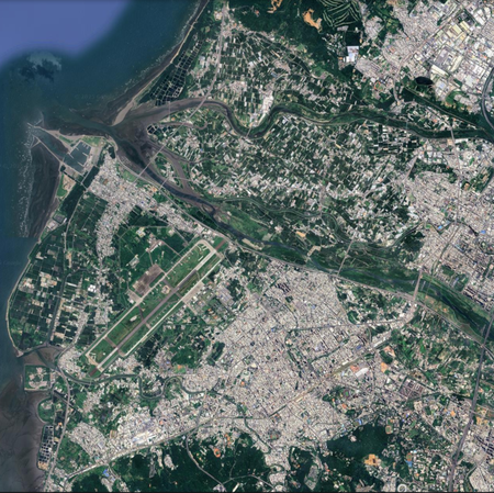
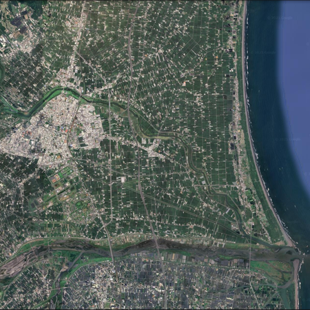
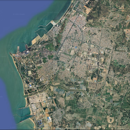
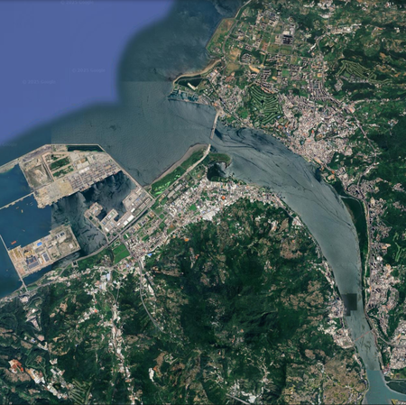
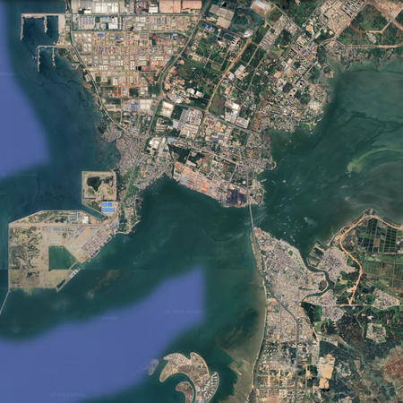
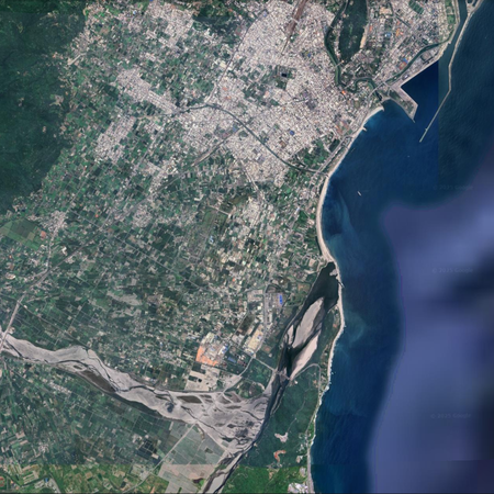
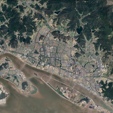
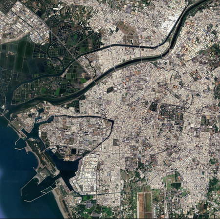
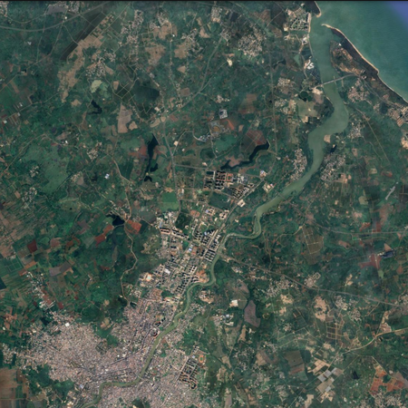
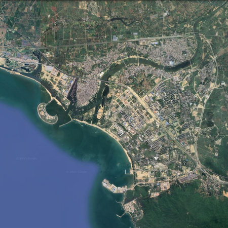
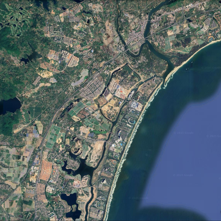
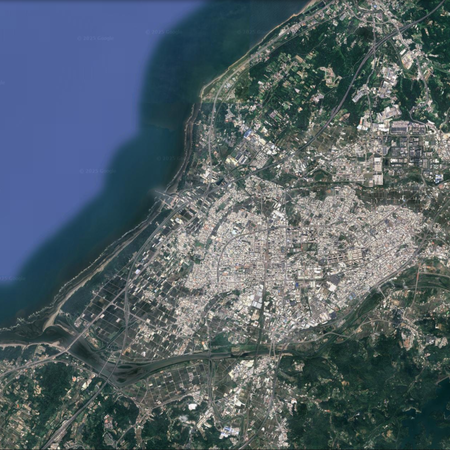
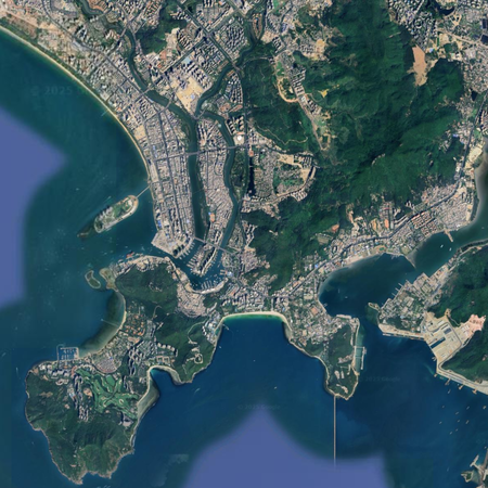
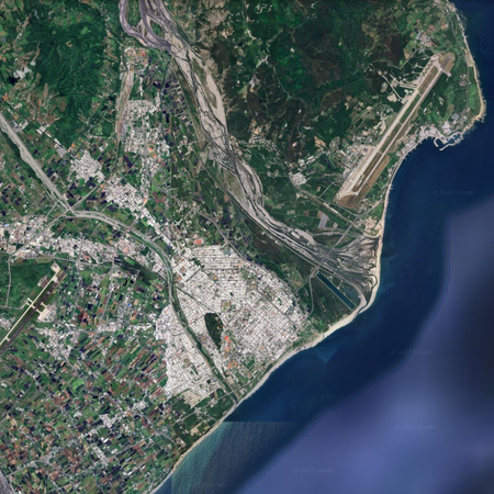
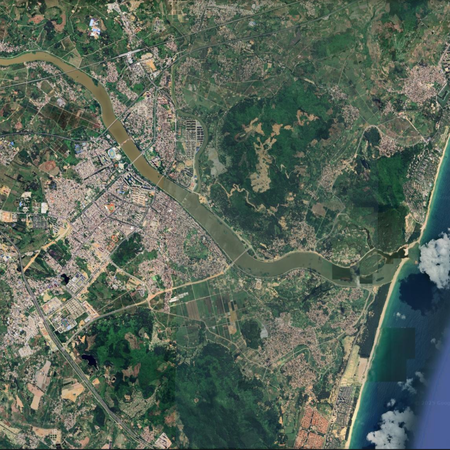
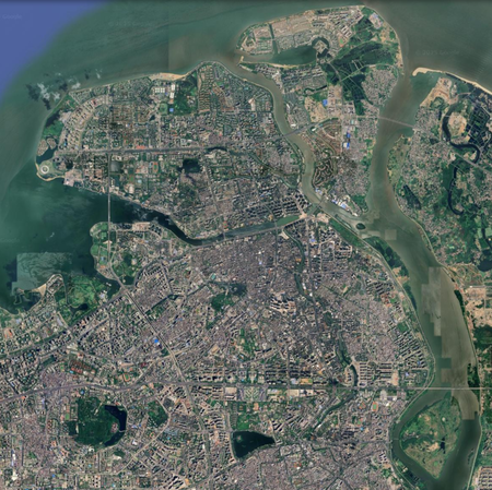
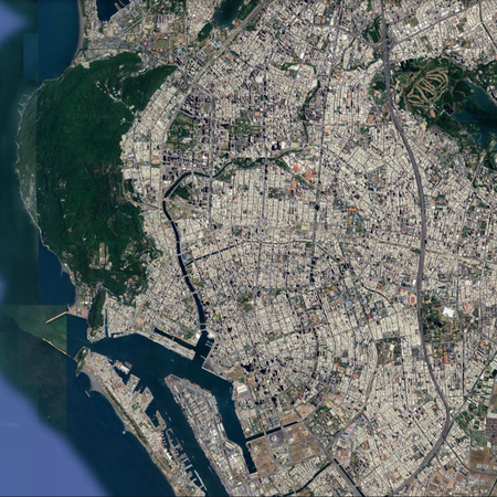
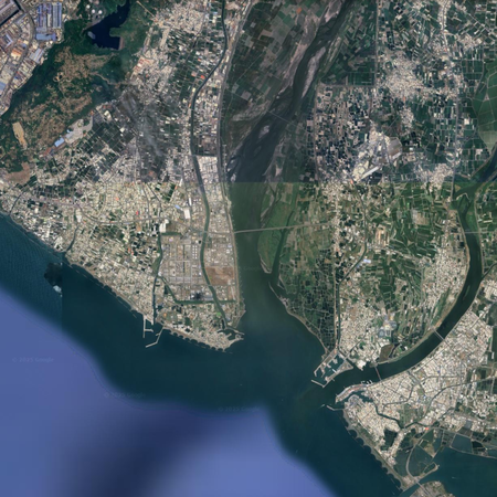
以河流入海处卫星图认中国海岛城市 Chinese cities by river estuary satellite images
请尝试借助城市建成区临近的较明显的入海口的卫星照片,辨认中国台湾岛、海南岛(和一个不属于以上两岛的彩蛋)的一些海岛城市(填写所在地级/直辖县/台湾一级行政区名)。其实可以看做是两岛沿海城市合集,只是挑选了有河流的比较好识别的位置截图(
图片来源:谷歌地球,视角高度统一均在18~19km之间
每次刷新,顺序会随机变化;注意时间限制
都认不出来?问题不大,仔细看看,总有认得出来的!其它的就当看答案科普啦
提示:可以大致根据海岸线方向猜测;有多个答案分属于三亚市的不同城区,写“三亚”或对应城区名均可;部分答案为政府驻地在更内陆的行政区下辖的沿海较大城区
Rate:
Last updated: September 2, 2025
You have not attempted this quiz yet.
More quiz info >>
| First submitted | August 22, 2025 |
| Times taken | 5 |
| Average score | 57.9% | Report this quiz | Report |
4:00
Enter answer here
0
/ 19 guessed
Time Used
00:00
Best Time
00:00
The quiz is paused. You have remaining.
Copied!
Scoring
You scored / = %
This beats or equals
% of test takers
also scored 100%
The average score is
Your high score is
Your fastest time is
Keep scrolling down for answers and more stats ...
Save Your Stats
Your Next Quiz

Try to name the best-selling video game consoles and of all-time.

Can you name the 49 urban agglomerations of the world that have a population of at least 10 million?

Can you name the four most populous cities in each U.S. state?

Drag the pin onto the correct country. Careful, though! Three wrong moves and the game ends.
Comments
No comments yet
New and Popular
卫星图 Satelite images
Quiz series by uoiunion
...