Language
Recent User Quizzes
Create Quiz
Recent User Puzzles
Recent User Blogs
More
About JetPunk
Dark Mode

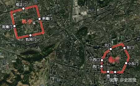
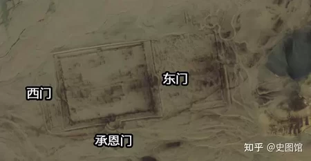
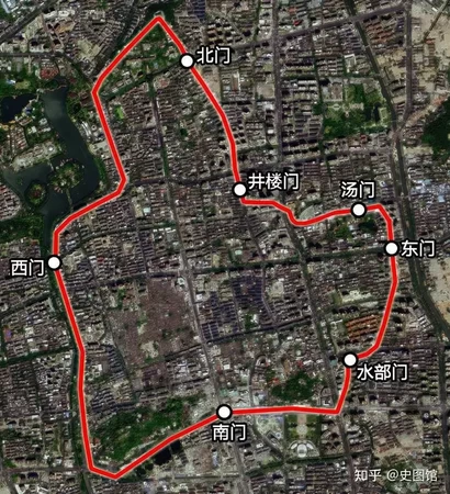
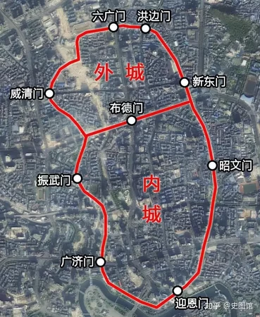
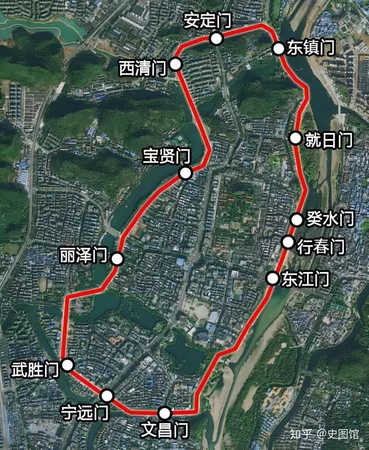
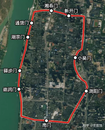
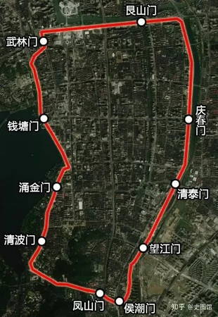
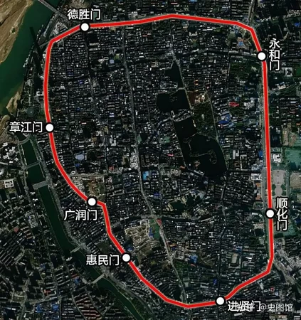
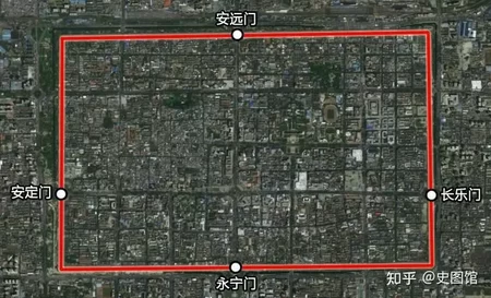
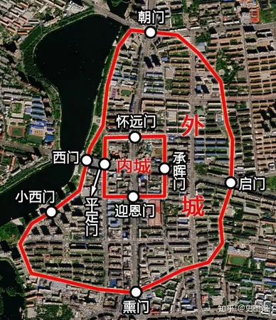
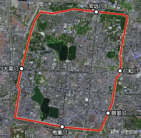
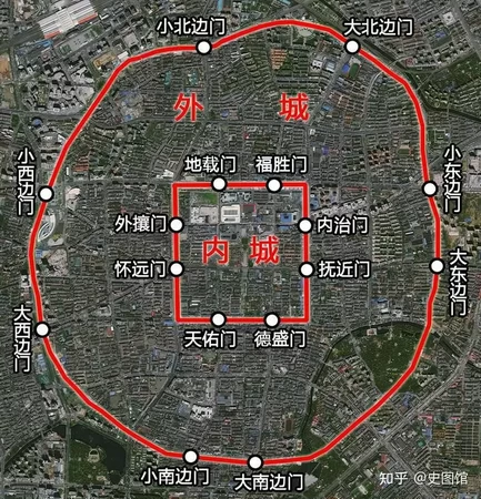
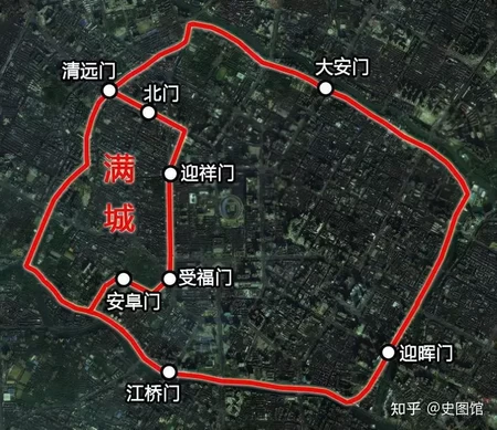
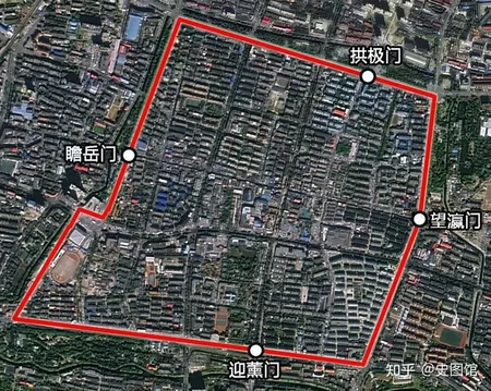
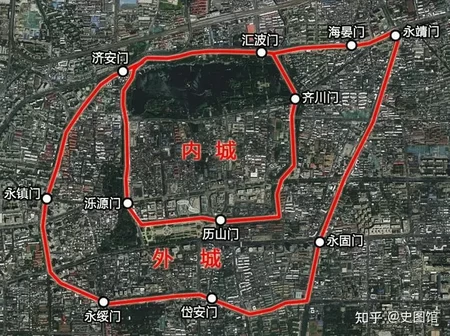
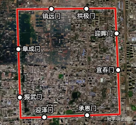
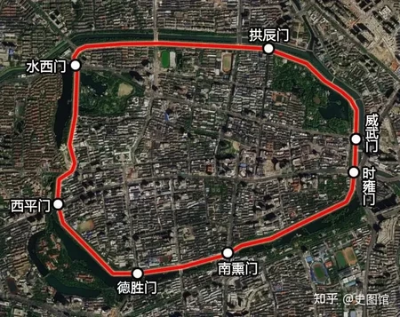
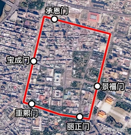
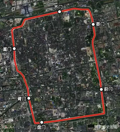
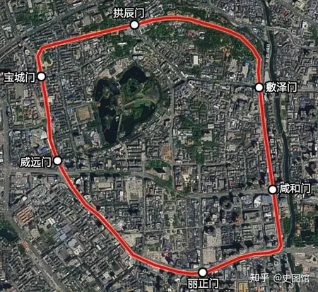
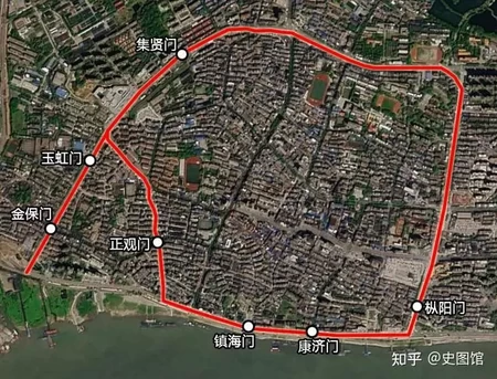
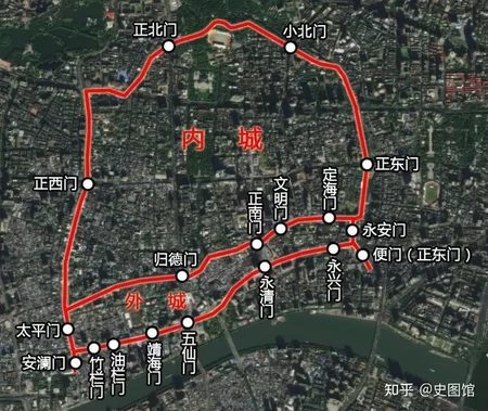
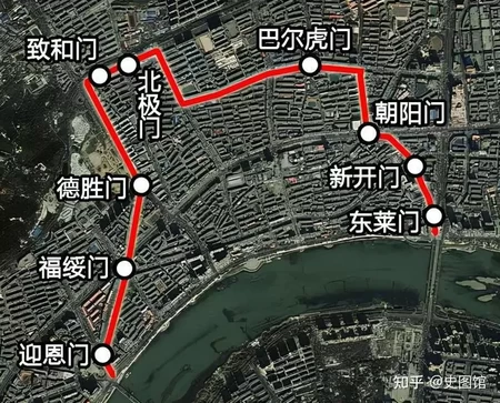
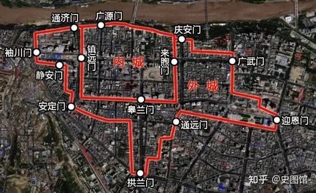
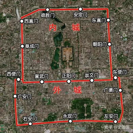
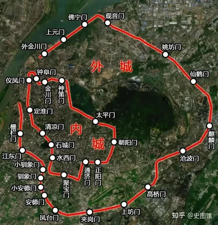
根据城墙地图写出清代各省城 Name the Qing Dynasty provincial cities based on map
请根据考证的城墙地图写出对应的清代省城(不完全严谨含所有省城)。
【重要提示 备填的省城包括:安庆、保定、北京、成都、长沙、迪化、福州、桂林、贵阳、广州、合肥、开封、杭州、吉林、济南、昆明、兰州、南昌、南京、齐齐哈尔、沈阳、苏州、台北、太原、武汉、乌里雅苏台、西安】
图片来源:知乎https://zhuanlan.zhihu.com/p/420592561
方向均为正上北下南,比例尺不完全一致。
注意时间,不鼓励穷举。
Rate:
Last updated: February 19, 2024
You have not attempted this quiz yet.
More quiz info >>
| First submitted | February 19, 2024 |
| Times taken | 88 |
| Average score | 37.0% | Report this quiz | Report |
6:00
Enter answer here
0
/ 27 guessed
Time Used
00:00
Best Time
00:00
The quiz is paused. You have remaining.
Copied!
Scoring
You scored / = %
This beats or equals
% of test takers
also scored 100%
The average score is
Your high score is
Your fastest time is
Keep scrolling down for answers and more stats ...

Save Your Stats
Your Next Quiz

Try to name the clubs in England's top football division for the 2025–26 season.

When you guess a country, all the countries it borders will also be completed. Can you fill in the world map in just 90 seconds?

Click the animals that live in Africa without clicking any of the ones that don't!

Can you guess the movies that these memes came from?
1 Comments
Ozbeg
+2
Level 38
Feb 20, 2024
民国城市地图大部分和城墙范围差不太多
New and Popular
中国人文地理 Chinese cultural geography
Quiz series by uoiunion
...