Featured Quizzes
User Quizzes
Create Quiz
Data and Charts
Word Search
Badges and Games
About JetPunk
Message Board
Random Quiz
Dark Mode
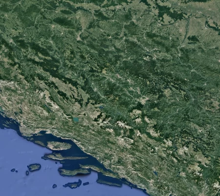
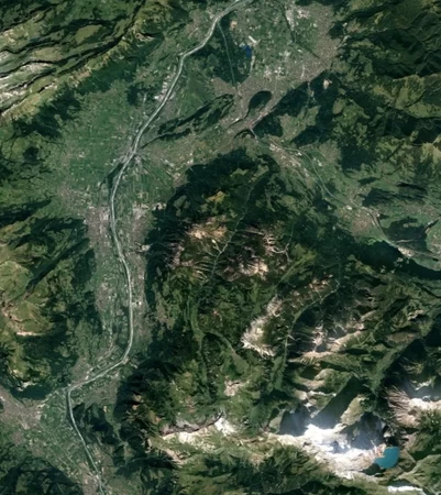
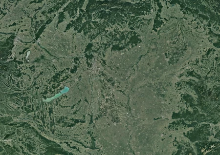
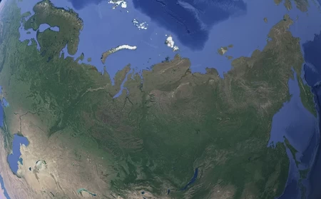
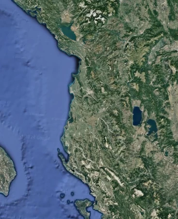
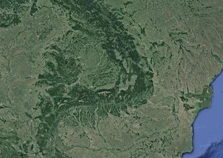
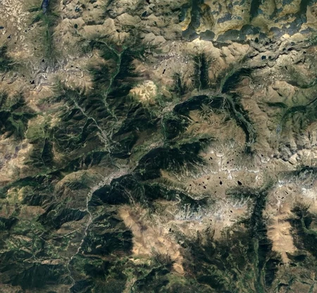
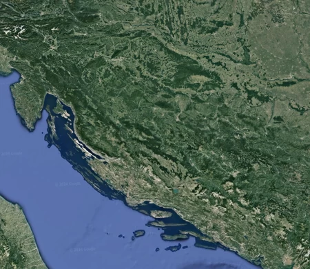
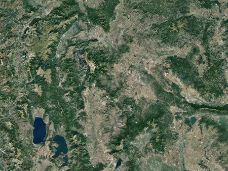
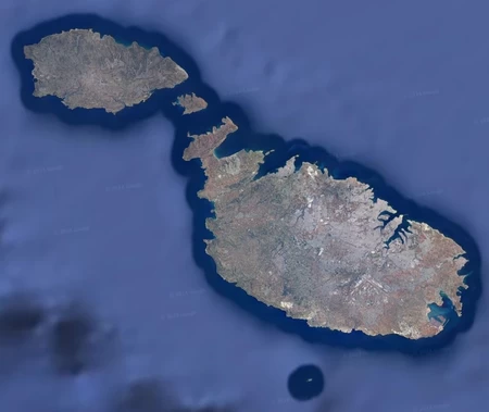
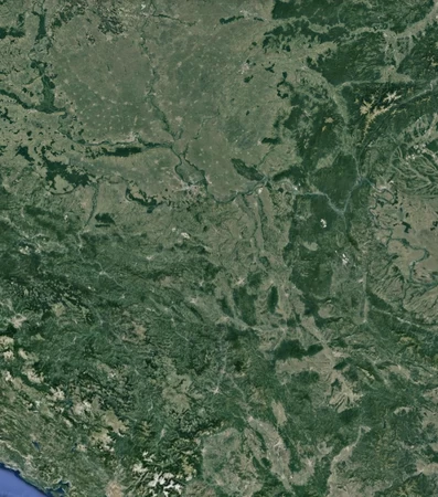
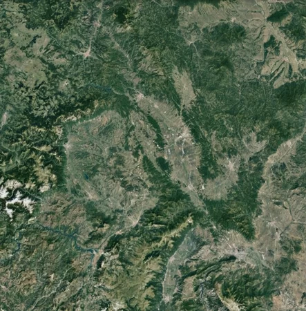
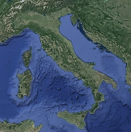
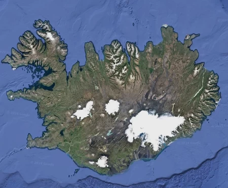
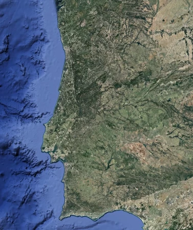
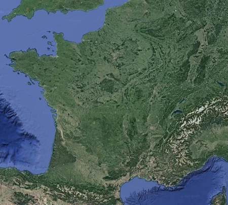
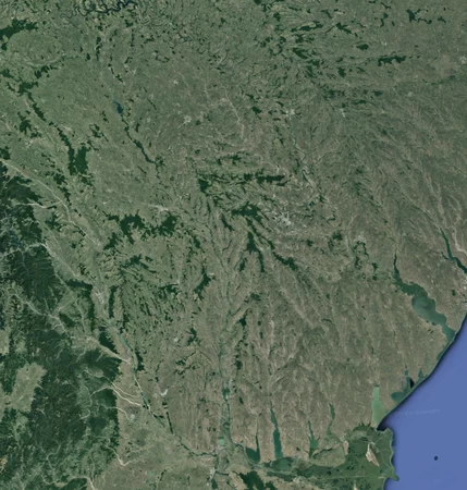
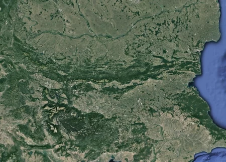
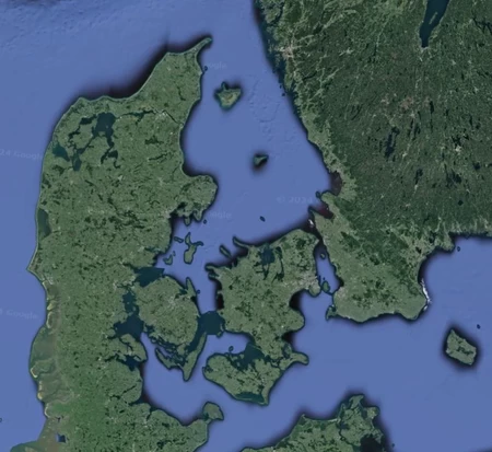
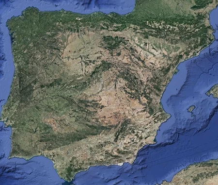
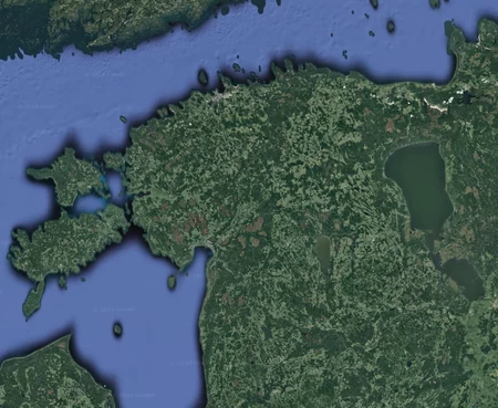
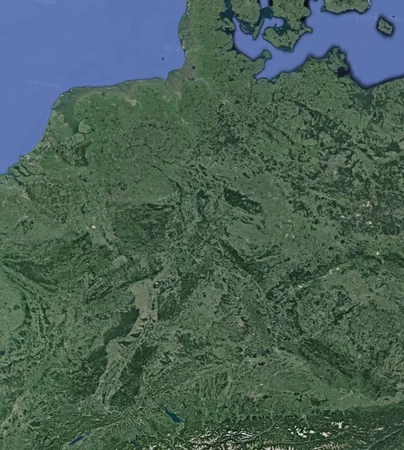
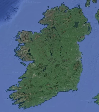
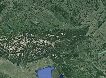
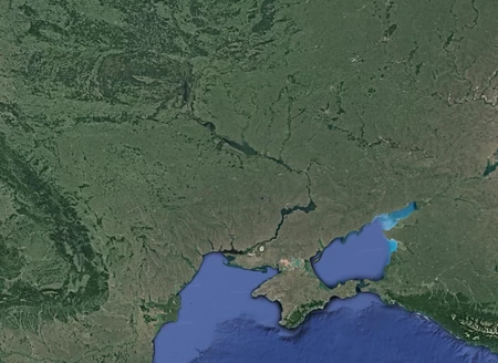
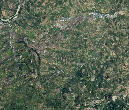
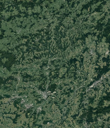
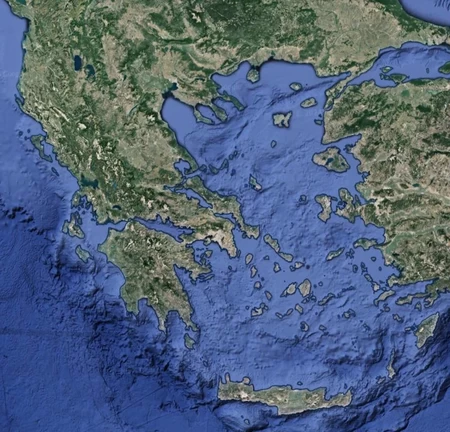
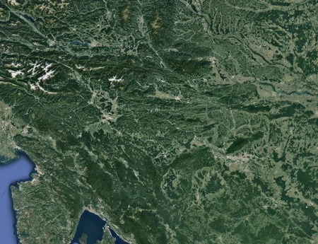
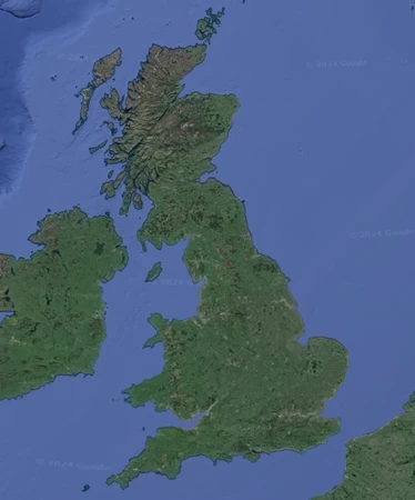
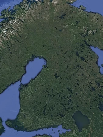
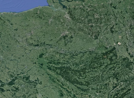
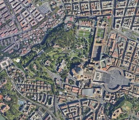
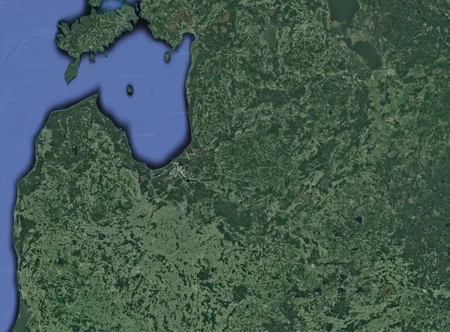
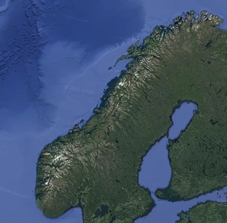
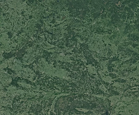
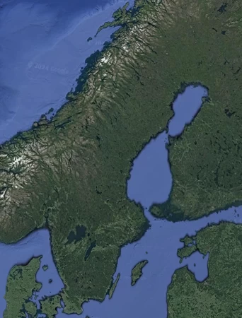
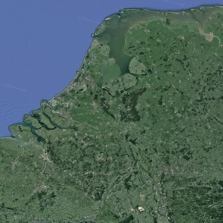
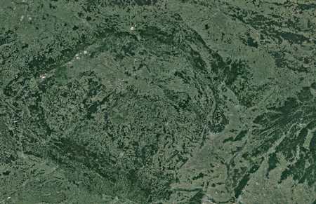
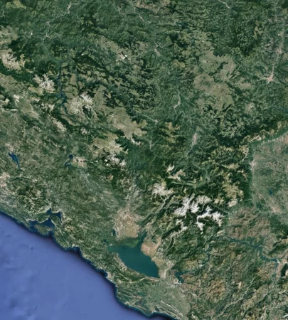
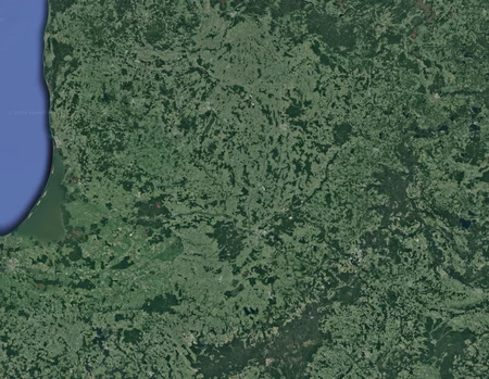
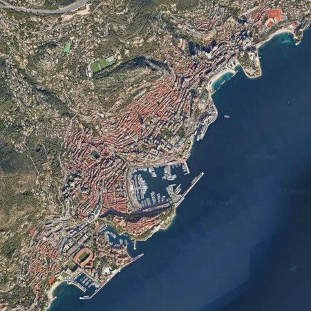
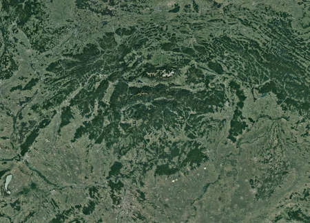
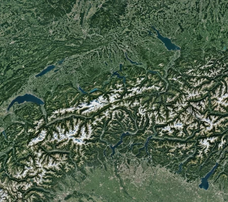
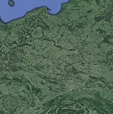
European Countries by Satellite Image
Can you identify each European country by a satellite image of its territory?
Europe as classified by the United Nations Geoscheme
Images taken from Google Earth
Some pictures include parts of other countries, the answer will always be the most central in the image
Rate:
Last updated: September 7, 2024
You have not attempted this quiz yet.
More quiz info >>
| First submitted | September 7, 2024 |
| Times taken | 26 |
| Average score | 68.9% | Report this quiz | Report |
5:00
Enter answer here
0
/ 45 guessed
Time Used
00:00
Best Time
00:00
The quiz is paused. You have remaining.
Copied!
Scoring
You scored / = %
This beats or equals
% of test takers
also scored 100%
The average score is
Your high score is
Your fastest time is
Keep scrolling down for answers and more stats ...
Save Your Stats
Your Next Quiz

Can you name the countries with the highest GDP per capita?

Beat the clock to unscramble the names of these countries. The answers change every time you play!

Can you name the ten Asian countries with the largest GDPs?

20 random countries have been removed from the map of the world! Can you identify them in 3 minutes?
Comments
No comments yet
New and Popular