Featured Quizzes
User Quizzes
Create Quiz
Data and Charts
Word Search
Badges and Games
About JetPunk
Message Board
Random Quiz
Dark Mode
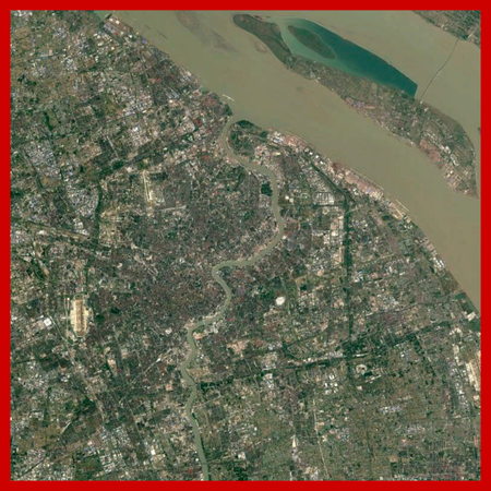
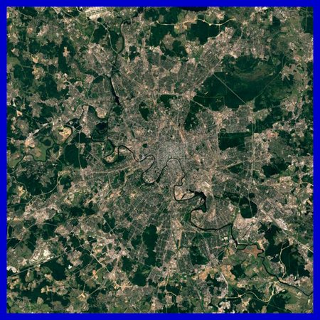
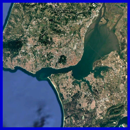
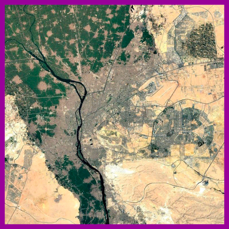
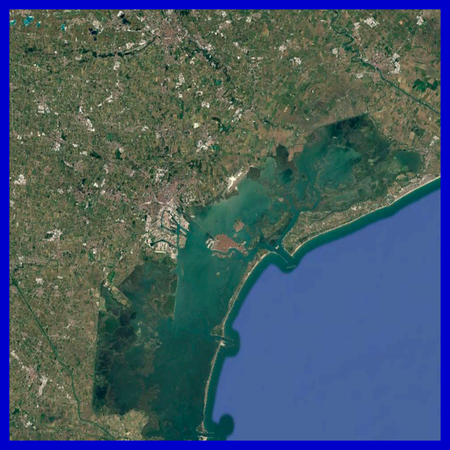
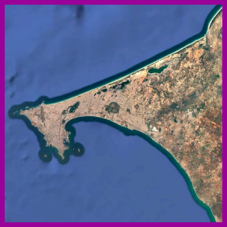
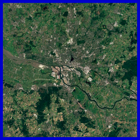
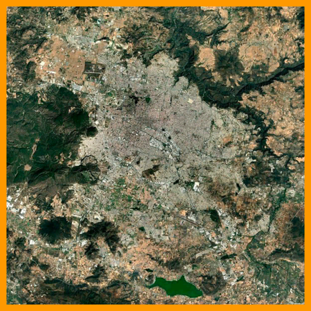
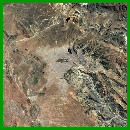
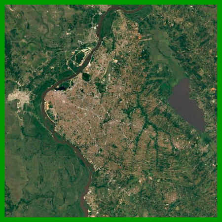
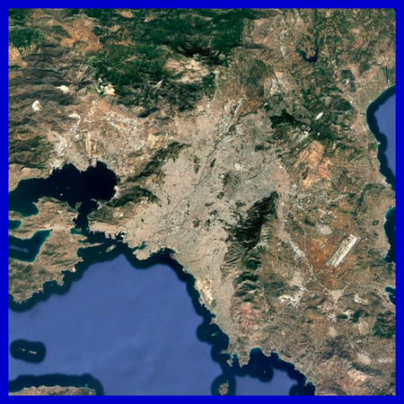
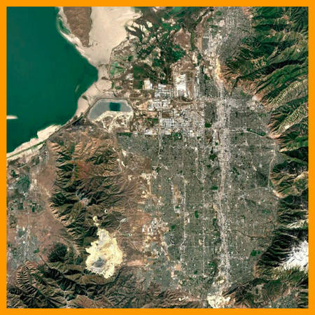
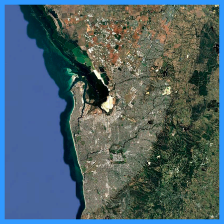
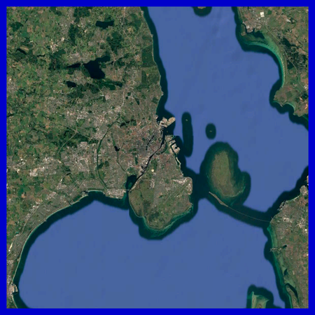
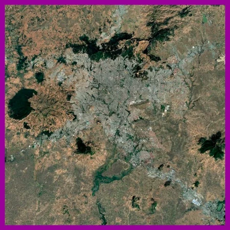
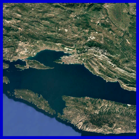
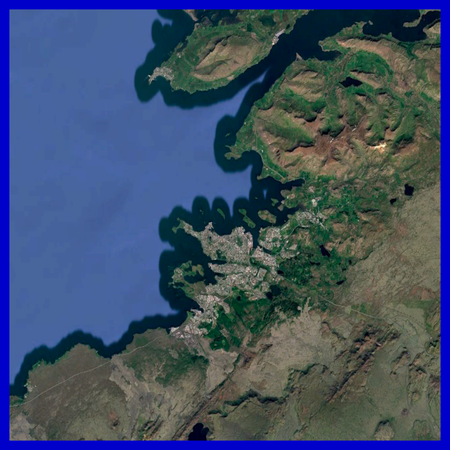
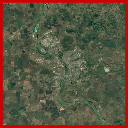
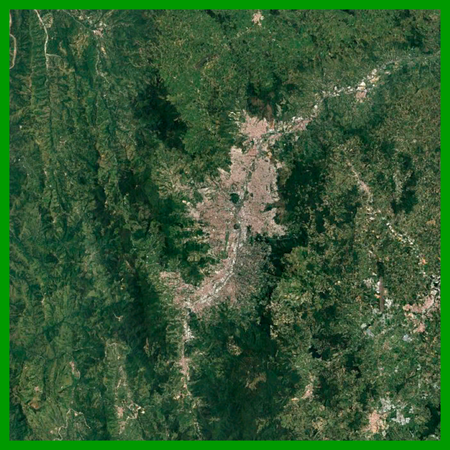
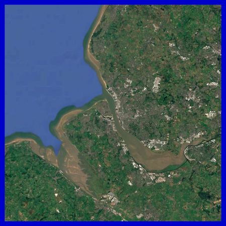
Random City by Satellite Photo
The following images have all been taken from Google Earth Pro with an eye altitude of 100 km. Can you guess which city is shown in each one?
The answers change every time you play!
The continent each city is located on is indicated by the coloured border around the photo.
Rate:
Last updated: June 8, 2025
You have not attempted this quiz yet.
More quiz info >>
| First submitted | June 8, 2025 |
| Times taken | 11 |
| Average score | 45.0% | Report this quiz | Report |
5:00
Enter city here
0
/ 20 guessed
Time Used
00:00
Best Time
00:00
The quiz is paused. You have remaining.
Copied!
Scoring
You scored / = %
This beats or equals
% of test takers
also scored 100%
The average score is
Your high score is
Your fastest time is
Keep scrolling down for answers and more stats ...
Save Your Stats
Your Next Quiz

Name all 50 states in the USA. Easy, right?

Watching the news might help you place these countries on the map.

Can you name the American cities that have ever had a population of at least one million within the city limits?

Drag the flag onto the correct state. Careful, though! One wrong move and the game ends.
New and Popular
Firstly, all the images are almost exactly the same scale. If you know what one city is, you can compare other ones to it and get a rough estimate of whether they're larger or smaller.
Depending on how much time you've spent on JetPunk, you're probably familiar 80-95% of the cities shown. There's a couple obscure ones, but most of them are pretty well-known.
In general, the clearer, sharper satellite photos are from richer countries and areas. There are exceptions to this, of course, but it might be a good way to narrow down your search.
Finally, most of the cities are pretty much centred in the frame. If you have an image of a city that isn't centred, it's probably because the stuff on the other side of the photo is a potential clue—pay attention to it!
That's all, hope you enjoy the quiz.