Featured Quizzes
User Quizzes
Create Quiz
Data and Charts
Word Search
Flash Cards
Badges and Games
About JetPunk
Message Board
Dark Mode

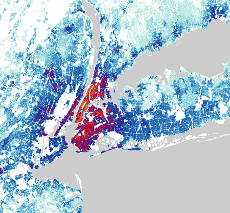
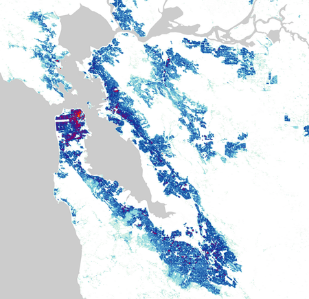
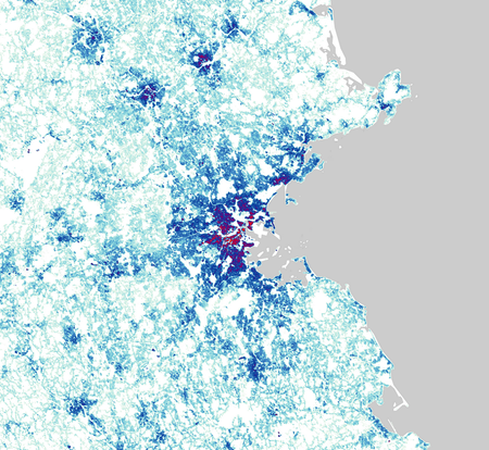
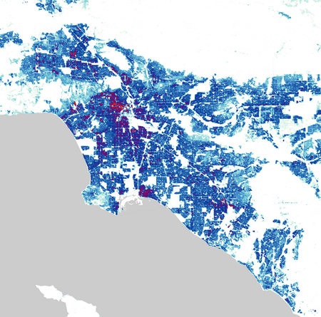
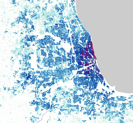
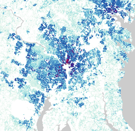
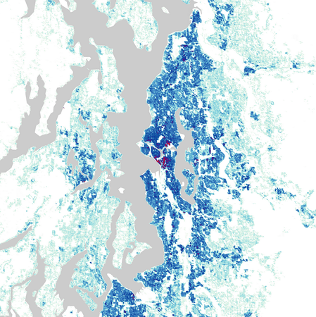
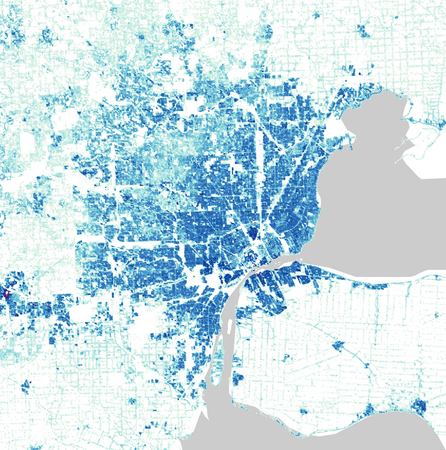
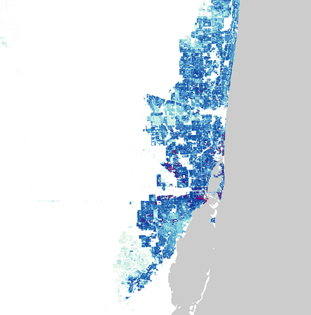
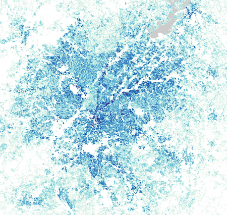
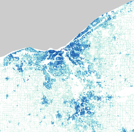
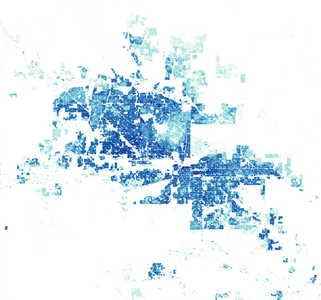
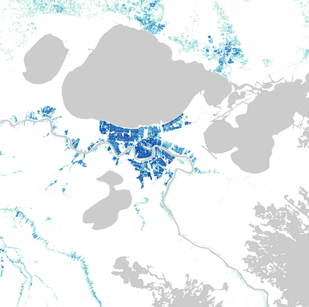
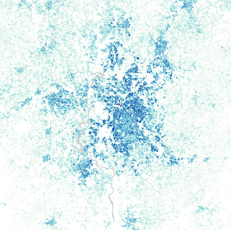
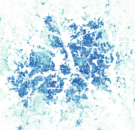
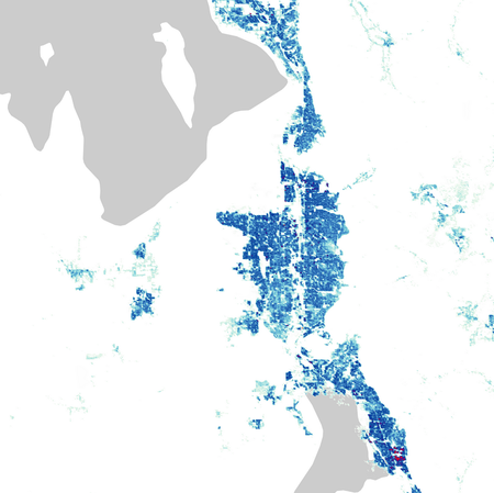
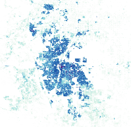
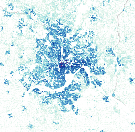
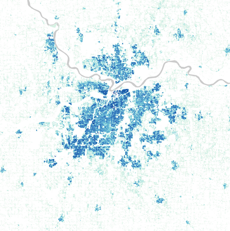
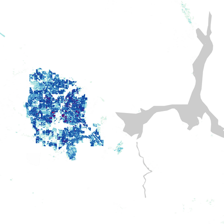
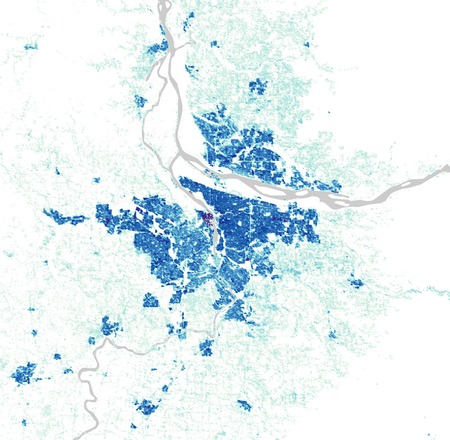
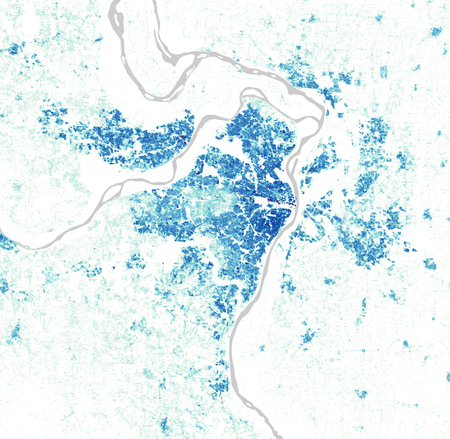
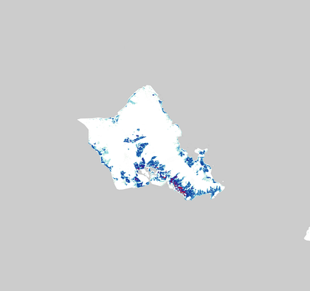
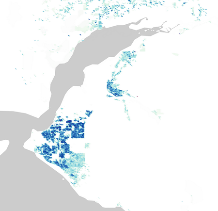
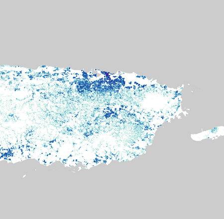
US Cities by Population Density Map
How well do you know sattelite view? Identify the US cities by these maps showing the distribution of their population density.
Answers range from painfully easy to painfully difficult. The key for population density is in the thumbnail!
Data is from 2020 - taken from https://www.luminocity3d.org
All images are the same scale
Rate:
Last updated: September 15, 2025
You have not attempted this quiz yet.
More quiz info >>
| First submitted | September 12, 2025 |
| Times taken | 64 |
| Average score | 57.7% | Report this quiz | Report |
15:00
Enter answer here
0
/ 26 guessed
Time Used
00:00
Best Time
00:00
The quiz is paused. You have remaining.
Copied!
Scoring
You scored / = %
This beats or equals
% of test takers
also scored 100%
The average score is
Your high score is
Your fastest time is
Keep scrolling down for answers and more stats ...

Save Your Stats
Your Next Quiz

Name all 50 states in the USA. Easy, right?

Can you name the capitals cities of all 196 countries in the world?

Click the countries which belong to NATO without clicking any of the ones that don't!

Drag the pin onto the correct country. Careful, though! Three wrong moves and the game ends.
Comments
No comments yet
New and Popular