Featured Quizzes
User Quizzes
Create Quiz
Data and Charts
Word Search
Flash Cards
Badges and Games
About JetPunk
Message Board
Dark Mode

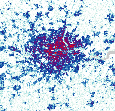
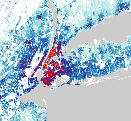
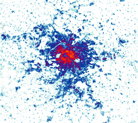
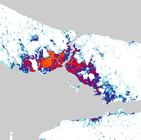
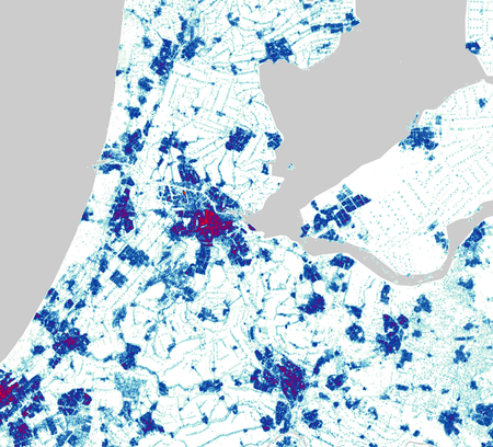
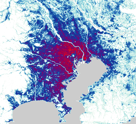
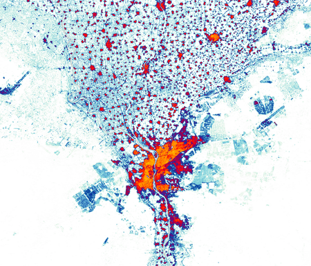
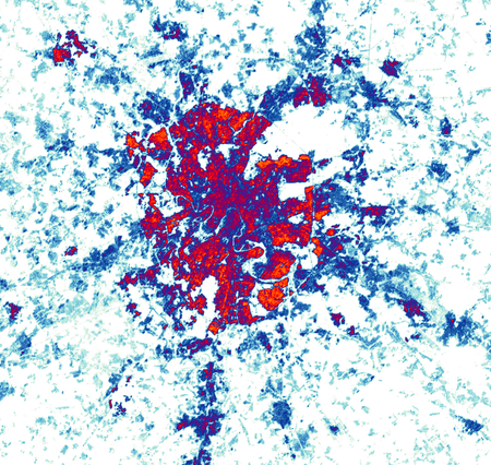
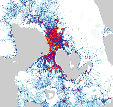
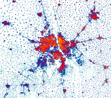
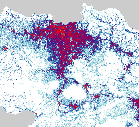
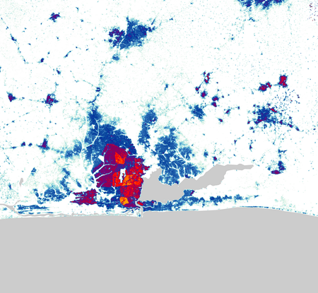
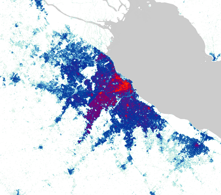
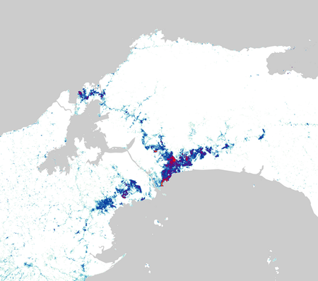
World Cities by Population Density Map #1
Identify the cities by these maps showing the distribution of their population density.
(Starting with a few easier ones but ramping up to the end)
The key for population density is in the thumbnail!
Data is from 2020 - taken from https://www.luminocity3d.org
All cities are either national capitals or the most populous city in their respective countries.
All images use the same scale.
Rate:
Last updated: September 15, 2025
You have not attempted this quiz yet.
More quiz info >>
| First submitted | September 10, 2025 |
| Times taken | 29 |
| Average score | 57.1% | Report this quiz | Report |
12:00
Enter answer here
0
/ 14 guessed
Time Used
00:00
Best Time
00:00
The quiz is paused. You have remaining.
Copied!
Scoring
You scored / = %
This beats or equals
% of test takers
also scored 100%
The average score is
Your high score is
Your fastest time is
Keep scrolling down for answers and more stats ...
Save Your Stats
Your Next Quiz

How many countries do you know? In this quiz, you've got 15:00 to name as many as you can. Go!

Can you name the capitals cities of all 196 countries in the world?

Italy has declared war 18 times on 16 unique countries. What were the countries?

Drag the pin onto the correct country. Careful, though! Three wrong moves and the game ends.
Comments
No comments yet
New and Popular