Featured Quizzes
User Quizzes
Create Quiz
Data and Charts
Word Search
Badges and Games
About JetPunk
Message Board
Random Quiz
Dark Mode
Deserts by Satellite Image
Can you identify these (non polar ice) deserts by a satellite image?
Sometimes more is shown, than just the desert, in order to make the identification easier.
Rate:
Last updated: May 4, 2020
You have not attempted this quiz yet.
More quiz info >>
| First submitted | May 4, 2020 |
| Times taken | 282 |
| Average score | 56.3% | Report this quiz | Report |
6:00
Enter answer here
0
/ 16 guessed
Time Used
00:00
Best Time
00:00
The quiz is paused. You have remaining.
Copied!
Scoring
You scored / = %
This beats or equals
% of test takers
also scored 100%
The average score is
Your high score is
Your fastest time is
Keep scrolling down for answers and more stats ...
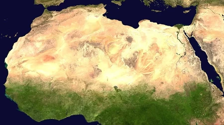
Algeria, Egypt, Libya, etc.
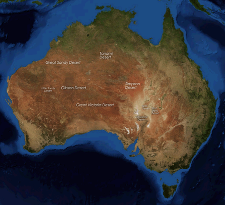
Australia
Australian Desert
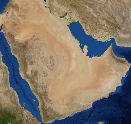
Saudi Arabia, Oman, etc.
Arabian Desert
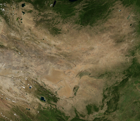
China and Mongolia
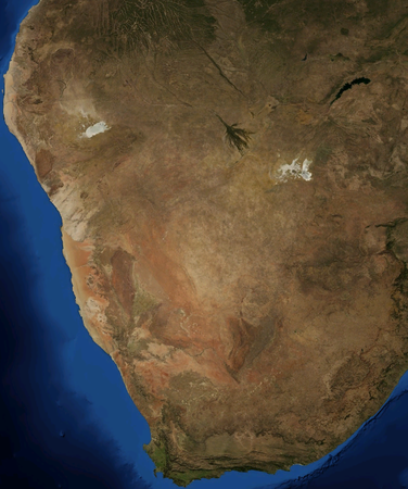
Namibia, South Africa, etc.
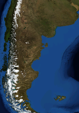
Argentina and Chile
Patagonian Desert
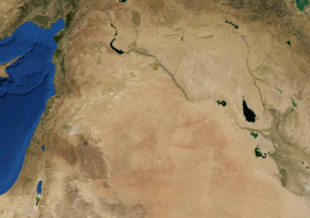
Syria, Iraq and Jordan
Syrian Desert
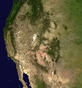
United States
Great Basin
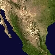
Mexico and USA
Chihuahuan Desert
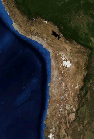
Chile and Peru
Atacama Desert
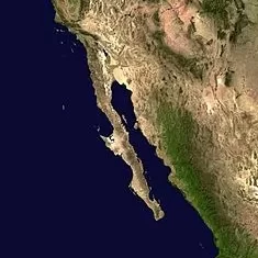
Mexico and USA
Sonoran Desert
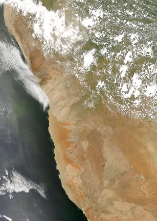
Namibia and Angola
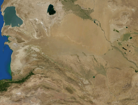
Turkmenistan
Karakum Desert
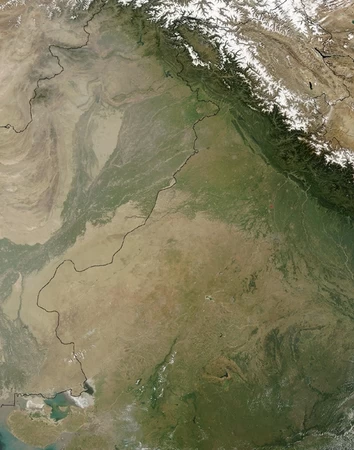
India and Pakistan
Thar Desert
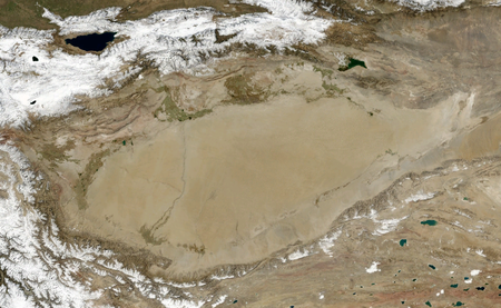
China
Taklamakan Desert
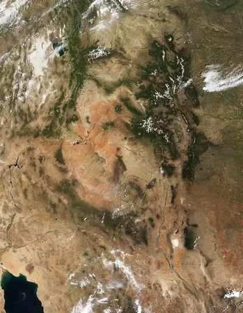
United States
Colorado Plateau
Save Your Stats
Your Next Quiz

196 countries. 196 flags. The ultimate challenge for geography champions.

Guess the countries that are pictured in these satellite images.

Guess the countries that are pictured in these satellite images.

Can you remember which squares have Jeppy the JetPunk fish inside them?
Comments
No comments yet
New and Popular