My Maps - Episode 1
Last updated: Monday December 1st, 2025
Report this blog
MapTime
I made a map for each continent (Except Oceania and Antarctica, Americas are one continent) and the World + US States + Middle East highlighting a different thing. Hope you enjoy!
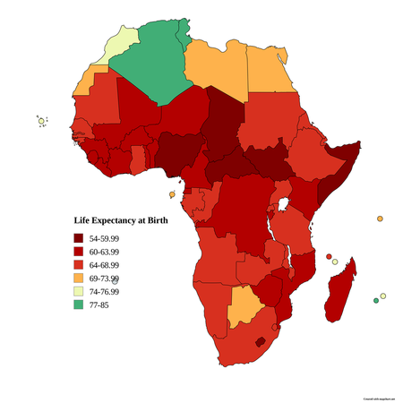
1. Africa's Life Expectancy
Countries of Africa by life expectancy
Source: Wikipedia (UN data for 2023, life expectancy at birth)
Data from Wikipedia
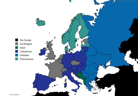
Note that Switzerland and UK are labelled as No Religion, because no religion makes up a larger proportion than any individual of the three Christian denominations, but Christianity is still the largest overall
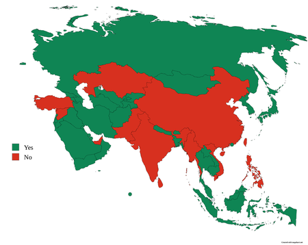
3. Asia: Is the capital the largest city?
Note that the largest city in Palestine is either Jerusalem or Gaza, not the capital of Ramallah, but I do not consider Palestine a country, so I marked it green anyways
Data from Wikipedia
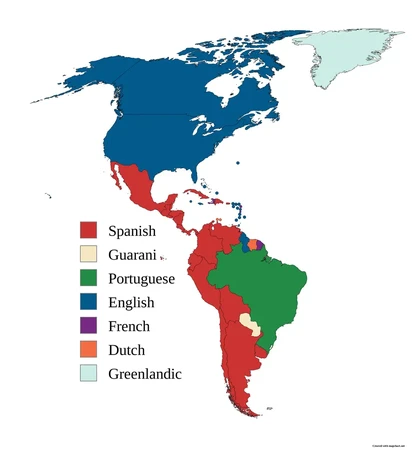
4. Languages in the Americas
Various Creoles are spoken in the Caribbean, but I am naming English for the Lesser Antilles, Jamaica, Bahamas, and British Territories, French for Haiti and French Territories, and Dutch for the Dutch territories
Source is my own knowledge with some fact checking
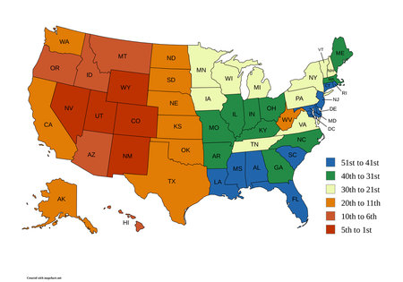
5. USA Elevation Map
This shows the rank of average elevation among the states, with different colors representing different ranks (51-41, 40-31, 30-21, 20-11, 10-6, 5-1) among highest average elevation
Source is Wikipedia
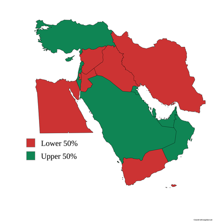
6. Middle Eastern GDP
Here, the green countries have a nominal GDP per capita in the upper 50% of the world's countries, while the red ones have a nominal GDP per capital in the lower 50% of the world's countries. This time, Palestine is going to be separate from Israel in order to rub some salt. Source is wikipedia
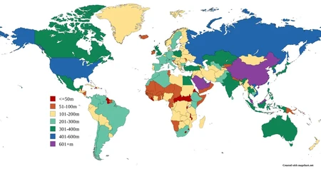
7. The Global Building Map
This map divides the countries of the world by how tall their tallest building is. Source is Wikipedia
If you then split up the religious 50% into different followings then the non-religious group will always be a majority.
This note