My Maps - Episode 3
First published: Sunday December 14th, 2025
Report this blog
MapTime
Time for the US Edition
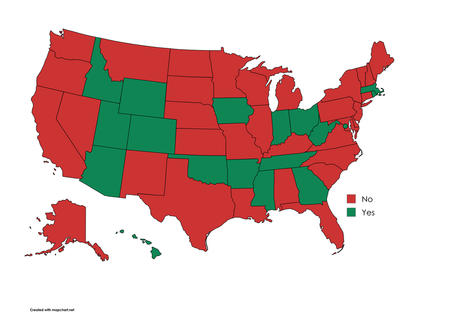
1. Is the State Capital the largest city?
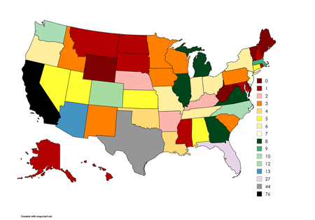
2. Number of 100k+ Cities in each US State
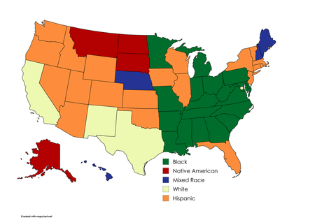
3. Second Largest Race
Groups I Will Be Considering
White (Non Hispanic)
Hispanic
Native American
Asian
Black
Mixed Race
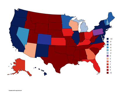
4. New Political Map
I made a political map last episode. Now, time to refine it. This time, they will be given ten points. Four points for each of the last four elections, one point for each Senator, one point for the party with a House of Representatives majority, one point for the current governor, one point for a State Senate majority, and one point for a State House of Representatives majority. Nebraska will not be able to get one of those points. If you know you know. The more red it is, the more Red points it has, and the more Blue it is, the more Blue points it has. Purple means it is split. Note that Virginia held a gubernatorial election that flipped it blue, so I will give it a point for Blue as governor. They will receive a score -10 to 10, where -10 is perfect Democratic and 10 is perfect Republican and 0 is True Battleground.
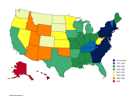
5. When did it become a state?
And there you have it! Next episode will be next week and will feature World Maps!
So, the questions are the different maps, and thing you need to click is what the map is representing, ig.