
County Overviews 9#
First published: Sunday May 18th, 2025
Report this blog
Hello everybody and welcome back to part nine of the County Overviews. I'm going to test this new format and tell me if you guys like it. Today, we are doing Charleston, South Carolina (LuckyCat); Allegheny, Pennsylvania (Neodymium); Door, Wisconsin (Lingonax); Jefferson, West Virginia (FlabberBapper). Also it's April guys. (I'm editing this and it's May - my schedule is absolutely terrible)
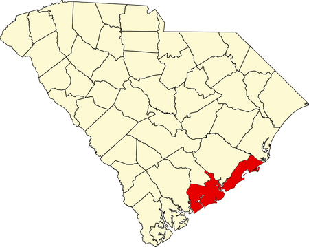
CHARLESTON COUNTY (LuckyCat)
Entrance
Charleston County is a county located on South Carolina's southeastern coast. Its county seat is Charleston, which is also its largest city. It is named after King Charles II and was founded on New Year's Day of 1800.
(2022 Data)
Population: 419,279
Total Area (includes water): 1,358 mi2
Population Density: 456.73/mi2
Largest Age Range: 20-34
MHI: $79,969
Poverty Rate: 11.6%
Largest Sources of Immigrants: Mexico, India, Honduras
History
After the throne was restored following Oliver Cromwell's Protectorate, King Charles II granted the Carolina Territory to eight of his friends in 1663. In 1670, the settlement called Charles Town was established in the territory. Soon, Charles Town became the capital of the Carolina colony due to its growing population. Following the Revolutionary War, the county was first chartered in 1785, but was dissolved due to the lack of governance. The county was then redrawn in 1798 and it officially became a county on January 1 of 1800.
Miscellaneous & Fun Facts
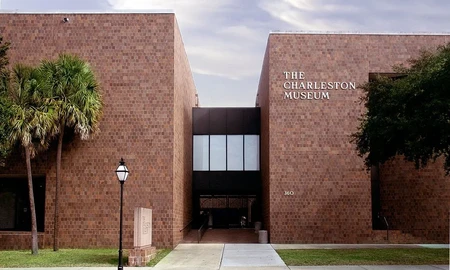
Charleston County is actually only the third most populous county in the state, only behind Greenville and Richland County. The county is shifted slightly towards Democratic likely due to its urban population, though it is sort of equal with Republicans. The majority of people are employed in the Health care and Food services sectors. Charleston County is home to the Charleston Museum, America's oldest museum and founded in 1773. Visit St. Philip's Church and the many wildlife refuges in the county if you find yourself in the county.
ALLEGHENY COUNTY (Neodymium)
Entrance
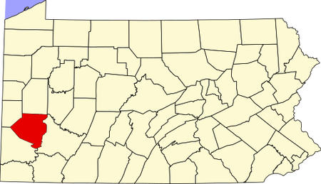
Allegheny County is a county located in southwestern Pennsylvania. Its county seat is Pittsburgh, which is also its largest city. It is named after the Allegheny River and founded on September 24, 1788.
(2022 Data)
Population: 1,233,253
Total Area (includes water): 745 mi2
Population Density: 1675.69/mi2
Largest Age Range: 50+
MHI: $71,973
Poverty Rate: 11.3%
Largest Source of Immigrants: India, Dominican Republic, China
History
Before European colonization, the area was inhabited by the Iroquois peoples. Then, European fur traders, such as Peter Chartier, set up early trading posts in the region. In 1749, the French colonized the Ohio River Valley in the west. The British and French battled to control the Ohio River Valley. The British set up Fort Prince George in the area, but was then captured and rebuilt by the French, who called it Fort Duquesne. Then, it was reclaimed by Gn. John Forbes in 1758 and destroyed the fort, making another one called Fort Pitt. After the Mason-Dixon line was extended westward, Pennsylvania claimed the northern part of Yohogania County, which was called Washington County. Then, Allegheny County was created from Washington County and Westmoreland County on September 24, 1788.
Miscellaneous & Fun Facts
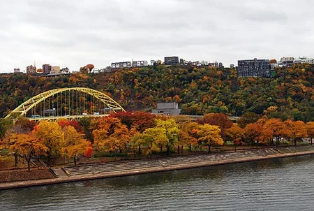
Allegheny County is shifted towards Democratic due to its urban population. Steel manufacturing was once a very key economic sector in the county due to Pittsburgh, but as it declined in the 20th century, Allegheny County's economy has shifted into other sectors. It is home to many major companies in the U.S., such as the U.S. Steel Corporation, H.J. Heinz Company, and PPG Industries. Visit the Point State Park, Allegheny Islands State Park, and the Allegheny Land Trust in the county.
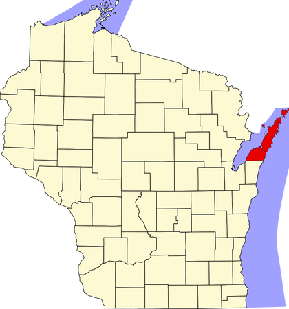
DOOR COUNTY (Lingonax)
Entrance
Door County is a county located in eastern Wisconsin. Its county seat is Sturgeon Bay, which is also its largest city. It is named by the strait between the Door Peninsula and Washington Island, called Death's Door (which is called that due to shipwrecks in the area). It was founded in 1851.
(2022 Data)
Population: 30,526
Land Area: 482 mi2
Population Density: 63.3/mi2
Largest Age Range: 65+
MHI: $72,296
Poverty Rate: 8.7%
Largest Source of Immigrants: Mexico
History
Many Native American tribes lived on the peninsula before European colonization, such as the Pottawatomi. Throughout the 1600s and early 1700s, various French explorers came to make contact with these tribes, such as Jean Nicolet, Claude-Jean Allouez, La Salle, Louis Jolliet, and Nicolas Perrot. Some French Jesuit priests even came to the area to minister to these tribes too. French rule ended in 1763 and the peninsula fell to the British claim, then later to the Americnas. The Menominee gave up the peninsula by the 1831 Treaty of Washington, opening the land for settlement. The county was then created in 1851 from Brown County.
Miscellaneous & Fun Facts
The county is swung between Democratic and Republican. The county is known as the "Cape Cod of the Midwest." It is the easternmost county in the state. The Sturgeon Bay Shipping Canal in the county makes the northern half of the peninsula an artificial island. Visit the many state parks, state natural areas, Mackaysee Lake, lighthouses, and Hog Island if you find yourself in the county.
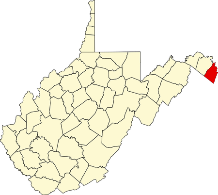
JEFFERSON COUNTY (FlabberBapper)
Entrance
Jefferson County is a county located in the northeastern panhandle of West Virginia. It is West Virginia's easternmost point. Its county seat is Charles Town, which is also its largest city. It is named after Thomas Jefferson, the third president of the U.S. It was founded on October 26, 1801.
(2022 Data)
Population: 58,979
Total Area: 212 mi2
Population Density: 280.8/mi2
Largest Age Range: 50-64
MHI: $87,259
Poverty: 9.1%
Largest Source of Immigrants: Mexico, Germany
History
Before colonizers, many Native American tribes lived in the area, such as the Saponi and Delaware. When the 13 Colonies became the U.S., a Jefferson County existed in Virginia, but is now part of Kentucky (1780). Then in 1801, citizens in Berkeley County felt that they were traveling too far to the county seat in Martinsburg; Charles Washington, brother of George Washington, petitioned a new county to be made. On October 26, 1801, Jefferson County was created. In 1863, Jefferson County voted to be part of the newly created West Virginia. Though the vote was controversial, Congress recognized Jefferson County's annexation to West Virginia in 1866.
Miscellaneous & Fun Facts
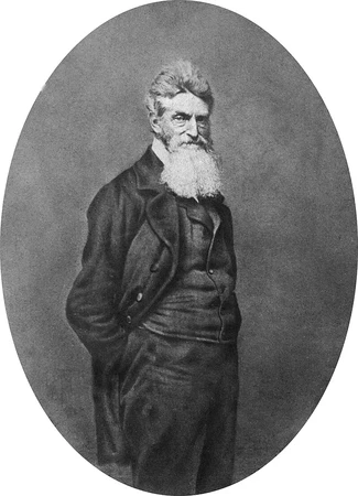
The county is shifted towards Republican. In October of 1896, it became the first county in the U.S. to begin the Rural Free Delivery service. In 1859, John Brown, a radical abolitionist, raided an armory in Harpers Ferry, but was captured and executed in the county's courthouse. The county was a frequent site of battle during the American Civil War, most likely due to its proximity to the Shenandoah Valley. Conflict was so frequent in the county that some cities and towns kept switching sides between the Union and the Confederacy.
If you're in the county, see the Harpers Ferry National Historical Park, the Happy Retreat house, Mount Ellen, and John Brown's Fort.
Epilogue
I hope you enjoyed and learned something for the ninth blog of the series! I really have nothing much to say.
Here's the current list of upcoming counties:
10# - Ocean County, New Jersey (trumpit)
10# - Erie County, Pennsylvania (cathlete)
10# - Montgomery County, Maryland (Ptcairn)
?? - The Washington Counties (Rockum99) {Sorry Rockum! This one might be a bit difficult!}
Again, you can recommend a county and you'll be on the list! See you next time!
I'd say that Charleston is increasingly becoming Democratic due to the influx of people from other parts of the country, especially the North.
The poverty here is very noticeable, which is sad. I've also been to the Museum at least once, maybe twice, I can't remember.
There are 4 McDonalds in Charleston County, they must be packing all the workers into the 2 KFC's or 13 Starbucks :D