
Five Islands of The Americas - Part 3
First published: Saturday July 27th, 2024
Report this blog
Introduction
If you read the blurb on this blog before just blindly clicking in your haste to read my latest addition, you will have seen that this is the penultimate blog in the series. That means the last but one. By now, you all know that I am truly fed up and bored with islands. The research has become tedious, many islands have little or no information, even less visual media, and not even a presence on Google Street View.
If I had known how bored I would get when I started the series back in January 2022 with this BLOG, I perhaps would have stuck to the UK. Ah well never mind, we're nearly at the end now. Just ten more islands to write about. This blog covers Colombia and Central America as far as the United States border.....
Santa Cruz del Islote (Colombia)
This partly artificial island lies southwest of Cartagena and is part of the San Bernardino archipelago. It was built up using materials from the sea and nearby islands by fishermen that used the island for protection from storms. It is thought that the island is now the most densely populated island in the world.
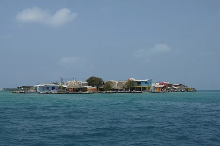
The population increased in proportion to the island's size. Its main attraction was the abundance of fish and the absence of mosquitos.
The island was named by early settlers when a cross was washed ashore and placed in the centre of the island.
Due to its small size, only three acres, residents often migrate to the larger islands nearby.
The island isn't autonomous, but there is a community group that helps with the running of the island. There is no police force, but there is no crime either. There is a free 24hour internet service allowing remote learning for residents.
Santa Cruz became the first territory in Colombia to be fully vaccinated against Covid-19.
Getting to the island is by boat on one of the day trips organised from the nearby islands of Murcura and Tintipan or from the mainland at Tolu and Cartagena.
This YouTube video describes a visit to the island.
Coiba Island (Panama)
For the first time in the whole series, I have chosen the largest island, not only in Panama, but in Central America. (I think that is a correct statement, I haven't gone back through all my blogs to check). Anyway, Coiba Island is located off the Pacific coast of Panama, in the Montijo District. It is part of the Coiba National Park, which encompasses the island and surrounding coral reefs.
In 1919, a penal colony was established on the island. It was a feared place with many instances of torture, political executions, and murders. It is thought that over 300 prisoners lost their lives in the prison during the dictatorships of Omar Torrijos and Manuel Noriega. Most locals avoided the island for these reasons, and following the closure of the prison in 2004, the island's untouched condition meant it was ideal as a nature reserve.
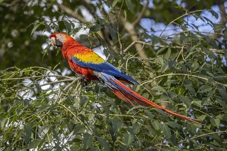
The island is home to many different species and is the only place in Central America where the Scarlet Macaw can be seen in the wild.
The island can be visited, with the appropriate permit, from several places, although the closest is from the beach at Santa Catalina, the journey takes around one and a half hours.
The National Park has its own website.
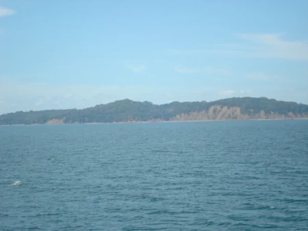
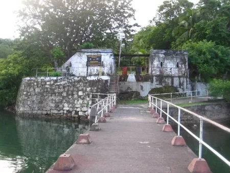
San Lucas Island (Costa Rica)
San Lucas Island is located on Costa Rica's Pacific coast near the city of Puntarenas. Coincidently, like the previous island, San Lucas was the home of a brutal prison and is now a National Park.
There is evidence of indigenous groups having lived on the island from around 1000AD, however, its main period of occupation was during the prison era from 1873 to 1991. The prison was known on the mainland as being a place of torture from which few returned.
The island was designated as a wildlife reserve in 2002 and became Costa Rica's 30th National Park in 2020.
Tourism has been encouraged, although some argue this is spoiling archaeological remains. UK-based charity organisation, Raleigh International, occasionally sends volunteers to help with infrastructure.
Several companies operate charters to the island, it is around 40 minutes by boat from Puntarenas. There is also a small airstrip on the island.
This YouTube video describes a visit to the island and former prison. It is however from 2012, so it may be a bit different nowadays.
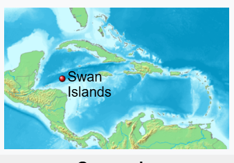
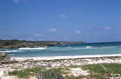
Swan Islands (Honduras)
The Swan Islands are a group of three islands in the Caribbean Sea, about 95 miles (153 km) northeast of Honduras. The largest is Great Swan Island, the middle one is Little Swan Island, and the smallest is called Booby Cay. The only human residents are a small Honduran Navy garrison on Great Swan Island.
The islands were discovered by Christopher Columbus in 1502 and named "Islas de las Pozas", but were renamed Swan Islands in the 18th century after Charles Swan, the captain of Cygnet, who was captured by pirates.
In 1856, the US claimed the islands under the Guano Islands Act for the purpose of exporting guano as a fertilizer. The islands changed hands several times over the following years with various exports including coconuts. They were used as a weather station for hurricane watching and as a base for US forces during World War II.
The islands also became a quarantine station for imported beef after the war until 1949.
After many years of disputed ownership between Honduras and the USA, the islands were finally handed to Honduras in 1972.
It has been suggested that the CIA had a covert training facility for Nicaraguan Contra rebels.
At the turn of the millennium, a Florida-based company announced plans to build a luxury resort on the islands, however, 20 years later there were no signs of development.
In 2023, the president of Honduras announced plans to build...guess what? Yup, an isolated prison for up to 2,000 gang leaders.
It is not possible to visit the islands at this time, unless, of course, you decide to join the Honduran Navy, bide your time and request a transfer to the island.
This YouTube video shows what the islands were like during their US days.
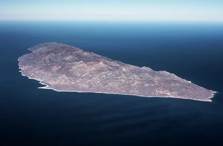
Jacques Cousteau Island (Mexico)
Previously known as Cerralvo Island until November 2009, when the Mexican government changed it to honour the famous French oceanographer and filmmaker, much to the consternation of the local population of Baja California, who apparently had no say in the matter. The island is situated just around the headland from the city of La Paz at the southern end of the Baja Peninsula. It is the ninth largest island in Mexico.
Jacques Cousteau was a regular visitor to the area and conducted many surveys and led expeditions in the waters around the island and elsewhere in the region.
There is abundant marine life in the island's coastal waters and there are many temporary camps used by local fishermen on the island.
Big game fishing for marlin, sailfish, and swordfish is popular in the channel next to the island.

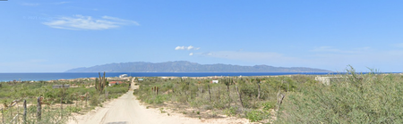
Ocean safari trips around and to the island are available from La Paz. Or you can visit with your own boat.
This YouTube video describes a visit to and around the island.
Summary
I have already given a little teaser in my last few blogs about my next project, and this blog is no different. I have already started the first blog in my next series and am looking forward to the research and writing. There will be a full disclosure in my final summary of my final blog of this series soon. I will just say that it is geography based, but with a history twist. That's all you're getting for now.
Once again, thanks for reading my blogs!
As an American I look forward to the next blog and to seeing what the Great Lakes Island is! (Maybe one that I've visited?!)
You're in luck, the Honduran Navy is recruiting right now !....
Application