Strangely Named Places ~ Ireland
First published: Sunday June 1st, 2025
Report this blog
Introduction
Firstly, I would like to apologise in advance if I offend anyone with this series of blogs. I am sailing in uncharted waters at this point. To me, these place names are strange, funny, or just plain weird. However, in another language they may appear perfectly normal. I will endeavour to add a short etymology of the name, and provide some interesting titbits about the place in question. I will not write anything that may degrade any place, or intentionally make fun of the name, that is not my style as you probably know. If anyone is offended, then please let me know and I will change the blog. Though I hope that won't be necessary.
The places are chosen by me, in a completely random way. I just browse through Google Maps until I spot a name that amuses me or looks strange. I then check on various sources for information on that place, and then write about it. That's it. No hidden agenda. If there isn't much info, or it is just derogatory, then the name is discarded. I may miss better examples, but that's too bad. Once I have six suitable placenames, I stop looking.
This edition comes to you from the Emerald Isle, the home of Guinness, and the Blarney Stone. Here are six weird and wonderful placenames from the Republic of Ireland...
Gorey (Co. Wexford)
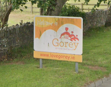
Located just of the M11 Dublin to Wexford motorway, Gorey is a growing town with many modern amenities. The name of the town may come from the Irish Gabhraighe, meaning "a place abounding with goats"
The town was granted a charter in 1619 under the name Newborough, but the name wasn't popular, as described in a Dictionary of Ireland by Samuel Lewis in 1837, the "inhabitants did not take kindly to the name chosen for the town". Norman records from 1296 refer to a town called Gorey already established at that time.
Many of the buildings in the town date from the 19th century, however many earlier buildings, including Ramsfort House, home to the Ram family that designed the town in the 17th century, were burnt down during the Irish Rebellions of 1641 and 1798.
The parents of former New Zealand Prime Minister, Jim Bolger, emigrated from Gorey in the 1930's.
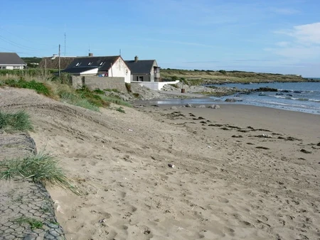
North Slob (Co. Wexford)
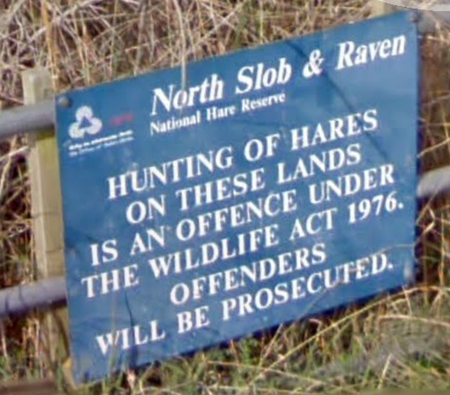
North Slob isn't a settlement, it is a nature reserve, as you can see from the above photo. It is an area that was reclaimed from the sea in the 19th century when a sea wall was built. The area is the lowest point of the island of Ireland.
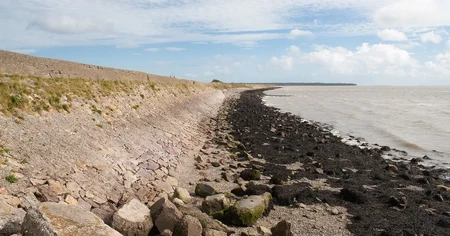
About one third of the world population of Greenland white-fronted geese spend their winter at North Slob.
North Slob has another claim to fame. In 1951, Sir Hugh Beaver, the managing director of Guinness Breweries at the time, was on a shooting trip at North Slob. An argument ensued as to which bird, the grouse or the golden plover, was the fastest game bird. Later in the evening over drinks, he realised that there wasn't a source in reference books to decide the argument over the fastest bird. He also realised that there must be hundreds of arguments in pubs over various similar subjects. He then thought that a book supplying answers to such arguments would be popular. And so the Guinness Book of World Records was born.
Sneem (Co. Kerry)
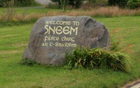
The name of Sneem in Irish is An tSnaidhm and means "the knot". There are several theories as to the meaning, firstly it is thought to come from a swirling in the nearby river that resembles a knot. It is also thought to come from the fact there are two squares in the village with a bridge between them acting as a knot. A less popular theory is that Sneem is the knot in the famous Ring of Kerry.
Former French president Charles de Gaulle visited Sneem in 1969, and a statue in North Square commemorates his visit. Other statues in the village memorialise local sportsmen, Steve Casey was a rower and five times wrestling world champion between 1938 and 1947, and John Egan, Gaelic footballer that won six All-Ireland medals and five GAA (Gaelic Athletic Association) awards. Also from the village was William Melville, the first head of the British Secret Service.
Ballybunion (Co. Kerry)
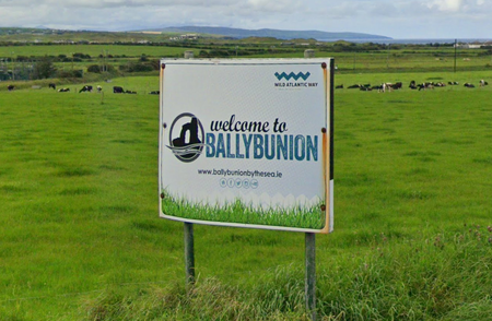
Ballybunion is located on the west coast of Ireland on the Wild Atlantic Way, a tourist route of 2,500 km (1,553 mile) from the south to the north of Ireland along coastal roads. It is thought to be one of the most scenic drives in the world.
The name of the town derives from the family name of the early inhabitants of the castle. The castle was associated with the Bunyan family in the early 16th century. It has been a protected national monument since the 1920's, along with several other buildings in the village including the Church of Ireland and Roman Catholic churches.
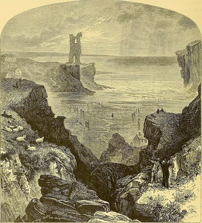
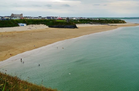
The village has two beaches named Ladies Beach and Mens Beach. The names come from a time when bathing was segregated between the sexes. The headland between the two beaches is the site of the ruined Ballybunion Castle, as can be seen in the adjacent photo. You just have to look closely!
The local Ballybunion Golf Course was described in the Golf Digest magazine as the seventh best golf course outside the USA. Many famous golfers have played there including Tiger Woods and Rory McIlroy, as well as such dignitaries as astronaut Neil Armstrong and President Bill Clinton, of which there is a statue in the town commemorating his visit.
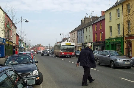
Clogherhead (Co. Louth)
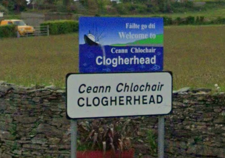
Clogherhead is located on the east coast of Ireland between the capital, Dublin, and the border with Northern Ireland. It's name in Irish is Ceann Chlochair and means "rocky headland". Just to confuse people, the headland is called Clogher Head, and the village is Clogherhead, got that? Good!
The main industries in the area are fishing and farming, there is a large fishing fleet in the harbour and a RNLI lifeboat has been stationed there for over 100 years.
The headland is also the location of Red Mans Cave, where soldiers of Oliver Cromwell are reputed to have killed a number of Catholic priests during the Cromwellian Wars of 1649.
Due to the expansive sands and headland Clogherhead has been the location of many films over the years, including "The Devil's Own" starring Harrison Ford and Brad Pitt. One inhabitant of Clogherhead was Albert Cashier who served in the Union Army during the American Civil War. Albert was actually born as Jennie Irene Hodgers, but in order to enlist dressed as a man. Cashier kept up the identity for the next 53 years prompting historians to believe that Cashier was one of the earliest trans men.
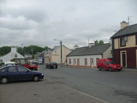
Convoy (Co. Donegal)
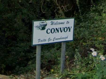
The derivation of the name Convoy is from the Irish Conmhaigh meaning "Plain of Hounds" and, like many towns in the area, has it's origins in the "Plantation of Ulster", an organised colonisation of Ireland during the reign of James I in 1609.
There are five churches in the village, reflecting the areas past with a mixed Catholic and Protestant population. The Free Presbyterian Church was opened by Ian Paisley, a famous religious and political leader that was head of the Democratic Unionist Party, he was Northern Ireland's First Minister in 2007 and 2008. It is thought that in the 1960's he started the Protestant opposition to the Catholic rights movement, thus contributing to the conflict known as "The Troubles" that plagued Northern Ireland for the next thirty years.
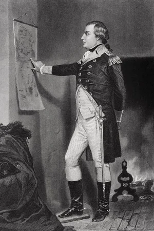
The Montgomery family settled in the area in 1604. One descendant, Richard Montgomery, pictured left, served in George Washington's Continental Army becoming a Major General. During the American Revolutionary War he led the unsuccessful 1775 invasion of northeastern Quebec. Many counties and cities are named after him in the US, most notably the state capital of Alabama. The family home of Boyton House has a letter sent from George Washington informing the family of his death.
Summary
I hope you enjoy reading this blog as much as I enjoyed making it. Some of the history of these small villages never ceases to amaze me. Even small mundane settlements have a past it seems. Nowadays, when passing through in a comfortable, air conditioned, car, you look out of the windows and see "just a village". Incidentally, if you started at the first entry on this blog, and drove in order to the last, you would have travelled 973km or 605 miles, well according to Google Maps anyway. I may start adding the mileage (kilometrage?) at the bottom of each of these blogs, just for comparison. What do you think?
So, Ireland has been done, although there are many other villages and towns with weird names, I have just picked a few at random. I try to find ones with a bit of history or something interesting. This blog is by no means an exhaustive list, and will never be, that would just get boring. Also, to remind everyone, that these are just for a bit of fun, I don't want to offend anyone.
So where to next? Well, I haven't really decided yet, but I think I will stay in Europe for now, with the size of France, Italy, Germany and Spain, there must be some weird sounding places. We shall see, I need to spend a couple of hours (days?) researching and wandering around on Google Maps to see what I can find.
(All town sign pictures are screenshots of Google Street View)
IRELAND TOTAL DISTANCE = 605 MILES / 973 KM
I'm also tempted to do each Canadian Province, and each Australian State. This series could go on forever!
If you're looking for more, I compiled a bunch of them in these quizzes:
https://www.jetpunk.com/series/1374763/strangely-named-towns-and-cities
I imagine Australia would be a good one for this.
At this moment, I have mothballed this series, the reasons why are outlined near the end of THIS BLOG
I shall however be taking your quiz!