Virtual Road Trip - US Route 1 - Part 1
First published: Monday June 9th, 2025
Report this blog
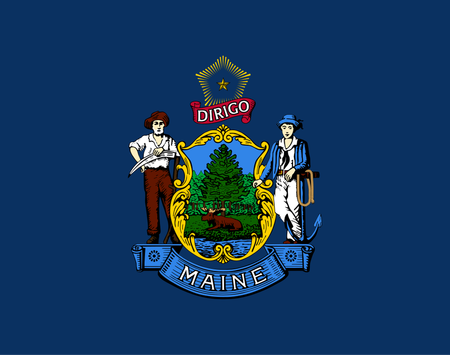
Maine
1. Fort Kent
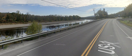
We've left Clair behind, no not a person, but the town of Clair, New Brunswick, Canada. We have travelled over the St.John River via the Clair-Fort Kent Bridge, we've cleared Canadian and US customs, and we're ready to go.
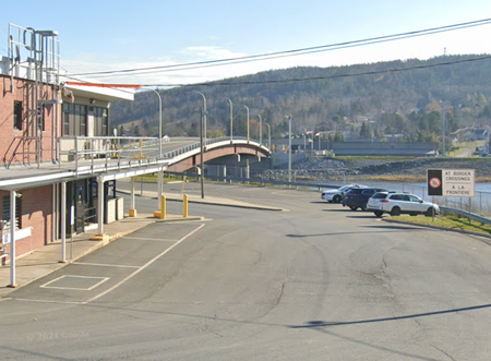
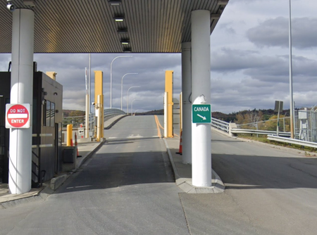
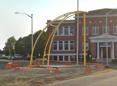
Make sure we turn left from the bridge, it's only Route 1 we need, and into Fort Kent, established in 1839 as a border outpost and named after the then governor of Maine, Edward Kent. The St.John River, that forms the border with Canada, was a logging route until the arrival of the railway, when logs were then transported by road and rail.
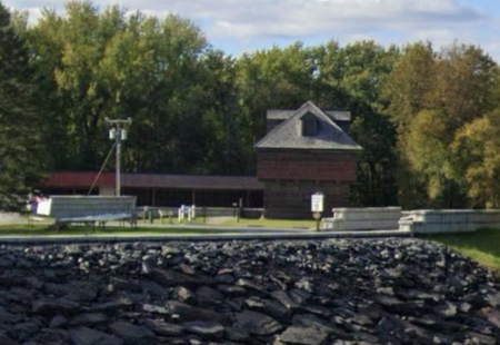
The above blockhouse was built in 1839 and became a National Historic Landmark in 1973 and is open to the public. A blockhouse is used to defend a larger fort.
2. Upper Frenchville
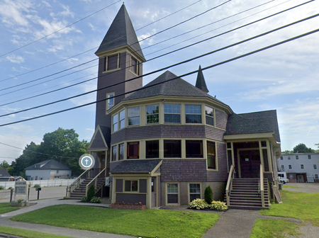
Just a small jumble of houses straddle the road in Upper Frenchville, but with this wonderful looking church...
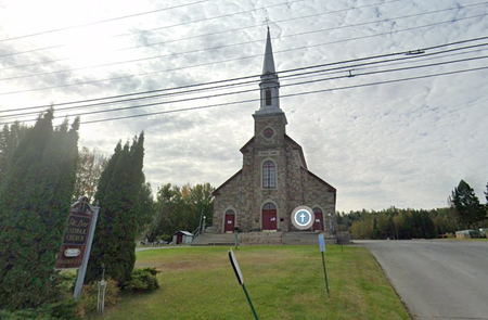
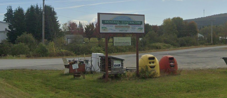
...founded in 1843, it sits across the road from the, much more mundane, Christian Life Center. Although, there are some really happy looking recycling bins...
3. Frenchville
Almost 80% of the population of Frenchville speak German, no wait, sorry, French. Mainly due to the proximity of Quebec and New Brunswick, Canada. The "yoof" of the town use a mixture of both languages known as "Valley French".
The water tower pictured opposite was built in 1911 as part of Frenchville Station on the Bangor & Aroostook Railroad. The station closed in 1971.
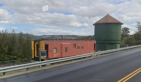
The town bought the water tower and used it as a reservoir for the fire department until 1981. The local historical society took over the preservation of the tower and station, including the caboose, in 1985.
4. Madawaska
Madawaska contains the next bridge over the St.John River to Canada, but we're not bailing out on the journey this soon.
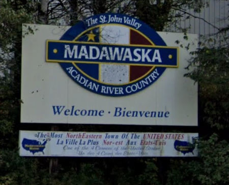
Madawaska relies on cross border trade with Edmunston on the Canadian side of the river. The two towns are linked by a road bridge and by a mile-long pipeline that transports wood pulp from a factory on the northern side of the river to a mill in Madawaska where it is made into paper.
Like Frenchville, the majority this town 's residents speak French, even at home.
Madawaska was originally a meeting place and hunting area for the Maliseet nation. In 1838 and 1839 it was the site of the Madawarska War, also called the Aloostook War, between the United States and the United Kingdom. Although the word "War" is somewhat an ambiguity, there was no bloodshed over what was essentially a border dispute. The area was designated part of the US so long as there was an overland route to the north.
5. Grand Isle
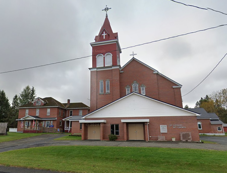
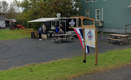
Grand Isle takes it's name from a nearby island in the St.John River named, strangely enough, Grand Isle. It's getting time for a snack on our route, and right opposite the brick-built St. Gerard Church and the Grand Isle museum, is Cou-yon's Cajun Shack.
6. Van Buren
Another border town with a bridge over the river, Van Buren has a population of just over 2,000 people. The bridge across the river was a popular route during the Prohibition Era, with alcohol being easily smuggled from the Canadian town of Saint Leonard on the other shore.
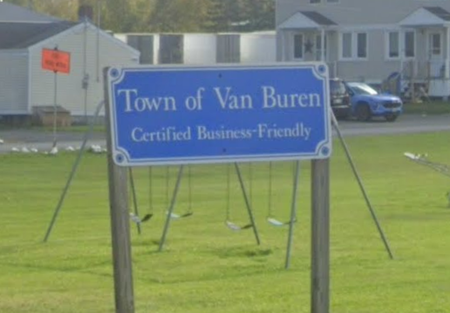
In Van Buren we turn away from the river, I missed the turning and was clicking for about a mile along the road before I realised.
Van Buren was named after the eighth US President, Martin Van Buren.
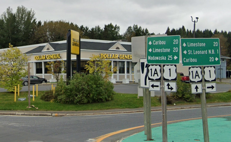
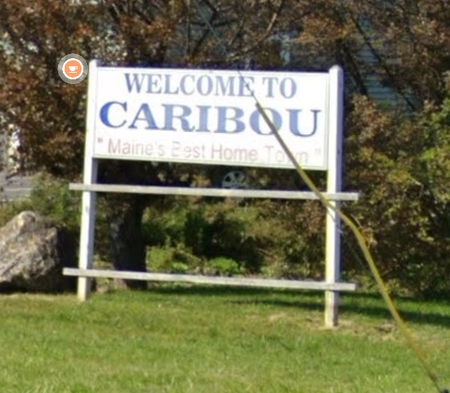
7. Caribou
Out of Van Buren the road is fairly straight, through forested areas, with the odd homestead, until we get to Caribou. The area was first settled by trappers and lumbermen, but the town wasn't incorporated until after the Aloostook dispute, and then as Lyndon, shortly changed to Caribou, before reverting to Lyndon and then back to Caribou. No-one knows why it was called Lyndon, or why it kept changing back and forth.
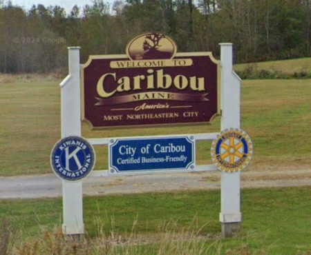
Caribou had a boom period starting in the 1890s when the railway arrived, this boom continued well into the 1960s when the city was the largest potato shipping hub in the world. Caribou was also the start point of the first successful solo crossing of the Atlantic Ocean by balloon, by former USAF Colonel Joseph Kittinger. According to Wikipedia, there is a memorial Park with a life size replica of the balloon, but GSV hasn't heard of it, and anyway, Route 1 bypasses the centre of Caribou at this point, and we can't deviate from the route.
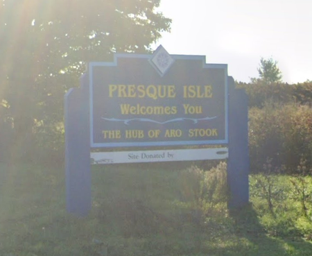
8. Presque Isle
Presque Isle was first established in 1828 and called Fairbanks, after the first settler, Dennis Fairbanks. The land was still in dispute between the US and the UK at that time. In 1859 when the town was incorporated it was called Presque Isle, from the French word for peninsula, presqu'île. The routes of nearby rivers form a peninsula of sorts.
Presque Isle Air Force Base was an important airfield during the Second World War and Korean War due to it's relative proximity to Europe. The air base eventually became privatised and in 2018 became known as Presque Isle International Airport.
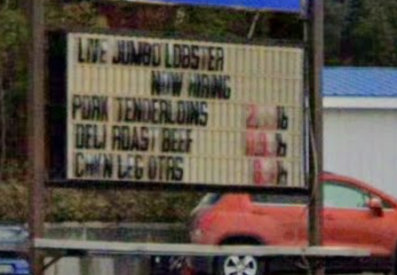
We pass lots of small businesses on the way into the city, lots of open space too. Oh, and lots of fast-food places, I fear his may be a constant with the many places we will pass through. At least I won't go hungry! One place that is just off our RADAR, is the site of the launch of the Double Eagle II, that completed the first successful balloon crossing of the Atlantic Ocean. Unlike Caribou's claim, this balloon had three occupants. But the site isn't on Route 1, unfortunately. What Presque Isle does have however, is a model of the Solar System. It is part of the University of Maine, and is situated on Route 1. It is also to scale, so the whole model spreads over several miles.
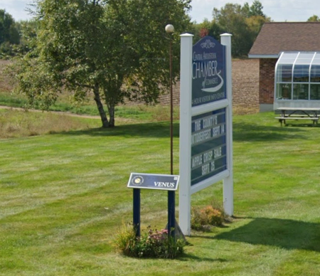
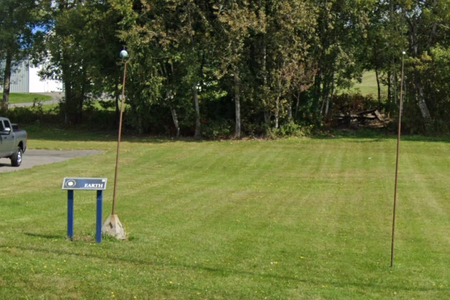
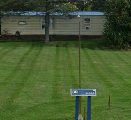
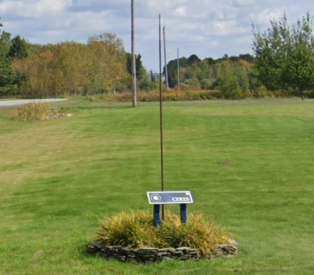
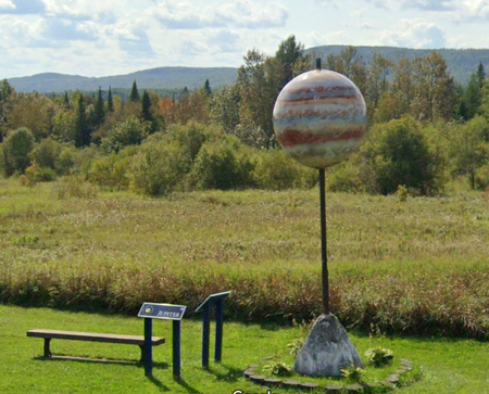
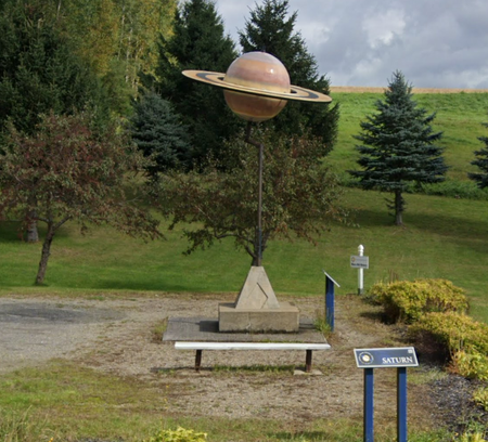
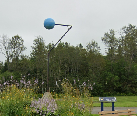
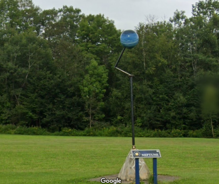
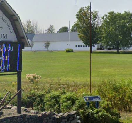
By this point, the model of Pluto is around 31 miles from the Sun model and not even in Presque Isle.
9. Mars Hill
Mars Hill is, ironically, situated between the orbits of Saturn and Uranus on the aforementioned Solar System model. Mars Hill was named after Hezekiah Mars, who also gave his name to a local mountain. He was an early settler that camped out in the area for three years in order to stake a claim to the land.
Maine's first windfarm is built on Mars Hill mountain, as is the Big Rock ski area. The town is next to the Canadian border, and exports electricity to New Brunswick Power.
10. Blaine
Blink and you'll miss the gap between Blaine and Mars Hill, the houses thin, there's a line, and more houses. Blaine must also be one of only a few places that rhymes with it's state.
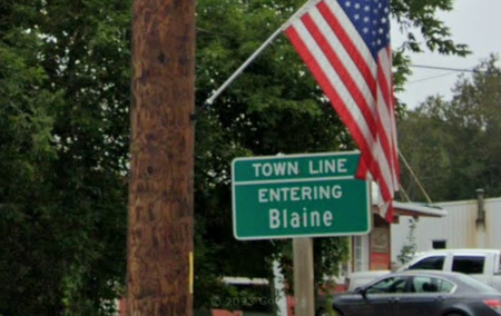
Originally known as Alva, the town was renamed upon incorporation in 1874, when it was named after James G. Blaine, who was then the Speaker of the US House of Representatives. Apparently, he donated a bell in exchange for the name change, I might have to try that at the next local council meeting in my town!
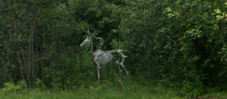
Between Blaine and the next marked settlement on GSV there are a couple of hamlets that are unmarked. Here are a couple of pictures from those places. See the Prologue episode of this blog series for a description of what is "marked" on GSV.
11. Houlton
Houlton was named after the Anglo-American pioneer Joseph Houlton, who had moved to the area, then controlled by Massachusetts, in 1807. This is where we pass below the I-95 interstate, that follows the route of our road for most of it's length, but terminates in Miami.
Houlton was the site chosen for the US Army's first transatlantic communications point during World War I. The site was taken over by AT&T who established a connection with the UK's Rugby Transmitting Station, to receive telephone calls via longwave. The Rugby station in the UK closed in 2007, and a large housing development took it's place. This was called Houlton in tribute to the connection.
One famous, at least at the time, person born in Houlton was Samantha Smith. She wrote a letter to the new Soviet leader, Yuri Andropov, in 1982 when she was 10. He invited her over to Russia, which she accepted, and became known as the youngest American ambassador. She travelled to various countries on goodwill missions and became a child actor. She died in a plane crash aged just 13.
12. Danforth
Named after Thomas Danforth, whoever he was, a proprietor according to Wikipedia, whatever that means. Storekeeper is the first thing that comes to my mind when I hear proprietor, but who knows?
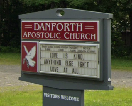
Due to there being very little information about Danforth, I thought I'd have a quick check on the distance we have travelled since Fort Kent. 156 miles, that's it. Maybe three and a half hours driving, and we've seen so much. I really wish I was doing this road trip for real. Maybe, one day. Anyway, onwards and upwards, or in this case, onwards and downwards. We are travelling south after all.
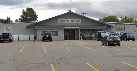
13. Princeton
No, not the university, just a village in the wilds of Maine. Princeton, Maine is named after Princeton, Massachusetts. Mainly because way back when, Massachusetts was a region that covered most of the northeast of the US prior to the 48 states being formed.
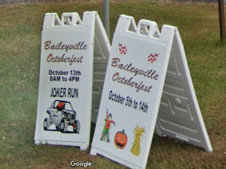
14. Baileyville
Baileyville was originally called Woodland, but there was a dispute with another town of the same name in a different Maine county. The other one, in Aloostook County, was established first and so kept it's name. Baileyville was then renamed after Ezekiel Bailey who began the commercial manufacture of oilcloth in the town in 1830. Although there is still a part of the town that is called Woodland, maybe in defiance of the state ruling, who knows?
The town was settled by Quakers in 1780.
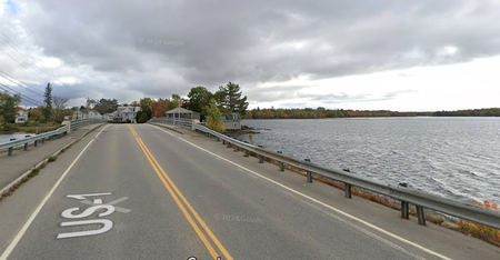
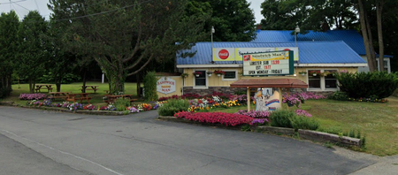
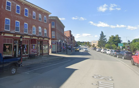
15. Calais
The direction of Route 1 changes to northbound briefly, and heads into Calais. No, not the French city opposite Dover, but the US city opposite St. Stephen, Canada. Although the town is named after the French one. There are three crossings of the river into Canada at this point.
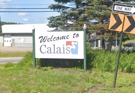
The relationship between Calais and it's Canadian neighbour is a close one. A story goes that during the War of 1812, the British supplied St.Stephen with a large amount of gunpowder to protect themselves against the American enemy in Calais. However, the town elders gave the gunpowder to Calais for their 4th of July celebrations.
Calais is also at the northern end of the East Coast Greenway, a 3,000 mile pedestrian and cycle route that ends at the same place as Route 1, Key West.
I think that'll do for the day, just have to find somewhere for the night. A little over 200 miles from Fort Kent, 206 to be exact, that's enough for the first day, and here's our stop for the night...
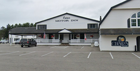
...Although, from reading the Trip Advisor reviews, I may have made a mistake. Oh Dear! , at least its a virtual stay, I'll have to do a lot more research if I ever take the trip for real. Maybe hire an RV instead of a car.
Until the next time my fellow travelling companions, see y'all soon!