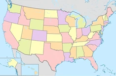
Where the Lines Cross: US States (AL-MO)
Last updated: Friday March 7th, 2025
Report this blog
What is this?
So I just randomly had the idea to do this: What happens if I make a line from the northernmost point of a state to the southernmost, and one from the easternmost to the westernmost, and see where they cross? This is just kind of a silly idea I had.
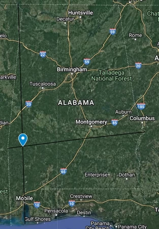
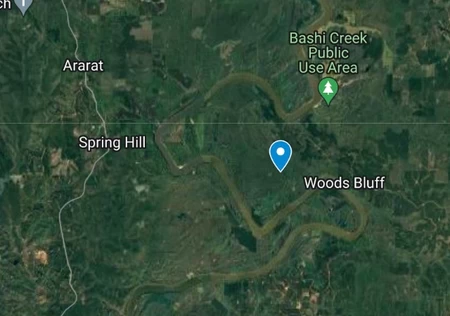
Alabama
Note that despite many US state borders LOOKING like a perfectly straight north-south or east-west line, almost none of them actually are. Alabama's northern border tends slightly north as you go west.
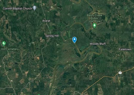
The point where the lines cross ends up right in the Tombigbee River, on the border between Choctaw and Clarke counties. The closest populated place is Spring Hill, about two miles to the west.
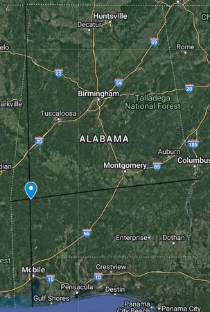
I have also decided that if any of the extreme points are on offshore islands, I will also find the point the lines cross if only the mainland is counted. In Alabama, however, this barely changes the result, just moving the point slightly to the east.
Alaska
Alaska is the largest state in the United States, and it has quite strange borders if you really think about it. However, the Aleutian Islands mean that quite a lot of Alaska is separated by ocean, and that's where the point lands. Not very interesting.
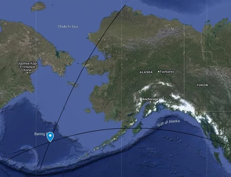
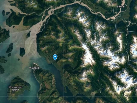
If you don't include offshore islands, we actually end up with a wildly different result. Since the easternmost and southernmost points are so close together, the lines cross all the way in the corner of the state, within the borough of Wrangell, right near the Canadian border.
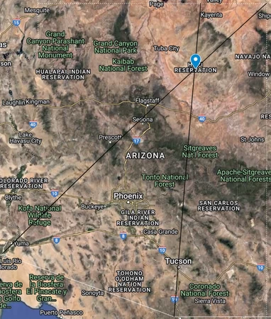
Arizona
I like how the west-east line does a perfect diagonal across the state. Remember, just because the state's borders LOOK straight, it doesn't mean they actually are.
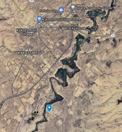
The lines cross right in the middle of the Hopi Reservation in Navajo County, right next to Kykotsmovi Village, the reservation's capital.
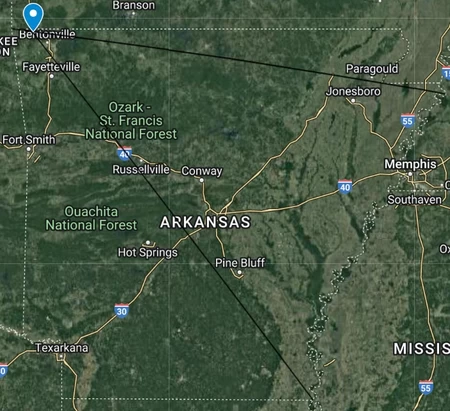
Arkansas
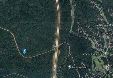
Arkansas's point ends up way in the northwest corner of the state, in Benton County. This happens because the northernmost and westernmost points are right next to each other.
The point itself isn't very interesting, it's just in the middle of the forest west of Bella Vista.
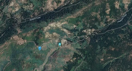
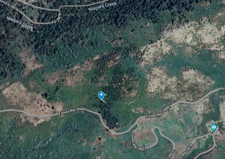
California
This point ends up in the Stanislaus National Forest in Tuolumne County. It's right near Jawbone Falls, so I guess that's kind of interesting.
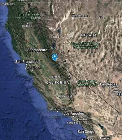
Removing offshore islands changes basically nothing. The point moves a whopping 1,200 feet.

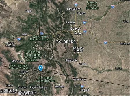
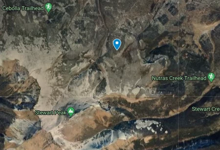
Colorado
If this state was actually a rectangle, the entire state would be where the lines cross, since you could make an infinite number of different lines between the edges of the state. (Kind of. Since latitude lines are curved and not actually straight, a section of the southern part of the state would not be able to have lines cross within it.) However, that's not the world we live in.
The point is in western Saguache County, just northeast of Stewart Peak in the San Juan Mountains.
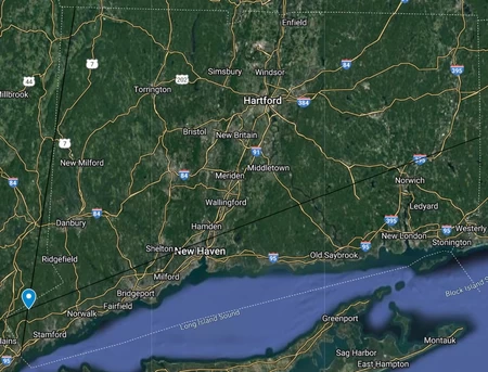
Connecticut
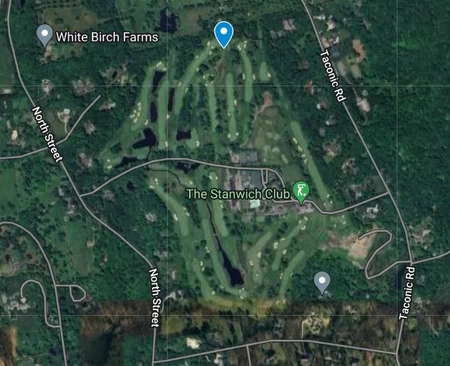
Finally, something a bit more interesting. This point actually ends up in the Connecticut panhandle in Fairfield County, in the city of Stamford. It is located in the corner of a field, in a residential area of the city.
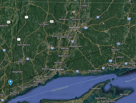
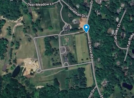
Since the lines cross very close to the southernmost point of Connecticut, removing offshore islands actually changes the point's location significantly. It now lands in a golf course in the town of Greenwich.
Delaware
The point lands in the eastern part of Sussex County, just north of an unincorporated community called Angola. Side note, right next to Angola is another community called "Angola by the Bay", unrelated but I just think that name is kind of funny.
Despite its name, Fenwick Island is in fact a peninsula and NOT an island, so we don't need to find a second point.
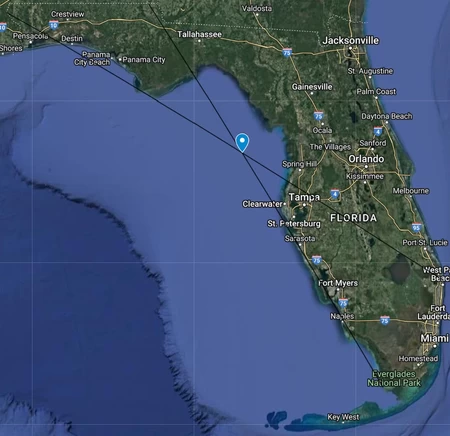
Florida
Similar to Alaska, Florida's weird shape causes the point to land in the middle of the Gulf of Mexico. Unlike Alaska, removing islands doesn't help much, and the point is still in the water.

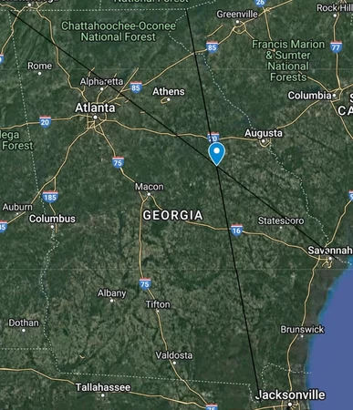
Georgia
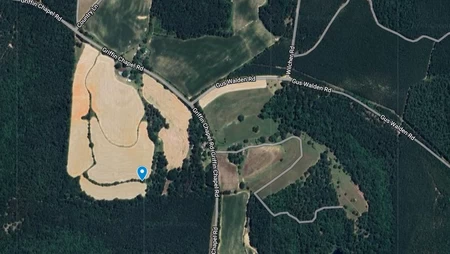
If you didn't know about the town of Mitchell, Georgia, you do now. The point lands BARELY outside of the town limits in western Glascock County. By the way, the town limits are literally just a circle. They really couldn't have made it more interesting?

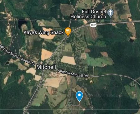
Removing islands doesn't really make it any more interesting. The point now lands in a random wheat field south of Mitchell.
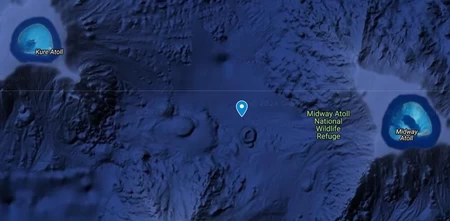
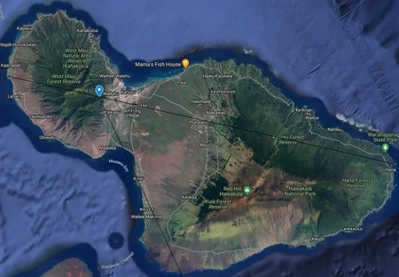
Hawaii
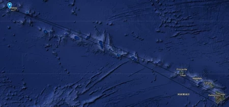
Be honest, you forgot about the Northwestern Hawaiian islands, didn't you?
Despite landing in the water, the point is still kind of interesting. Both the northernmost and westernmost points are in Kure atoll, and the lines cross between Kure and Midway atolls. The point appears to be right near an underwater volcano with a large crater.
Now let's see where the point lands without any islands.
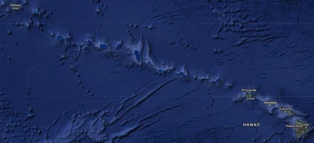
Huh, I don't see the marker anywhere, I wonder why...
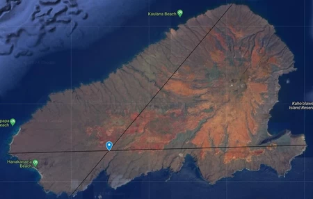
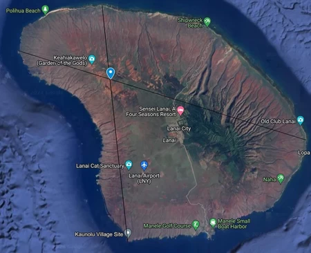
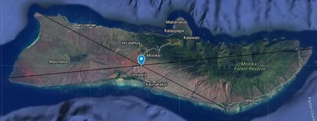
In actuality, here's where the point lands if we only include the eight main islands, the part you think of when you think "Hawaii". Still in the water, but much closer to civilization now.
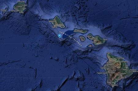
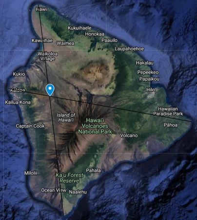
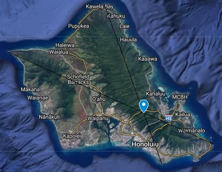
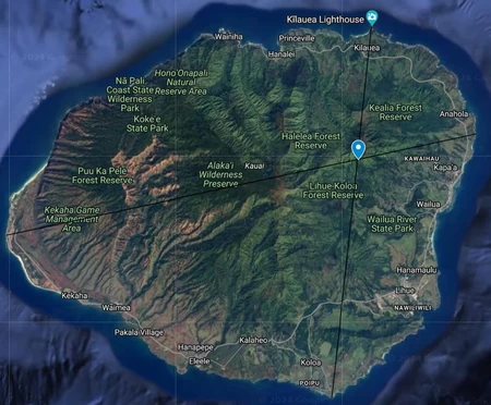
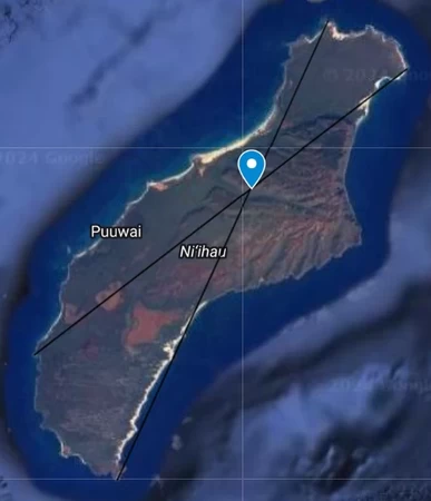
And, since Hawaii doesn't really have a "mainland", here are where the lines cross on each of the eight main islands.
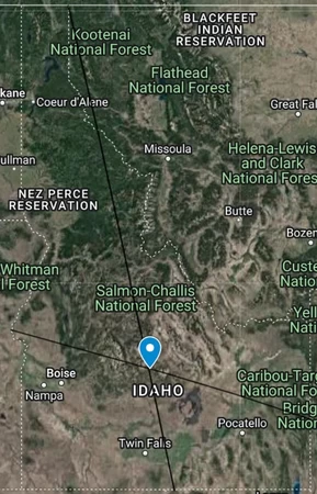
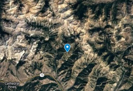
Idaho
The point lands in northern Blaine County, within the Boulder Mountains. It ends up just south of Ryan Peak and Kent Peak, the two highest peaks in the mountain range.
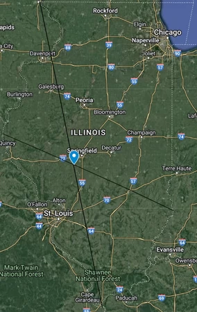
Illinois
It is at this point where I should specify that I'm only counting extreme points on land, not in water. If I was including water then the easternmost point would be in the middle of Lake Michigan. I should also specify that I'm only doing a second point without islands if they are offshore islands or in lakes, no islands in rivers as they would barely change the result.
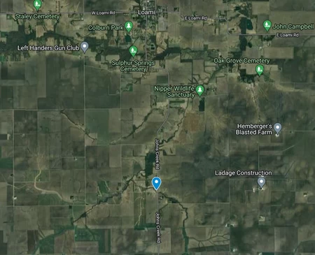
The point ends up just south of the village of Loami in Sangamon County. It's actually very close to the state capital of Springfield.
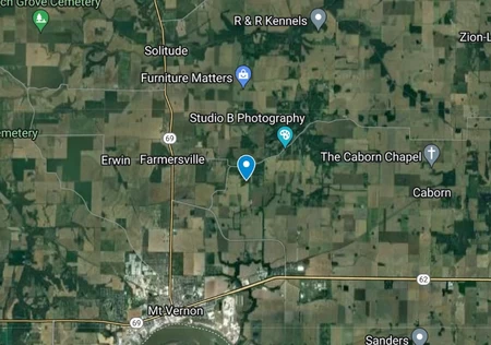
Indiana
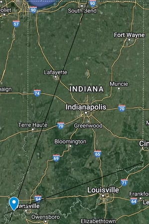
This point ends up right in the southwest corner of the state, just north of Mt. Vernon in Posey County. Not really much else to say.
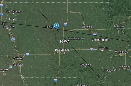
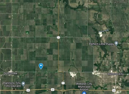
Iowa
This point is in the far west of Hamilton County, just west of the county seat, Webster City. What else do I say, it's just in the middle of some farm.
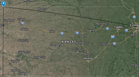
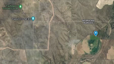
Kansas
We've seen points that end up way in the corner of the state, but this might be the most drastic example of that. The point is in Cheyenne County, less than two miles from the tripoint with Colorado and Nebraska.
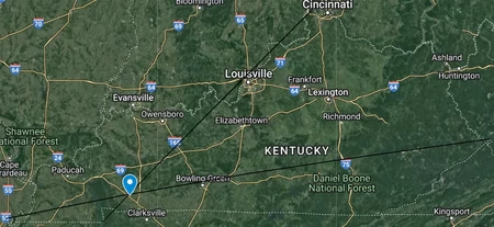
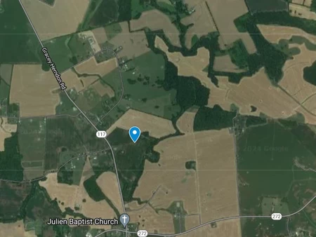
Kentucky
This point ends up in the west of Christian County, near Hopkinsville. Given the county name, it should be no surprise that it lands right near a church. It also happens to land directly in a small "island" of trees in the middle of a soybean field.
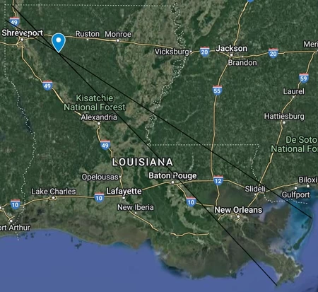
Louisiana
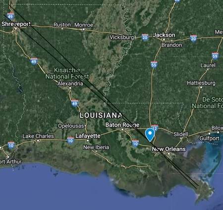
Looking at a map of Louisiana, it seems like there is still quite a lot of land in the south, but if you zoom in, you can see that it's mostly bayous and just water with just a bit of land here and there. Especially using the non-satellite view in Google Maps, you can really see how much land isn't actually there.
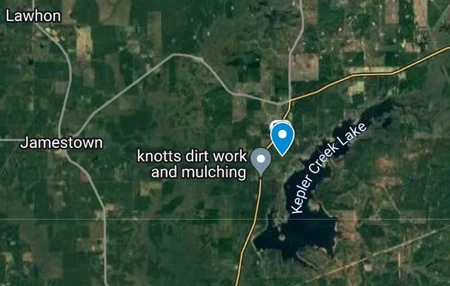
The point lands just west of Kepler Creek Lake in Bienville Parish in the northwest of the state.
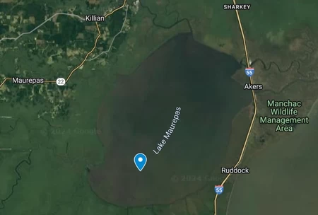
Removing islands moves the point across the state quite significantly. I should point out that I'm not confident in where the southernmost and easternmost points are excluding islands, it is REALLY hard to tell what land is an island and what is actually connected to the mainland.
The point lands right in Lake Maurepas, northwest of New Orleans, on the border between Livingston and St. John the Baptist parishes.
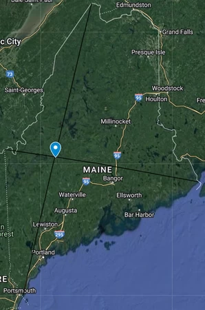
Maine
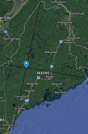
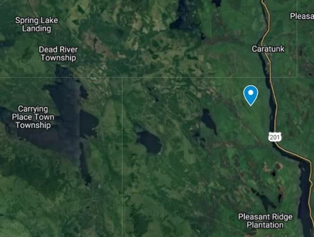
This point lands within the town limits of Caratunk in Somerset County. Just to the south is a "million dollar birdhouse wall" on the roadside.
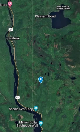
Removing islands puts the point across the river. The point itself is nothing special, but it's near places with names like "Carrying Place Town Township", and you really have to wonder how somewhere ended up with a name like that.
Maryland
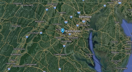
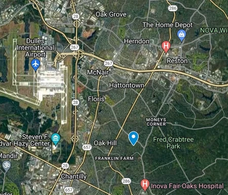
Maryland gives us something we haven't seen yet: a point in a completely different state. Maryland's strange shape means the point actually ends up in Virginia. Specifically, the point lands in Oak Hill, and unincorporated community between the CDPs of Reston and Chantilly.
We finally get a point that is in a much more built-up environment, as it is within the Washington metro area.
Just like in Delaware, Fenwick Island is not actually an island, only being disconnected from the mainland via an artificial canal. Therefore, the only point that moves when removing islands is the southernmost point.
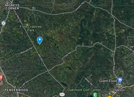
The lines cross slightly further east, between Reston and Oakton this time. It still doesn't land within an actual incorporated settlement, even though it's basically surrounded on all sides.
Massachusetts
We once again get a point that lands in the water, this time in Cape Cod Bay.
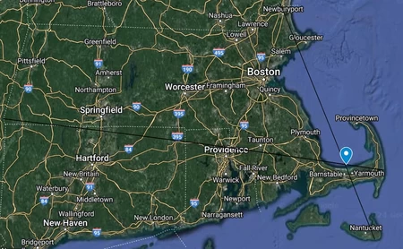
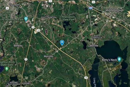
Removing islands does move the point quite significantly though, bringing it back on land. It ends up JUST within the city of Taunton, seat of Bristol County. Just to the southwest is Myricks Airport, a tiny little airfield with a single turf runway and only a couple of planes.
Michigan
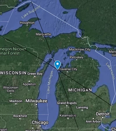
Michigan is one of the strangest shaped states in the United States, and the point just ends up in Lake Michigan. It appears to be within the waters of Leelanau County.
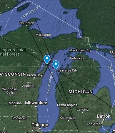
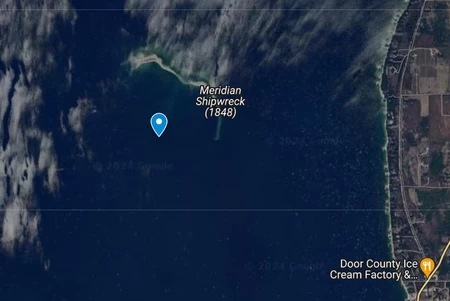
As for removing islands, I have to be honest, I'm not quite sure what to do. Copper Island is partially natural and partially artificial, but the artificial waterway isn't really a canal, it feels a lot more natural. I decided to just do two points, one including Copper Island, and one without it. Including Copper Island just puts the point in almost the exact same place, but excluding it puts the point in Green Bay within the waters of Door County, Wisconsin. It actually lands right near the shipwreck of the Meridian in the Sister Islands.
Minnesota
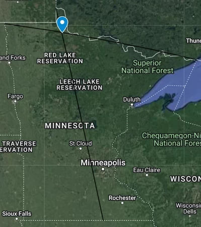
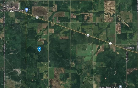
Given that Minnesota's westernmost and easternmost points are far to the north, the lines cross way up north as well. The point is just southeast of the city of Williams in Lake of the Woods County.
Side note, Lake of the Woods County is a really weird shape. Of course, there's the famous Northwest Angle, a large area of land completely blocked off from the rest of the state by Canada and the Lake of the Woods. But, in addition to that, the county also includes the ENTIRETY of the American side of Lake of the Woods, despite Roseau County also bordering the lake. Due to slight changes in the lake's shore over the years, there are several pockets and strips of land on the western side of the lake that are also part of Lake of the Woods county. Also, around this area is the Red Lake Reservation, which has some of the most wild exclaves and borders I have ever seen.
Despite both the northernmost and easternmost points of the state being in lakes, neither one actually ends up on an island.
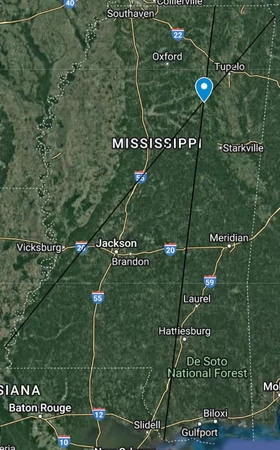
Mississippi
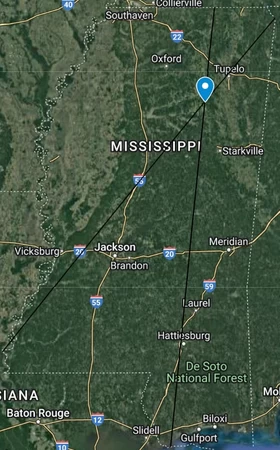
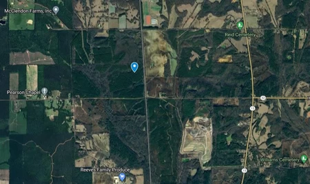
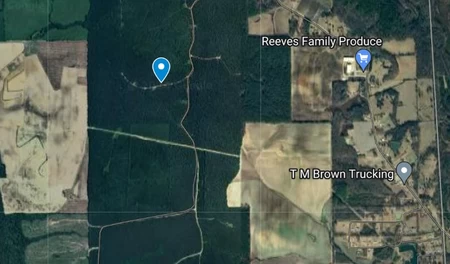
After four states with very interesting points, we reach one that isn't nearly as interesting. The point lands south of New Houlka in Chickasaw County. I did notice that there were a lot of locations around with people's names. McClendon Farms, Reid Cemetery, Pearson Chapel, Reeves Family Produce, and Williams Cemetery.
Just like Louisiana, Mississippi's southernmost point lands in a bayou, making it pretty difficult to find the southernmost point excluding islands. The lines cross a bit further southwest, but it really doesn't change anything.
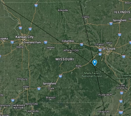
Missouri
I mentioned before how the US's "straight" borders are not actually straight, but most of them just look straight on a map and aren't really visible to the human eye. The Missouri/Iowa border, however, is actually visibly bending southward in the middle. You don't really notice it unless you are looking for it, but you can definitely see it. (And now you can't unsee it. Sorry.) And it's not just the latitude line being curved, it bends significantly more than other borders on latitude lines.
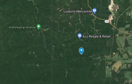
The point itself is just in the middle of a forest in a particularly empty part of Washington County.
Have a great day ;)
I agree with Maxibon, adding a thumbnail picture will make it more attractive to people who see it on the RUB page
What exactly is it that you mean by saying the borders aren't straight? Isn't Tennessee's southern border defined as a parallel, meaning that by definition it's a straight line?
I just was confused by when you said, "latitude lines are curved and not actually straight", because that would not be correct.
Latitude lines appear to be curved when you attempt to take a 3 dimensional surface and make it one dimensional. It's the problem of a map, not the problem of latitude lines. If you were to walk in a straight line across the globe, it would follow what are called "great arcs". If you try to project this onto a map, almost all of the time it's going to appear to be curved because of the same issue I mentioned above.
It's kind of a cool concept.