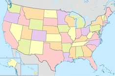
Where the Lines Cross: US States (MT-WY)
Last updated: Friday March 7th, 2025
Report this blog
This is a continuation of my first blog, go to that one for an explanation of what this is.
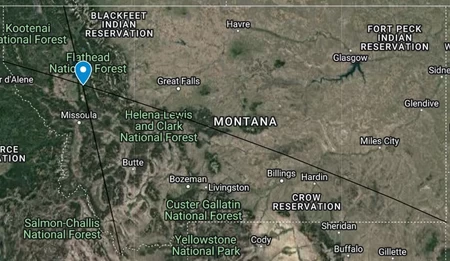
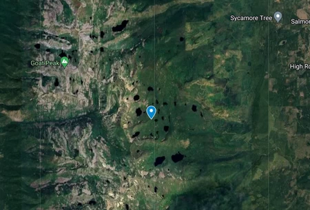
Montana
Welcome to Jim Lakes Basin. As the name suggests, it's a basin with lakes in it, in northern Missoula County. It's actually pretty interesting, at least compared to the endless fields and forests that these points usually land in. Especially since unlike other points, this one lands directly on a notable feature instead of just near it.
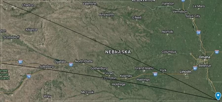
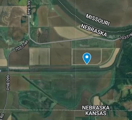
Nebraska
This point lands way in the southeast corner of the state. Not as close to the corner as Kansas was, this one is about 5 miles away. It lands between the Missouri and Big Nemaha rivers in Richardson County.
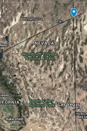
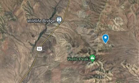
Nevada
Despite being in the middle of the desert of Elko County, there's actually some interesting stuff around. Most notably, there is a bridge to the west for wildlife to cross over the highway.
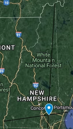
New Hampshire
The point lands directly on Back Chester Road, in the town of Derry, in Rockingham County, in the state of New Hampshire, within the region of New England. Yes, this area was colonized by the British, how did you know?
Also, nearby you can find "Bob's Pool Water". Which doesn't sound very appealing, if you ask me.
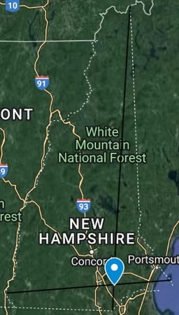
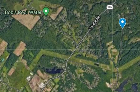
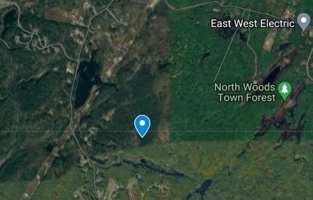
Removing islands, the point shifts northward into the town of Chester. If you didn't like Bob's Pool Water, how about Wason Pond Pounder or the Patriot Oil Burner Service?
New Jersey
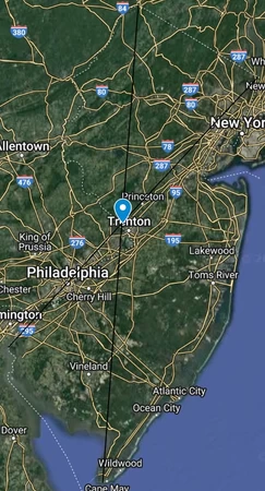
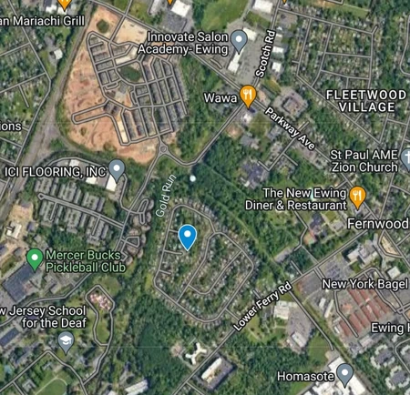
This is easily the closest we get to landing in the state's capital city. The point lands less than 0.7 miles away from Trenton, in a neighborhood of Ewing Township in Mercer County. There is some interesting stuff nearby, the Ewing Town Center, a school for the deaf, a pickleball club, and an "Nj Department-Trans Bureau-Materials", whatever that means. Surprisingly, despite being a coastal state, none of the extreme points land on islands.
New Mexico
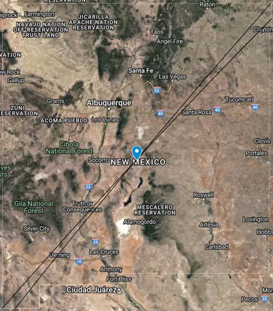
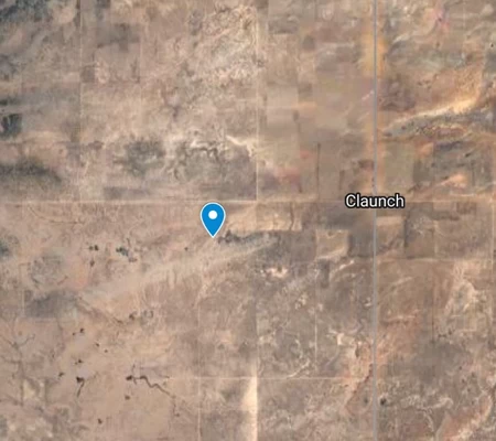
This one is interesting. The northernmost and easternmost points are very close together, but so are the southernmost and westernmost points, and it balances out perfectly so the lines cross almost exactly in the center of the state. The point is in the desert of eastern Socorro County, near the community of Claunch.
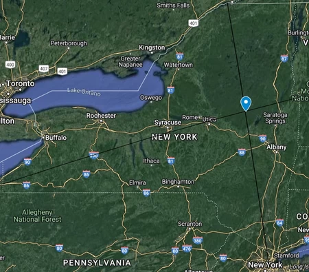
New York
This point lands directly on Scotchtown, a hamlet in the middle of Orange County. I guess something interesting nearby is Michigan Corners, another hamlet that's marked on maps but has no signs. It was named that way because someone left town and claimed he went to Michigan, so when he opened up a tavern there, it got named Michigan as well. At least, that's how the story goes.
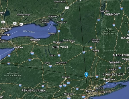
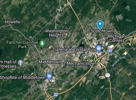
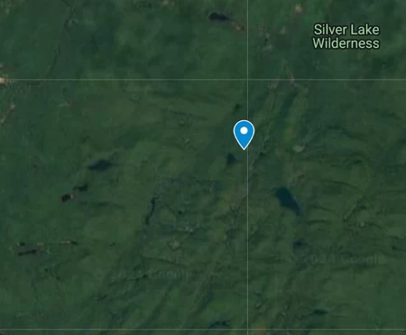
Without islands, the point moves pretty far. It now lands right next to Canary Pond in the Silver Lake Wilderness Area, in Hamilton County.
North Carolina
This point lands right in the middle of the Uwharrie National Forest in Montgomery County. There's a church to the east and a campground to the west, and that's about it.
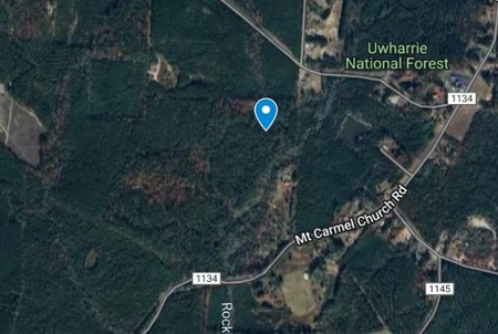
Removing islands shifts the point to the west quite a bit. It is now located in Stanly County, north of Millingport. It's just in some trees surrounded by farms, nothing much.
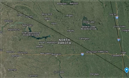
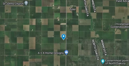
North Dakota
The middle of a field in Richland County, a.k.a. the middle of nowhere. This is another one that ends up right in the corner of the state.
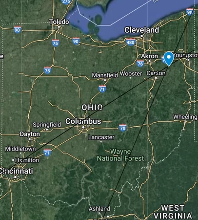
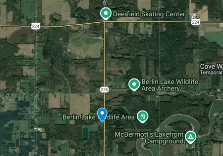
Ohio
We land in the far south of Portage County. Just to the east is the Berlin Lake Wildlife Area. It's probably interesting but I'm a bit tired of every location looking the same at this point.
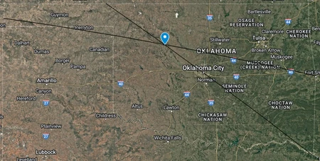
Oklahoma
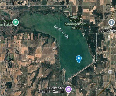
We actually get something somewhat interesting this time. In a state full of plains, plains, and more plains, we get plopped right into Canton Lake, in the northwest corner of Blaine County. There's also apparently a "Canadian Campground" nearby, whatever that means.
Oregon
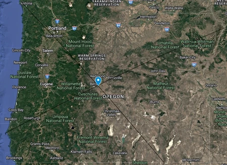
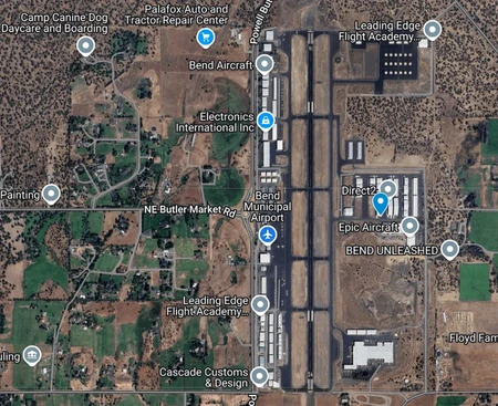
Welcome to Bend, Deschutes County. If you don't like it here, don't worry, you're right next to the airport so you can leave.
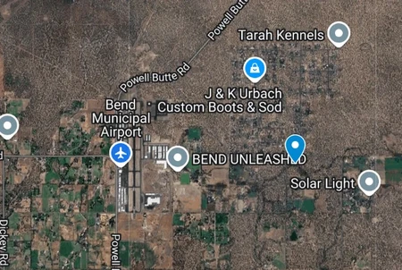
Removing islands moves the point enough to put you even closer to the airport. Although you may need some help escaping from whatever building this is that you end up locked in.
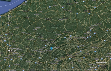
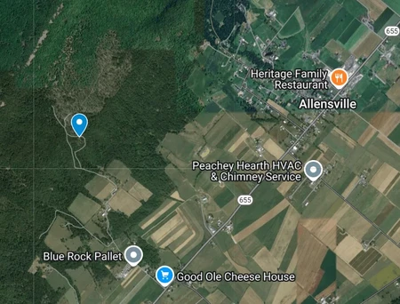
Pennsylvania
We end up on the side of a ridge in Huntingdon County, actually happening to end up right on a dirt road going up the side. The nearest town is Allensville to the east. Also, there's a "Good Ole Cheese House" nearby, which sounds amazing if you ask me.
Rhode Island
We end up right next to the Whaley Farm Market in South Kingstown, Washington County. That's about it.
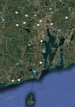
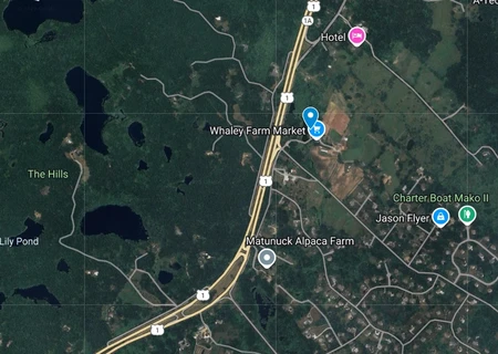
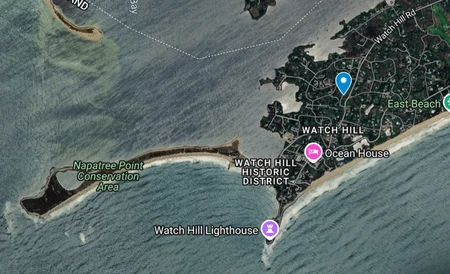
Unsurprisingly, both the westernmost and southernmost points land on islands. Ignoring islands moves the point very significantly, putting it in the town of Westerly, right in a neighborhood on the far southwestern peninsula of the state.
South Carolina
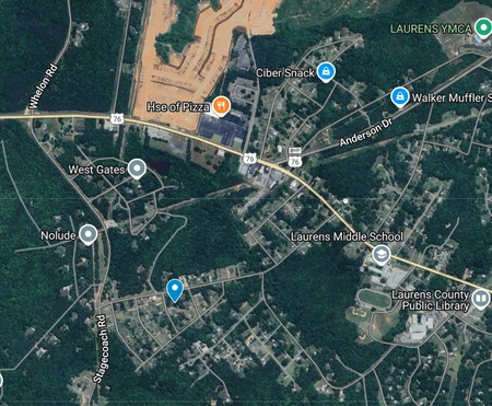
Welcome to Laurens, Laurens County. We nearly end up inside of someone's house in one of the residential areas. I guess whoever lives there can claim to have "the most central house in South Carolina" using these completely accurate methods.
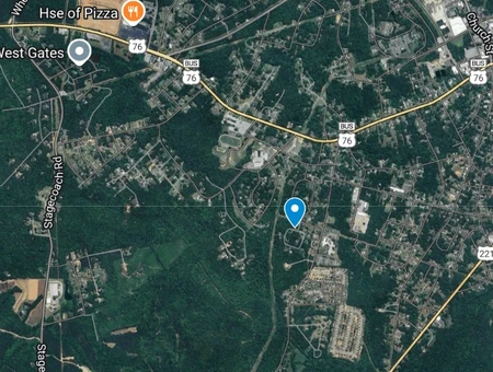
Removing islands, we now end up with the same problem we had with Louisiana and Mississippi. It is extremely difficult to figure out where the islands stop and mainland begins for the southernmost point. Not that it matters much, we still end up in someone's backyard in Laurens.
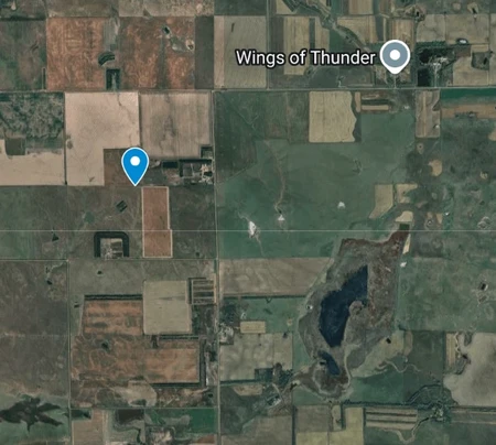
South Dakota
Well, we're back to points in the middle of farms in the middle of nowhere. Welcome to Brule County. We also seem to be near "Wings of Thunder", whatever that may be.
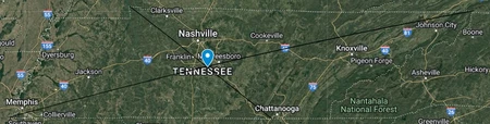
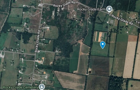
Tennessee
Another farm, this one in the southwestern "bulge" of Rutherford County. We appear to be in an area known as the "Rocky Glade", as several places around here have that name.
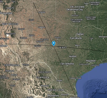
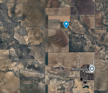
Texas
Welcome to Tom Green County, just north of Miles Dairy. The dairy is genuinely probably the most interesting thing about this place, because it's extremely desolate. Farther to the west is the Goodyear Proving Grounds, and the nearest major city is San Angelo to the southwest.
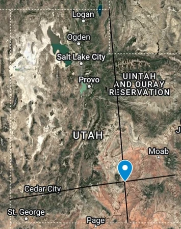
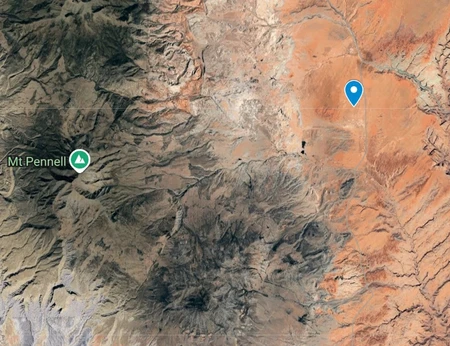
Utah
Let me introduce you to a place I call "The Middle Of The Desert". We're in Garfield County, east of Mount Pennell, and there doesn't appear to be a human settlement in quite a large radius around this point.
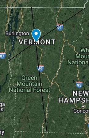
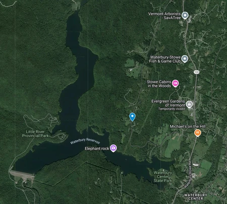
Vermont
Have you ever noticed how the northeast corner of Vermont actually sticks into New Hampshire a little? That looks like it hurts.
This one is actually relatively interesting (compared to the others, at least). We end up right next to the Waterbury Reservoir in Waterbury, Washington County.
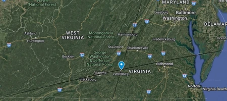
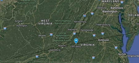
Virginia
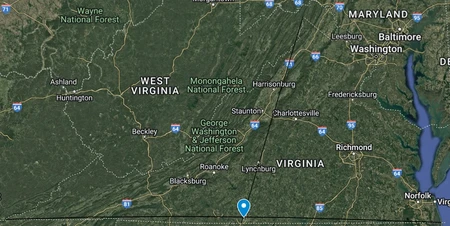
Welcome to Carter Bank, for all your banking needs. We land in the census-designated place of Madison Heights in the far south of Amherst County, right near the city of Lynchburg.
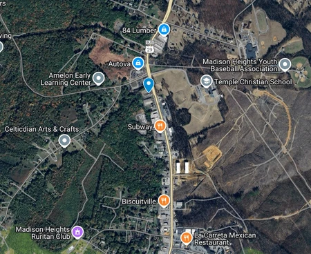
After removing islands, time to drive up the road a bit and buy some lumber from 84 Lumber with the money you just withdrew from the bank.
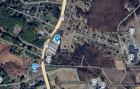
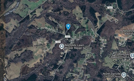
Lastly, even though it's not actually an island, I thought it would be interesting to see what would happen if we removed the Eastern Shore as well.
We end up near the southern border with North Carolina, in Pittsylvania County, very close to the city of Danville.
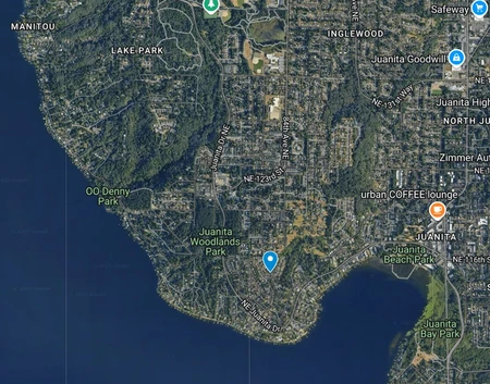
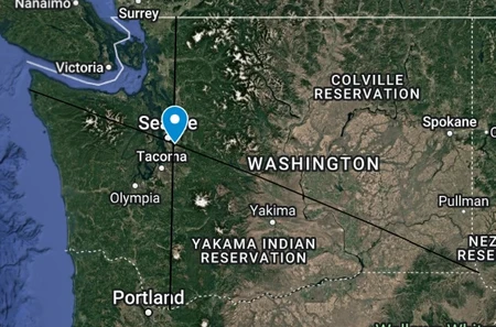
Washington
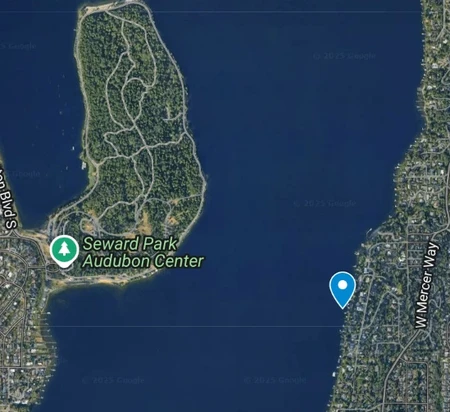
Easily one of the most interesting locations. We end up in Kirkland, a suburb right next to Seattle in King County. We land right in someone's backyard near Lake Washington.
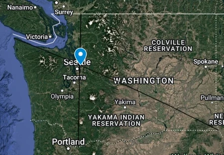
Removing islands shifts the point south quite a bit. We now end up in the lake, just off the coast of Mercer Island.
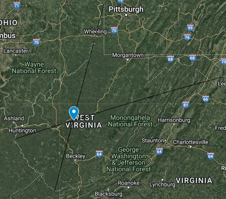
West Virginia
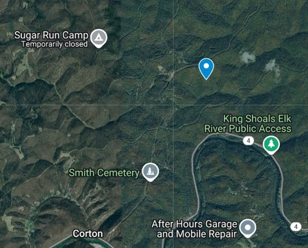
West Virginia is one of, if not the strangest shaped state in the country. However, its wacky panhandles seem to cancel each other out and place the point surprisingly central. The point simply ends up in the wilderness in the far northeast corner of Kanawha County.
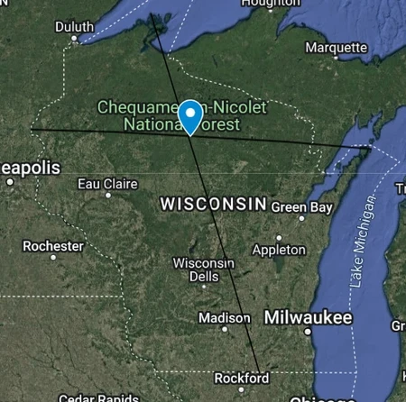
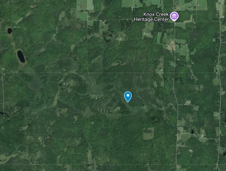
Wisconsin
Wisconsin's point is near the Chequamegon-Nicolet National Forest in the north of the state. The point itself is near the settlement of Clifford in Price County, with nothing notable nearby.
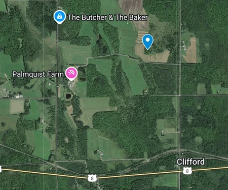
Removing islands shifts the point southwest, putting it even more in the middle of nowhere.
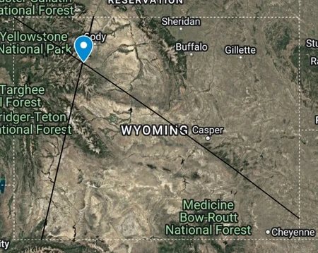
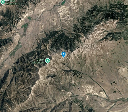
Wyoming
And finally, Wyoming, the second rectangle that's not actually a rectangle. We end off with a relatively interesting point, on the slopes of Carter Mountain in Park County. This point is also part of the Shoshone National Forest.
amazing blog, though maybe add a thumbnail.
All I wanted to do was be at the centre of the state
I'm not sure if you have any desire to do more of these, but if you decide to do more, there is massive series potential in you going around each continent and doing the countries there. You may also get some variation in the points as different countries have different climate and terrain