Featured Quizzes
User Quizzes
Create Quiz
Data and Charts
Word Search
Flash Cards
Badges and Games
About JetPunk
Message Board
Random Quiz
Dark Mode
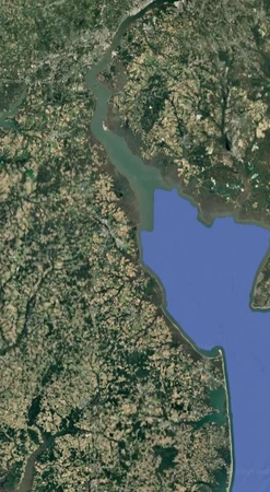
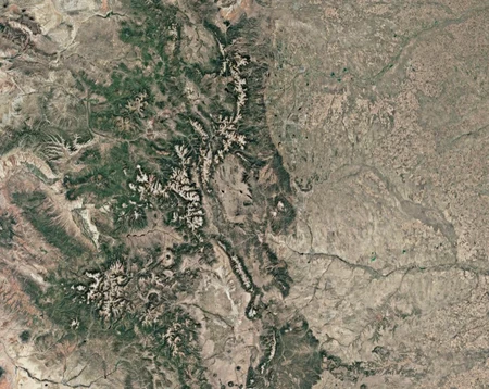
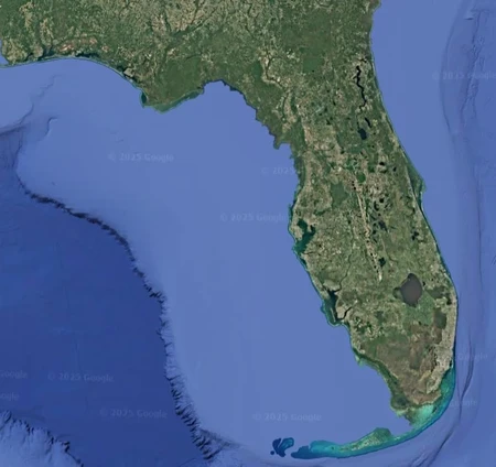
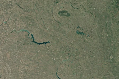
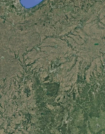
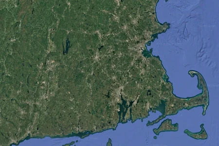
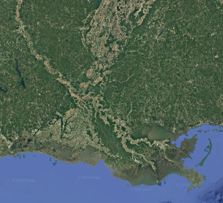
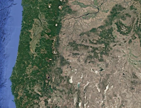
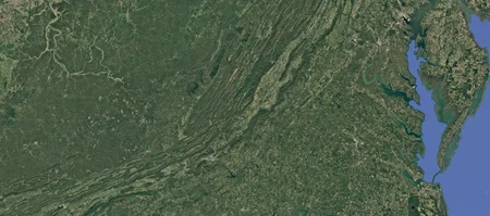
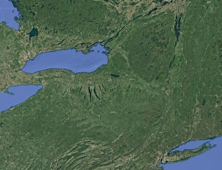
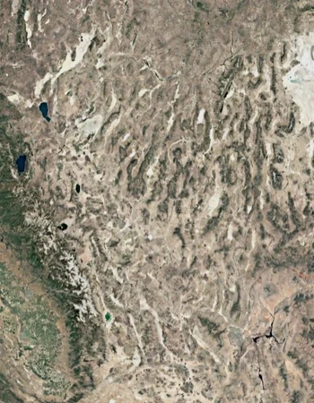
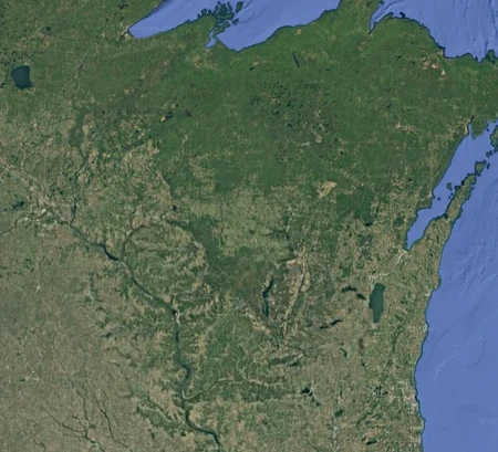
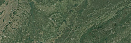
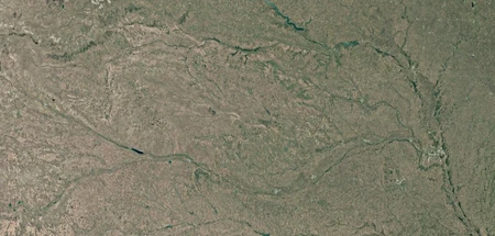
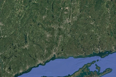
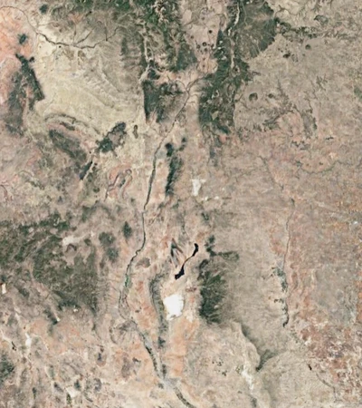
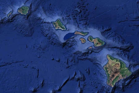
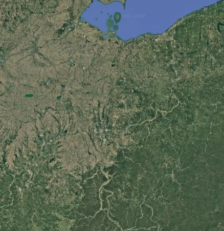
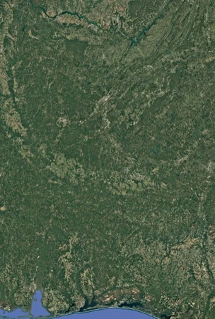
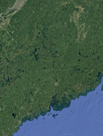
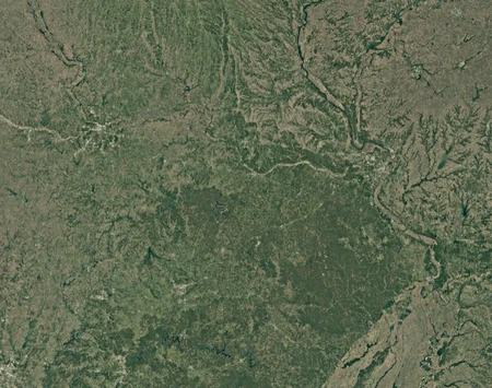
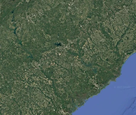
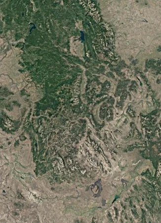
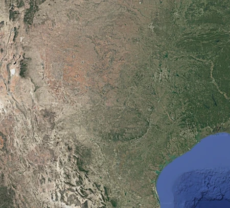
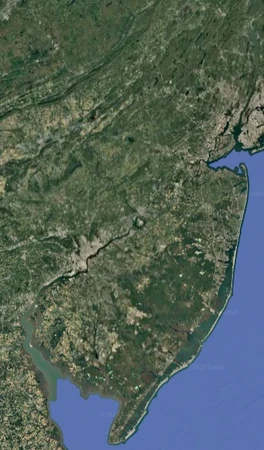
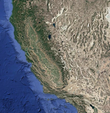
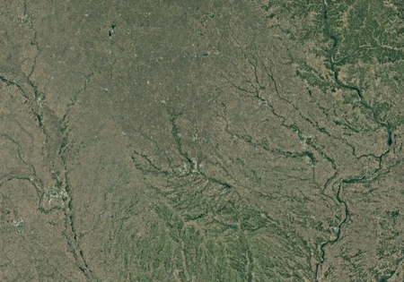
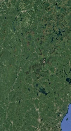
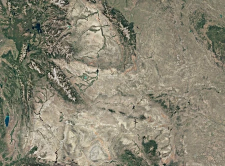
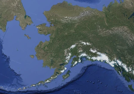
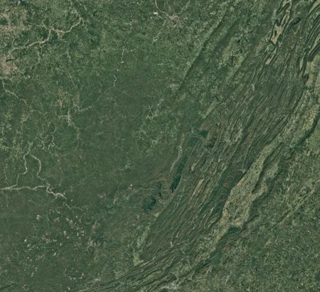
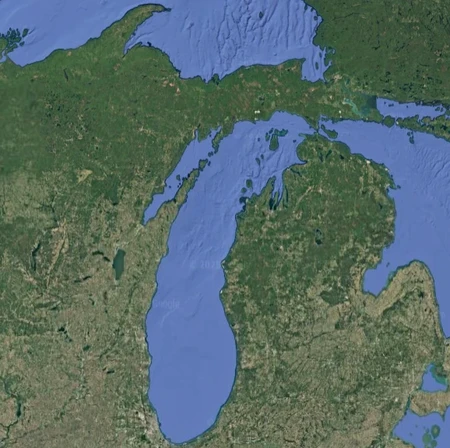
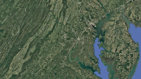
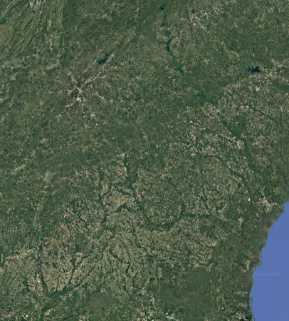
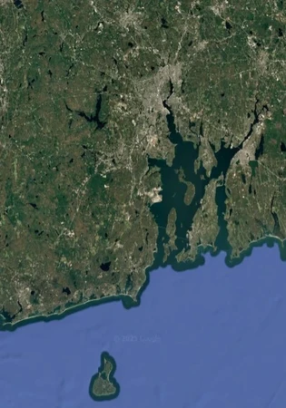
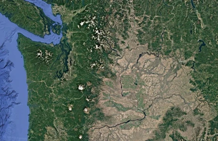
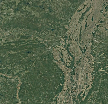
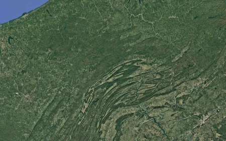
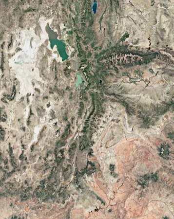
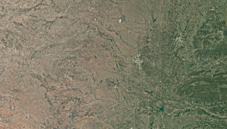
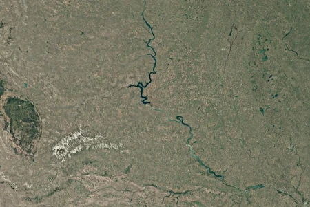
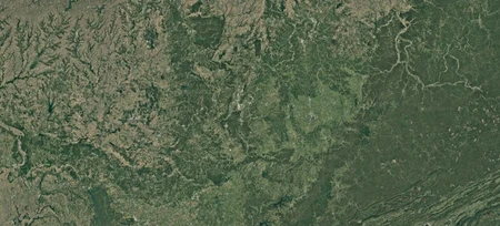
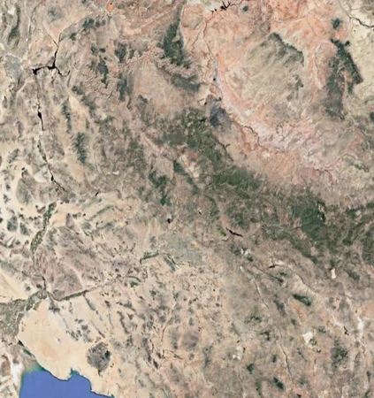
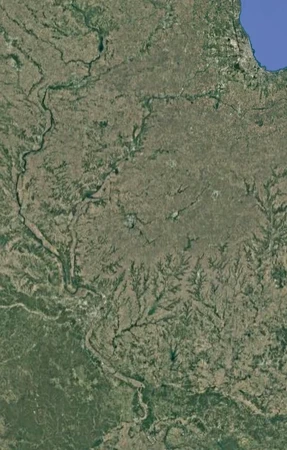
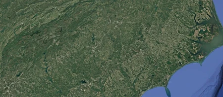
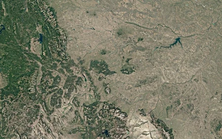
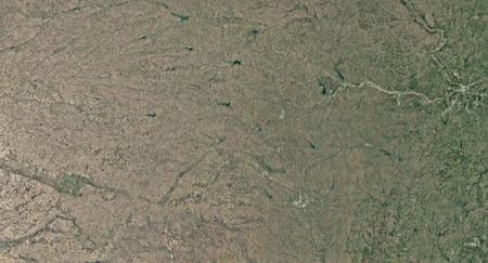
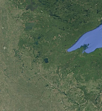
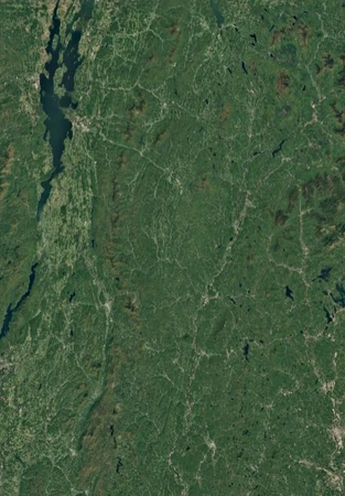
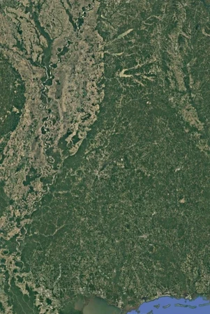
US states by satellite maps
Can you recognize all US states based on their satellite maps?
Photos come from Google Earth
District of Colombia is not included
Rate:
Last updated: December 28, 2025
You have not attempted this quiz yet.
More quiz info >>
| First submitted | April 2, 2025 |
| Times taken | 28 |
| Average score | 52.0% | Report this quiz | Report |
20:00
Enter answer here
0
/ 50 guessed
Time Used
00:00
Best Time
00:00
The quiz is paused. You have remaining.
Copied!
Scoring
You scored / = %
This beats or equals
% of test takers
also scored 100%
The average score is
Your high score is
Your fastest time is
Keep scrolling down for answers and more stats ...
Save Your Stats
Your Next Quiz

Try to name the best-selling video game consoles and of all-time.

Beat the clock to unscramble the names of these American states.

In one minute, can you match each set of highlighted countries with the letter they start with?

There were 19 states where more people voted for Kamala Harris than Donald Trump in the 2024 election. Try to click them all without clicking any red states!
1 Comments
Sticklink
+2
Level 52
Jun 10, 2025
mississippi
New and Popular