Featured Quizzes
User Quizzes
Create Quiz
Data and Charts
Word Search
Badges and Games
About JetPunk
Message Board
Random Quiz
Dark Mode
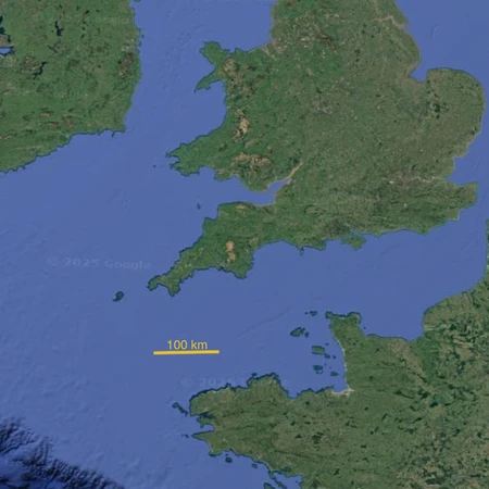
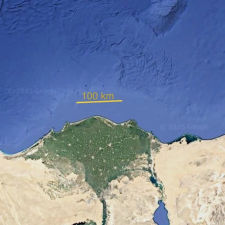
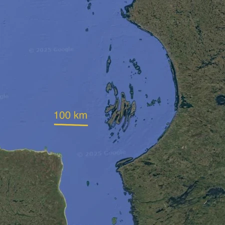
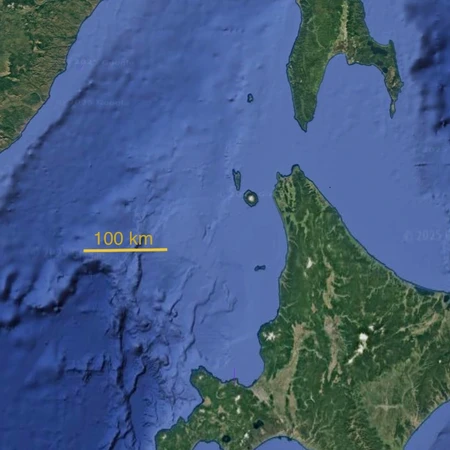
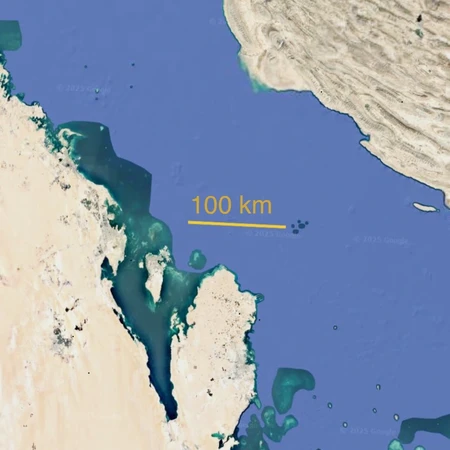
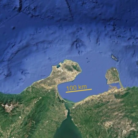
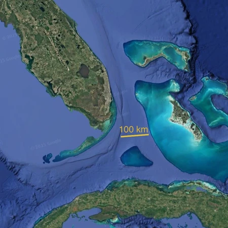
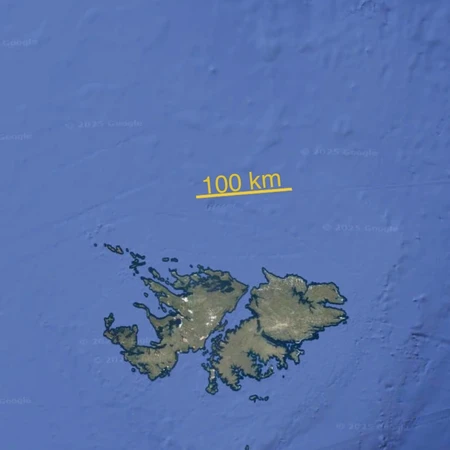
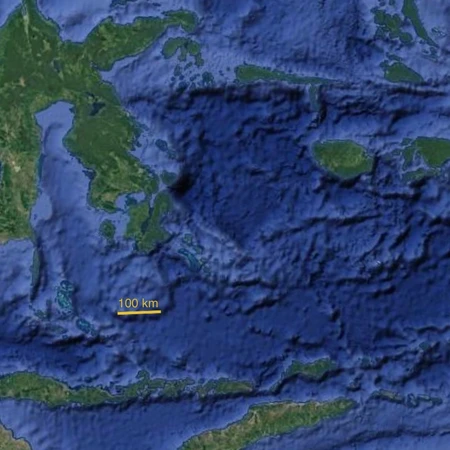
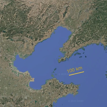
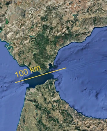
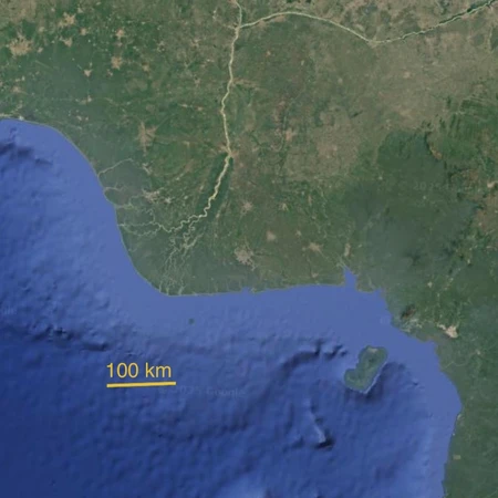
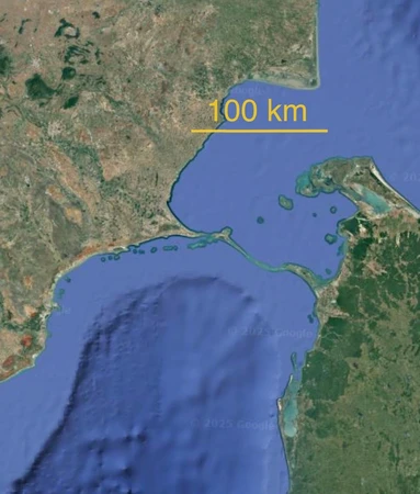
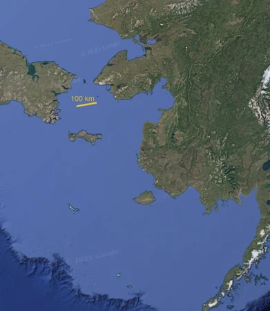
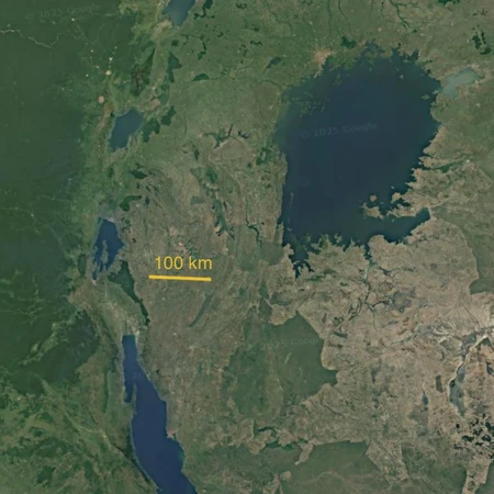
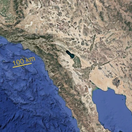
Countries on a zoomed satellite image
Using Google Earth, I zoomed on some parts of countries. Can you guess to which countries they belong ?
There is a scale of 100 km (62.13 miles)
This should be fairly easy for a regular Jetpunker
Rate:
Last updated: October 30, 2025
You have not attempted this quiz yet.
More quiz info >>
| First submitted | October 30, 2025 |
| Times taken | 24 |
| Average score | 75.0% | Report this quiz | Report |
8:00
Enter answer here
0
/ 16 guessed
Time Used
00:00
Best Time
00:00
The quiz is paused. You have remaining.
Copied!
Scoring
You scored / = %
This beats or equals
% of test takers
also scored 100%
The average score is
Your high score is
Your fastest time is
Keep scrolling down for answers and more stats ...
Save Your Stats
Your Next Quiz

In 12 minutes, try to name all the teams that compete in the MLB, NBA, NFL, and NHL. Can you name them all?

20 random countries have been removed from the map of the world! Can you identify them in 3 minutes?

Drag the flag onto the correct state. Careful, though! One wrong move and the game ends.

What countries finished atop the medal table at the 2026 Winter Olympics?
Comments
No comments yet
New and Popular
Countries on zoomed satellite images
Quiz series by LordHydro