Language
Recent User Quizzes
Create Quiz
Recent User Puzzles
Recent User Blogs
More
About JetPunk
Random Quiz
Dark Mode
Geografia de la Corona d'Aragó en un mapa
A vore quant saps de geografia de la Corona d'Aragó. Intenta esmentar les muntanyes, rius, ciutats, etc. que apareixen al mapa.
Font: Wikipedia (múltiples)
Rate:
Last updated: January 25, 2026
You have not attempted this quiz yet.
More quiz info >>
| First submitted | January 23, 2026 |
| Times taken | 8 |
| Average score | 59,1% | Report this quiz | Report |
5:00
Escriu la resposta açí:
0
/ 22 guessed
Time Used
00:00
Best Time
00:00
The quiz is paused. You have remaining.
Copied!
Scoring
You scored / = %
This beats or equals
% of test takers
also scored 100%
The average score is
Your high score is
Your fastest time is
Keep scrolling down for answers and more stats ...
|
|
|
|
||||||||||||||||||||||||||||||||||||||||||||||||||||


Save Your Stats
Your Next Quiz

Name as many U.S. Presidents as you can!

Can you name the capitals cities of all 196 countries in the world?

Name the countries where the most people speak Russian as their native language.

Drag the pin onto the correct country. Careful, though! Three wrong moves and the game ends.
3 Comments
jordibabot
+1
Level 69
Jan 24, 2026
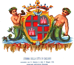
Genial! Cagliari en català és Càller.
elguisse7
+2
Level 59
Jan 25, 2026
No ho sabia, gràcies per la observació
elguisse7
+1
Level 59
Jan 25, 2026
*L'observació
New and Popular