Featured Quizzes
User Quizzes
Create Quiz
Data and Charts
Word Search
Flash Cards
Badges and Games
About JetPunk
Message Board
Random Quiz
Dark Mode
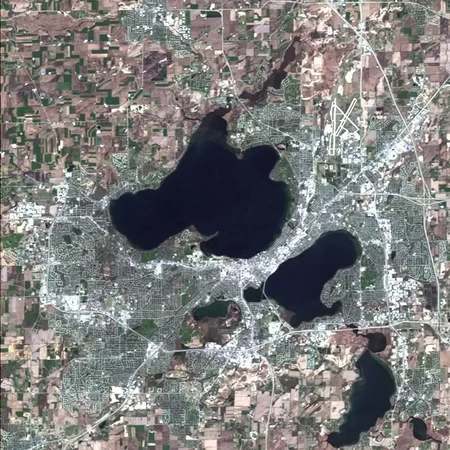
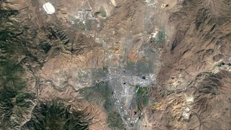
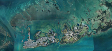
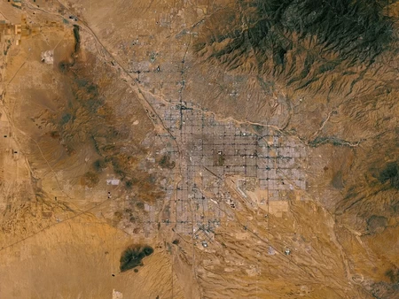
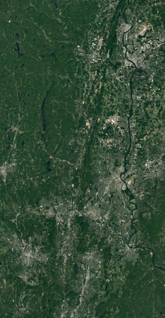
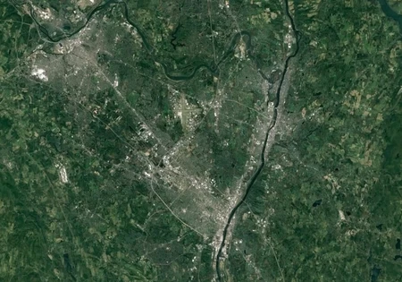
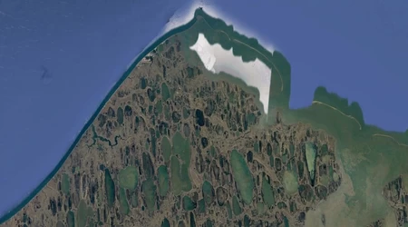
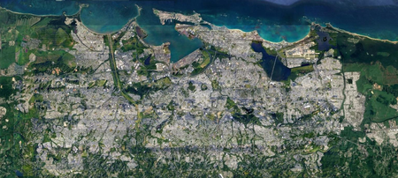
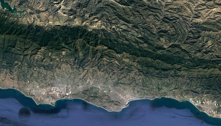
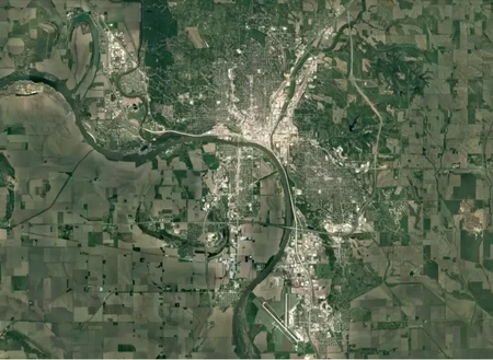
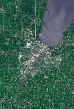
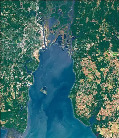
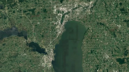
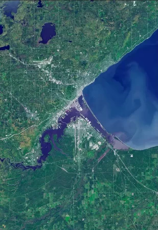
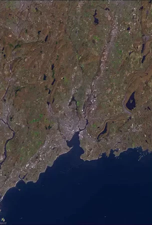
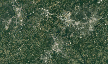
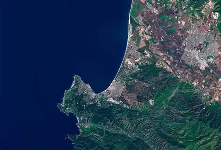
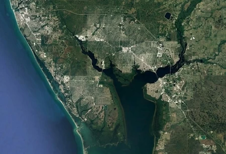
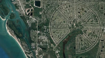
Satellite Images Of U.S. Cities Level 4
North is up on all of these.
Beware of seasonal coloring.
Obviously name a principle city, not some Hooterville in the far corner.
Some of these require a strong knowledge of U.S. geography. I would suggest trying the easier quizzes too; the easiest in the series being #1. https://www.jetpunk.com/series/289276/satellite-images
Rate:
Last updated: May 29, 2023
You have not attempted this quiz yet.
More quiz info >>
| First submitted | October 6, 2022 |
| Times taken | 186 |
| Average score | 42.9% | Report this quiz | Report |
6:00
Enter answer here
0
/ 21 guessed
Time Used
00:00
Best Time
00:00
The quiz is paused. You have remaining.
Copied!
Scoring
You scored / = %
This beats or equals
% of test takers
also scored 100%
The average score is
Your high score is
Your fastest time is
Keep scrolling down for answers and more stats ...
The lake at upper left actually is white.
Polycentric
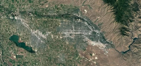
Polycentric
Think outside
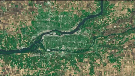
Hint: A tri-state area
Polycentric
Polycentric
Polycentric
Bonus from the previous photo
Save Your Stats
Your Next Quiz

Can you name the capitals cities of all 196 countries in the world?

20 random countries have been removed from the map of the world! Can you identify them in 3 minutes?

Click on all the people who were born in France. But three mistakes ends the quiz!

Drag the flag onto the correct country. Careful, though! One wrong move and the game ends.
Comments
No comments yet
New and Popular
Satellite Images
Quiz series by IsleAuHaulte
...